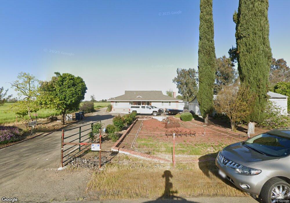
1585 Massasso St Merced, CA 95341
Estimated Value: $349,000 - $615,853
5
Beds
3
Baths
938
Sq Ft
$559/Sq Ft
Est. Value
About This Home
This home is located at 1585 Massasso St, Merced, CA 95341 and is currently estimated at $523,951, approximately $558 per square foot. 1585 Massasso St is a home located in Merced County with nearby schools including Leontine Gracey Elementary School, Tenaya Middle School, and El Capitan High School.
Ownership History
Date
Name
Owned For
Owner Type
Purchase Details
Closed on
Jun 4, 2018
Sold by
Massasso Mario A
Bought by
Massasso Mario A and Massasso Tamara J
Current Estimated Value
Purchase Details
Closed on
Mar 25, 2011
Sold by
Massasso Mario A and Massasso Mario
Bought by
Massasso Massasso Mario A Mario A
Home Financials for this Owner
Home Financials are based on the most recent Mortgage that was taken out on this home.
Original Mortgage
$97,000
Interest Rate
4.77%
Mortgage Type
New Conventional
Create a Home Valuation Report for This Property
The Home Valuation Report is an in-depth analysis detailing your home's value as well as a comparison with similar homes in the area
Purchase History
| Date | Buyer | Sale Price | Title Company |
|---|---|---|---|
| Massasso Mario A | -- | None Available | |
| Massasso Massasso Mario A Mario A | -- | First American Title Company |
Source: Public Records
Mortgage History
| Date | Status | Borrower | Loan Amount |
|---|---|---|---|
| Closed | Massasso Massasso Mario A Mario A | $97,000 |
Source: Public Records
Tax History
| Year | Tax Paid | Tax Assessment Tax Assessment Total Assessment is a certain percentage of the fair market value that is determined by local assessors to be the total taxable value of land and additions on the property. | Land | Improvement |
|---|---|---|---|---|
| 2025 | $2,089 | $195,044 | $102,724 | $92,320 |
| 2024 | $2,089 | $191,240 | $100,710 | $90,530 |
| 2023 | $2,056 | $187,511 | $98,736 | $88,775 |
| 2022 | $2,022 | $183,764 | $96,800 | $86,964 |
| 2021 | $2,458 | $180,179 | $94,902 | $85,277 |
| 2020 | $2,473 | $178,341 | $93,929 | $84,412 |
| 2019 | $1,903 | $174,863 | $92,088 | $82,775 |
| 2018 | $1,734 | $171,453 | $90,283 | $81,170 |
| 2017 | $1,798 | $168,110 | $88,513 | $79,597 |
| 2016 | $1,769 | $164,832 | $86,778 | $78,054 |
| 2015 | $1,740 | $162,371 | $85,475 | $76,896 |
| 2014 | $1,701 | $159,209 | $83,801 | $75,408 |
Source: Public Records
Map
Nearby Homes
- 2044 W State Highway 140
- 965 N Bryant
- 1664 W North Bear Creek Dr Unit 5
- 1803 Lopes Ave
- 1973 Shadowbrook Dr
- 1963 Shadowbrook Dr
- 1646 W North Bear Creek Dr
- 1648 W North Bear Creek Dr
- 2500 N State Highway 59 Unit 36
- 2500 N State Highway 59 Unit 239
- 2500 N State Highway 59 Unit 18
- 2500 N State Highway 59
- 2051 Wardrobe Ave
- 2790 N State Highway 59
- 1541 W North Bear Creek Dr
- 1437 W North Bear Creek Dr
- 1438 W 19th St
- 817 T St
- 1251 W 9th St
- 1441 W 20th St
- 1562 Massasso St
- 1570 Massasso Ct
- 1556 Massasso St
- 1578 Massasso Ct
- 1548 Massasso St
- 1537 Massasso St
- 1586 Massasso Ct
- 1540 Massasso St
- 1592 Massasso Ct
- 1592 Massasso St
- 1575 Thurman Ct
- 1574 Massasso St
- 1579 Thurman Ct
- 1461 Massasso St
- 1583 Thurman Ct
- 1561 Thurman Dr
- 1587 Thurman Ct
- 1591 Thurman Ct
- 1433 Massasso St
- 1576 Thurman Ct
Your Personal Tour Guide
Ask me questions while you tour the home.