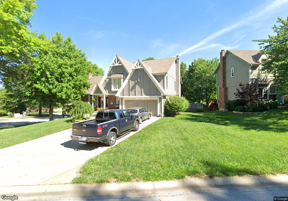
15850 W Locust St Olathe, KS 66062
Estimated Value: $426,000 - $509,000
4
Beds
4
Baths
2,616
Sq Ft
$183/Sq Ft
Est. Value
About This Home
This home is located at 15850 W Locust St, Olathe, KS 66062 and is currently estimated at $478,812, approximately $183 per square foot. 15850 W Locust St is a home located in Johnson County with nearby schools including Tomahawk Elementary School, Frontier Trail Middle School, and Olathe East Sr High School.
Ownership History
Date
Name
Owned For
Owner Type
Purchase Details
Closed on
Sep 3, 2008
Sold by
Affalter Jeffrey C and Affalter Jan J
Bought by
Bomberger Russell L and Bomberger Christy A
Current Estimated Value
Home Financials for this Owner
Home Financials are based on the most recent Mortgage that was taken out on this home.
Original Mortgage
$42,806
Outstanding Balance
$28,581
Interest Rate
6.6%
Mortgage Type
Future Advance Clause Open End Mortgage
Estimated Equity
$450,231
Create a Home Valuation Report for This Property
The Home Valuation Report is an in-depth analysis detailing your home's value as well as a comparison with similar homes in the area
Home Values in the Area
Average Home Value in this Area
Purchase History
| Date | Buyer | Sale Price | Title Company |
|---|---|---|---|
| Bomberger Russell L | -- | First American Title Insuran |
Source: Public Records
Mortgage History
| Date | Status | Borrower | Loan Amount |
|---|---|---|---|
| Open | Bomberger Russell L | $42,806 | |
| Open | Bomberger Russell L | $176,000 |
Source: Public Records
Tax History Compared to Growth
Tax History
| Year | Tax Paid | Tax Assessment Tax Assessment Total Assessment is a certain percentage of the fair market value that is determined by local assessors to be the total taxable value of land and additions on the property. | Land | Improvement |
|---|---|---|---|---|
| 2024 | $5,986 | $52,888 | $8,896 | $43,992 |
| 2023 | $5,516 | $47,966 | $7,731 | $40,235 |
| 2022 | $4,828 | $40,894 | $7,731 | $33,163 |
| 2021 | $4,889 | $39,480 | $7,027 | $32,453 |
| 2020 | $4,671 | $37,386 | $6,381 | $31,005 |
| 2019 | $4,402 | $35,017 | $6,381 | $28,636 |
| 2018 | $4,296 | $33,936 | $5,316 | $28,620 |
| 2017 | $4,011 | $31,372 | $5,316 | $26,056 |
| 2016 | $3,634 | $29,175 | $5,316 | $23,859 |
| 2015 | $3,291 | $26,461 | $4,833 | $21,628 |
| 2013 | -- | $23,886 | $4,577 | $19,309 |
Source: Public Records
Map
Nearby Homes
- 15828 W 136th St
- 15912 W 136th Terrace
- 15919 W 136th Terrace
- 16024 W Beckett Ln
- 13745 S Blackfoot Dr
- 16513 W 133rd St
- 13850 S Kaw St
- 15650 W 140th Terrace
- 15611 W 140th Terrace
- 320 S Lindenwood Dr
- 17262 S Tomahawk Dr
- 13013 S Sycamore St
- 13008 S Chippewa Cir
- 14117 S Locust St
- 14124 S Cottonwood Dr
- 16167 S Kaw Dr
- 16151 S Kaw Dr
- 12913 S Trenton St
- 25006 W 141st St
- 25054 W 141st St
- 15846 W Locust St
- 15842 W Locust St
- 13508 S Locust St
- 15851 W Locust St
- 15847 W Locust St
- 13507 S Locust St
- 13512 S Locust St
- 15843 W Locust St
- 15838 W Locust St
- 16012 W 136th St
- 15839 W Locust St
- 15834 W Locust St
- 13516 S Locust St
- 15848 W 136th St
- 13511 S Locust St
- 15844 W 136th St
- 16018 W 136th St
- 15835 W Locust St
- 15840 W 136th St
- 13515 S Locust St