Estimated Value: $128,000 - $166,000
5
Beds
1
Bath
1,260
Sq Ft
$114/Sq Ft
Est. Value
About This Home
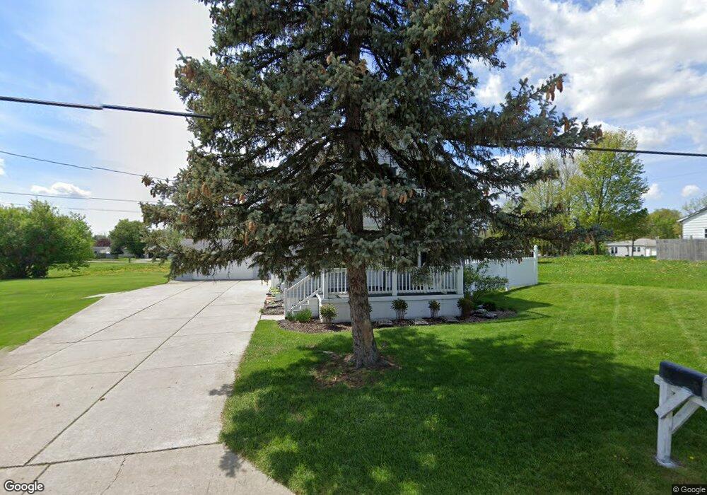
This home is located at 1586 S Graham Rd, Flint, MI 48532 and is currently estimated at $144,246, approximately $114 per square foot. 1586 S Graham Rd is a home located in Genesee County with nearby schools including Carman-Ainsworth High School, Genesee STEM Academy, and St. Paul Lutheran School.
Ownership History
Date
Name
Owned For
Owner Type
Purchase Details
Closed on
Aug 28, 2017
Sold by
Johnson Gordon
Bought by
Johnson Gordon A and The Gordon A Johnson Living Tr
Current Estimated Value
Purchase Details
Closed on
Nov 17, 2005
Sold by
Knapp Family Revocable Trust
Bought by
Johnson Gordon A and Johnson Laura D
Purchase Details
Closed on
Jun 3, 2004
Sold by
The Knapp Family Trust
Bought by
Johnson Gordon A
Purchase Details
Closed on
May 23, 1983
Sold by
Bennett Robert H and Bennett Emma
Bought by
Knapp Claude B and Knapp Beverly A
Create a Home Valuation Report for This Property
The Home Valuation Report is an in-depth analysis detailing your home's value as well as a comparison with similar homes in the area
Home Values in the Area
Average Home Value in this Area
Purchase History
| Date | Buyer | Sale Price | Title Company |
|---|---|---|---|
| Johnson Gordon A | -- | None Available | |
| Johnson Gordon A | $60,000 | Lawyers Title | |
| Knapp Family Revocable Trust | -- | Lawyers Title | |
| Johnson Gordon A | -- | -- | |
| Knapp Claude B | $11,000 | Guaranty Title Company |
Source: Public Records
Tax History Compared to Growth
Tax History
| Year | Tax Paid | Tax Assessment Tax Assessment Total Assessment is a certain percentage of the fair market value that is determined by local assessors to be the total taxable value of land and additions on the property. | Land | Improvement |
|---|---|---|---|---|
| 2025 | $1,803 | $66,100 | $0 | $0 |
| 2024 | $864 | $57,400 | $0 | $0 |
| 2023 | $824 | $53,900 | $0 | $0 |
| 2022 | $852 | $41,600 | $0 | $0 |
| 2021 | $1,601 | $36,700 | $0 | $0 |
| 2020 | $679 | $33,000 | $0 | $0 |
| 2019 | $670 | $30,200 | $0 | $0 |
| 2018 | $1,372 | $30,400 | $0 | $0 |
| 2017 | $1,310 | $30,400 | $0 | $0 |
| 2016 | $1,346 | $30,200 | $0 | $0 |
| 2015 | $1,098 | $28,200 | $0 | $0 |
| 2014 | $651 | $27,300 | $0 | $0 |
| 2012 | -- | $33,000 | $33,000 | $0 |
Source: Public Records
Map
Nearby Homes
- 1540 Pound Dr
- 3277 Whitney Ave
- 1600 Houran St
- 1574 Houran St
- 1260 Gilbert St
- 18.41 Taft Rd
- 3320 Timberview St
- 3493 Ridgecliffe Dr
- 3321 Hogarth Ave
- VL Clairmont St
- 3288 Tall Oaks Ct
- 3522 Ridgecliffe Dr
- 3477 Ridgecliffe Dr
- 10 Acres T A Mansour Blvd
- 959 Tacken St
- 3631 Ridgecliffe Dr
- 1136 Gilbert St
- 1112 Lask Dr
- 874 Tacken St
- 870 Tacken St
- 1595 Pound Dr
- 1605 Pound Dr
- 1585 Pound Dr
- 1616 S Graham Rd
- 1574 S Graham Rd
- 1615 Pound Dr
- 1615 Pound Dr
- 1575 Pound Dr
- 1626 S Graham Rd
- 1598 Pound Dr
- 1586 Pound Dr
- 4004 Red Wing Dr
- 1576 Pound Dr
- 1620 Pound Dr
- 4024 Red Wing Dr
- 1616 Pound Dr
- 1597 Lambden Rd
- 1605 Lambden Rd
- 1591 Lambden Rd
- 1617 Lambden Rd