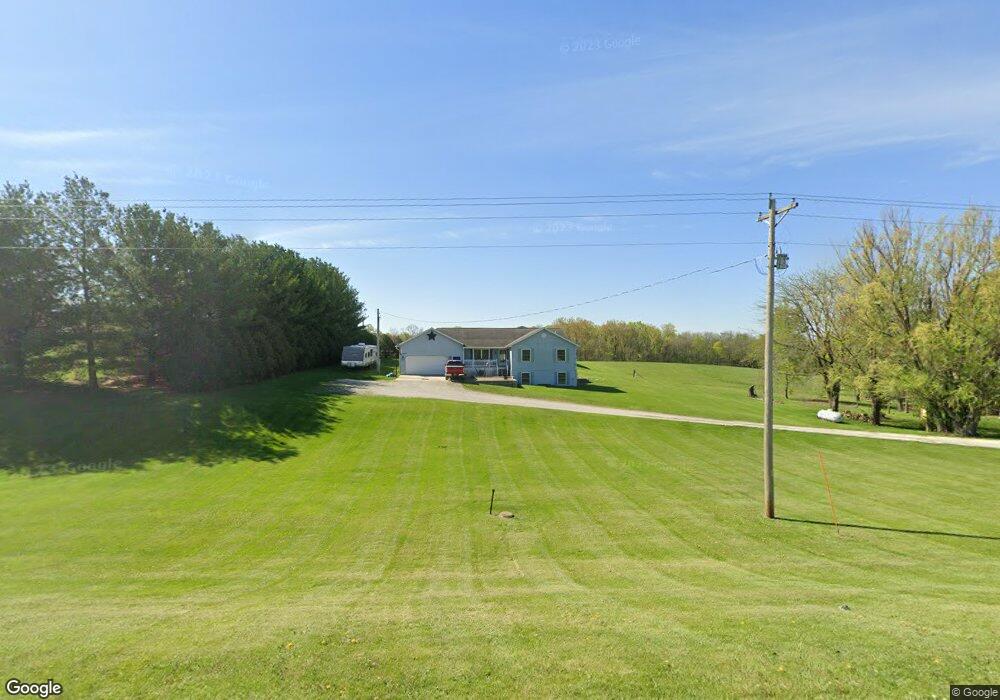
1588 Old Highway 34 Mount Pleasant, IA 52641
Estimated Value: $303,000 - $319,000
5
Beds
3
Baths
1,512
Sq Ft
$208/Sq Ft
Est. Value
About This Home
This home is located at 1588 Old Highway 34, Mount Pleasant, IA 52641 and is currently estimated at $313,909, approximately $207 per square foot. 1588 Old Highway 34 is a home located in Henry County with nearby schools including Mount Pleasant High School.
Ownership History
Date
Name
Owned For
Owner Type
Purchase Details
Closed on
Aug 18, 2011
Sold by
Two Rivers Bank & Trust
Bought by
Wilson Kenneth J and Wilson Jessica
Current Estimated Value
Home Financials for this Owner
Home Financials are based on the most recent Mortgage that was taken out on this home.
Original Mortgage
$99,750
Outstanding Balance
$69,001
Interest Rate
4.55%
Mortgage Type
New Conventional
Estimated Equity
$244,908
Purchase Details
Closed on
May 19, 2005
Sold by
Federal Home Loan Mortgage Corporation
Bought by
Herr Randal and Herr Tami
Home Financials for this Owner
Home Financials are based on the most recent Mortgage that was taken out on this home.
Original Mortgage
$115,200
Interest Rate
5.5%
Mortgage Type
Adjustable Rate Mortgage/ARM
Create a Home Valuation Report for This Property
The Home Valuation Report is an in-depth analysis detailing your home's value as well as a comparison with similar homes in the area
Home Values in the Area
Average Home Value in this Area
Purchase History
| Date | Buyer | Sale Price | Title Company |
|---|---|---|---|
| Wilson Kenneth J | $105,000 | None Available | |
| Herr Randal | -- | None Available |
Source: Public Records
Mortgage History
| Date | Status | Borrower | Loan Amount |
|---|---|---|---|
| Open | Wilson Kenneth J | $99,750 | |
| Previous Owner | Herr Randal | $115,200 |
Source: Public Records
Tax History Compared to Growth
Tax History
| Year | Tax Paid | Tax Assessment Tax Assessment Total Assessment is a certain percentage of the fair market value that is determined by local assessors to be the total taxable value of land and additions on the property. | Land | Improvement |
|---|---|---|---|---|
| 2025 | $4,076 | $312,530 | $40,400 | $272,130 |
| 2024 | $3,834 | $284,300 | $40,400 | $243,900 |
| 2023 | $3,804 | $284,300 | $40,400 | $243,900 |
| 2022 | $3,814 | $230,100 | $40,400 | $189,700 |
| 2021 | $3,814 | $230,100 | $40,400 | $189,700 |
| 2020 | $3,742 | $218,250 | $40,400 | $177,850 |
| 2019 | $3,476 | $209,490 | $0 | $0 |
| 2018 | $3,328 | $209,490 | $0 | $0 |
| 2017 | $3,328 | $196,040 | $0 | $0 |
| 2016 | $3,174 | $196,040 | $0 | $0 |
| 2015 | $3,174 | $171,280 | $0 | $0 |
| 2014 | $2,738 | $171,280 | $0 | $0 |
Source: Public Records
Map
Nearby Homes
- Tbd Pin Oaks Ln
- TBD Pin Oaks Ln
- 2336 Sunrise Cir
- LOT 7 Pin Oaks Ln
- 0 Pin Oaks Lot 8 Unit 6309313
- LOT 10 Pin Oaks Ln
- LOT 11 Pin Oaks Ln
- LOT 12 Pin Oaks Ln
- LOT 14 Pin Oaks Ln
- LOT 15 Pin Oaks Ln
- 3015 Hickory Ln
- 2100 W Washington St
- 1008 Westwood Dr
- 1515 240th St
- 1525 240th St
- 1206 W Saunders St
- 301 N Lafayette St
- 810 W Washington St
- 802 N Bergdahl Cir
- 603 W Courtland St
- 1586 Old Highway 34
- 1580 Old Highway 34
- 1598 Old Highway 34
- 1589 Old Highway 34
- 1591 Old Highway 34
- 0 W Old Hwy 34 Unit 6300019
- 1577 Old Highway 34
- 1576 Old Highway 34
- 1599 Old Highway 34
- 1575 Old Highway 34
- 1605 Old Highway 34
- 1567 Old Highway 34
- 1611 Old Highway 34
- 1614 Old Highway 34
- 1617 Old Highway 34
- 1560 Old Highway 34
- 1619 Old Highway 34
- 1621 Old Highway 34
- 1616 Old Highway 34
- 2270 Franklin Ave