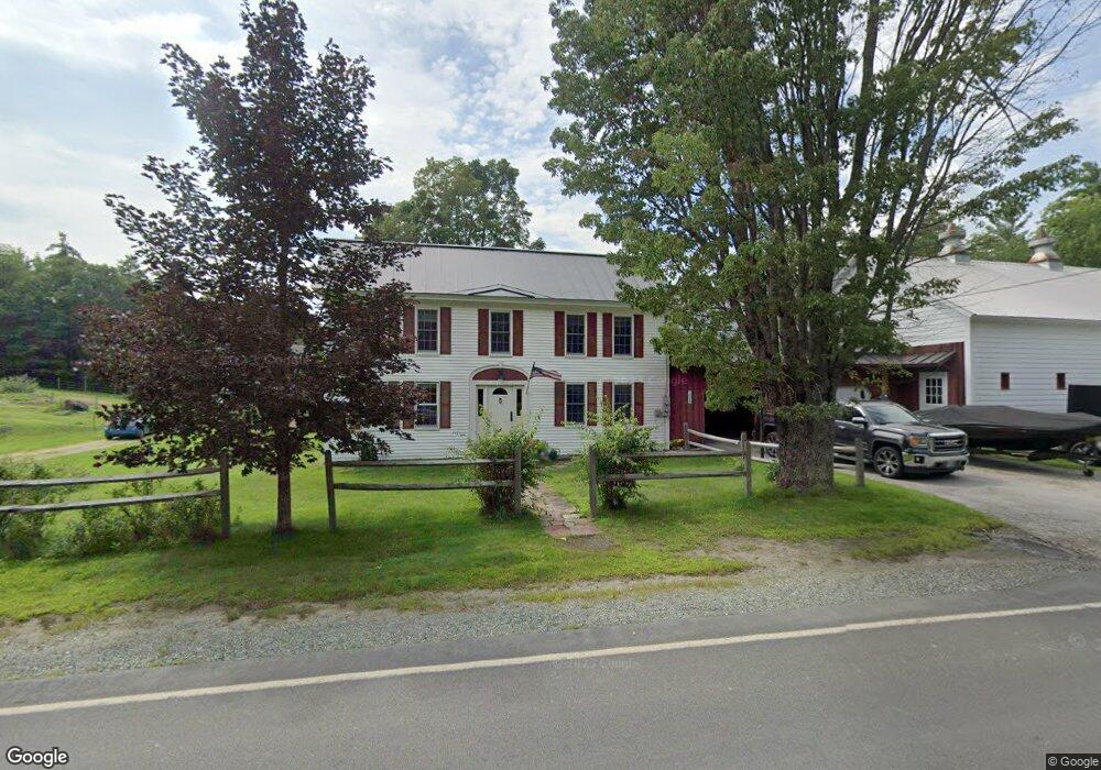
1589 Main St Springfield, NH 03284
Estimated Value: $545,036 - $703,000
3
Beds
2
Baths
2,300
Sq Ft
$272/Sq Ft
Est. Value
About This Home
This home is located at 1589 Main St, Springfield, NH 03284 and is currently estimated at $624,759, approximately $271 per square foot. 1589 Main St is a home located in Sullivan County with nearby schools including Kearsarge Elementary School - New London, Kearsarge Regional Middle School, and Kearsarge Regional High School.
Ownership History
Date
Name
Owned For
Owner Type
Purchase Details
Closed on
Dec 8, 2010
Sold by
Catmur Robin V and Herrmann Edward B
Bought by
Leblanc David D and Leblanc Lisa M
Current Estimated Value
Home Financials for this Owner
Home Financials are based on the most recent Mortgage that was taken out on this home.
Original Mortgage
$195,000
Interest Rate
4.24%
Mortgage Type
Purchase Money Mortgage
Create a Home Valuation Report for This Property
The Home Valuation Report is an in-depth analysis detailing your home's value as well as a comparison with similar homes in the area
Home Values in the Area
Average Home Value in this Area
Purchase History
| Date | Buyer | Sale Price | Title Company |
|---|---|---|---|
| Leblanc David D | $295,000 | -- |
Source: Public Records
Mortgage History
| Date | Status | Borrower | Loan Amount |
|---|---|---|---|
| Open | Leblanc David D | $192,000 | |
| Closed | Leblanc David D | $88,000 | |
| Closed | Leblanc David D | $195,000 | |
| Previous Owner | Leblanc David D | $180,000 |
Source: Public Records
Tax History
| Year | Tax Paid | Tax Assessment Tax Assessment Total Assessment is a certain percentage of the fair market value that is determined by local assessors to be the total taxable value of land and additions on the property. | Land | Improvement |
|---|---|---|---|---|
| 2024 | $7,514 | $317,574 | $73,074 | $244,500 |
| 2023 | $7,273 | $312,527 | $72,927 | $239,600 |
| 2022 | $6,426 | $312,833 | $73,233 | $239,600 |
| 2020 | $5,907 | $301,664 | $73,464 | $228,200 |
| 2019 | $5,754 | $261,684 | $61,284 | $200,400 |
| 2018 | $5,928 | $261,723 | $61,323 | $200,400 |
| 2016 | $5,824 | $261,281 | $60,881 | $200,400 |
| 2015 | $5,641 | $261,286 | $60,886 | $200,400 |
| 2014 | $5,835 | $272,930 | $64,030 | $208,900 |
| 2013 | $5,497 | $269,454 | $100,254 | $169,200 |
Source: Public Records
Map
Nearby Homes
- 435 Messer Hill Rd
- 8 Stoney Brook Rd
- 1279 Route 11
- 1024 Lake
- 242 Prospect Hill Rd
- 770 Jobs Creek Rd
- 26 Otterville Rd
- 140 Hogg Hill Rd
- 77 Hazzard Rd N
- 151 Woodland Heights
- 143 Hilltop Place
- tbd Stocker Pond Unit 236-43
- tbd Stocker Pond
- 0 Newport Rd Unit 10
- 682 Philbrick Hill Rd
- 32 Homan Ln
- 617 & 619 Route 103a Map 91 Lot 37 38
- 163 Quaker Path Rd
- 76 Tonset Slope
- 22 Brookridge Dr
- 67 Georges Mills Rd
- 1709 Main St
- 1691 Main St
- 1733 New Hampshire 114
- 11 Pellerin Hill Rd
- 110 & 145 Pellerin Hill Rd
- 110 & 145 Pellerin Rd
- 145 Pellerin Hill Rd
- 110 Pellerin Hill Rd
- 110 Pellerin Hill Rd
- 157 Foxstand Rd
- 0 Route 114
- 0 Route 114
- 0 Route 114
- 0 Route 114 Unit 2791313
- 0 Route 114 Unit 2790699
- 0 Route 114 Unit 4854092
- Lot 2 Main St
- Lot 1 Main St
- 0 Route 114 Unit 4459205
Your Personal Tour Guide
Ask me questions while you tour the home.