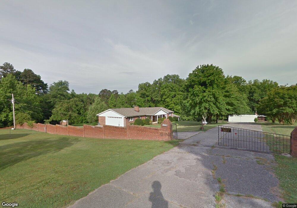
1589 Sandy Ln Lincolnton, NC 28092
Estimated Value: $454,363 - $502,000
3
Beds
3
Baths
4,594
Sq Ft
$104/Sq Ft
Est. Value
About This Home
This home is located at 1589 Sandy Ln, Lincolnton, NC 28092 and is currently estimated at $478,341, approximately $104 per square foot. 1589 Sandy Ln is a home located in Lincoln County with nearby schools including Battleground Elementary School, Lincolnton Middle School, and Lincolnton High School.
Ownership History
Date
Name
Owned For
Owner Type
Purchase Details
Closed on
Nov 30, 2017
Sold by
Lineberger James F and Lineberger Jessica C
Bought by
Miles Steven and Miles Kelly
Current Estimated Value
Purchase Details
Closed on
Mar 31, 2014
Sold by
Steele Betty Conklin and Steele Betty J
Bought by
Lineberger James F and Lineberger Jessica C
Home Financials for this Owner
Home Financials are based on the most recent Mortgage that was taken out on this home.
Original Mortgage
$225,700
Interest Rate
4.4%
Mortgage Type
New Conventional
Purchase Details
Closed on
Dec 28, 1999
Bought by
Steele Betty J Aka Betty Conklin S
Create a Home Valuation Report for This Property
The Home Valuation Report is an in-depth analysis detailing your home's value as well as a comparison with similar homes in the area
Home Values in the Area
Average Home Value in this Area
Purchase History
| Date | Buyer | Sale Price | Title Company |
|---|---|---|---|
| Miles Steven | $280,000 | None Available | |
| Lineberger James F | $227,000 | None Available | |
| Steele Betty J Aka Betty Conklin S | $238,000 | -- |
Source: Public Records
Mortgage History
| Date | Status | Borrower | Loan Amount |
|---|---|---|---|
| Previous Owner | Lineberger James F | $225,700 |
Source: Public Records
Tax History Compared to Growth
Tax History
| Year | Tax Paid | Tax Assessment Tax Assessment Total Assessment is a certain percentage of the fair market value that is determined by local assessors to be the total taxable value of land and additions on the property. | Land | Improvement |
|---|---|---|---|---|
| 2025 | $2,473 | $386,272 | $55,848 | $330,424 |
| 2024 | $2,453 | $386,272 | $55,848 | $330,424 |
| 2023 | $2,390 | $386,272 | $55,848 | $330,424 |
| 2022 | $1,973 | $267,416 | $44,678 | $222,738 |
| 2021 | $1,958 | $267,416 | $44,678 | $222,738 |
| 2020 | $1,789 | $267,416 | $44,678 | $222,738 |
| 2019 | $1,789 | $267,416 | $44,678 | $222,738 |
| 2018 | $1,650 | $227,494 | $42,247 | $185,247 |
| 2017 | $1,481 | $227,494 | $42,247 | $185,247 |
| 2016 | $1,481 | $227,494 | $42,247 | $185,247 |
| 2015 | $1,537 | $227,494 | $42,247 | $185,247 |
| 2014 | $952 | $255,419 | $46,832 | $208,587 |
Source: Public Records
Map
Nearby Homes
- 00 Shell St
- 00 Eastview Dr
- 1156 Walker Branch Rd
- 141 Mallory Tai Dr
- 00 Walker Branch Rd
- 0 Wilma Sigmon Rd Unit A CAR4306088
- 4586 Harris Elliot Rd
- 4582 Harris Elliot Rd
- 4578 Harris Elliot Rd
- 4552 Harris Elliot Rd
- 4548 Harris Elliot Rd
- 4594 Harris Elliot Rd
- 4603 Harris Elliot Rd
- 4590 Harris Elliot Rd
- 4583 Harris Elliot Rd
- 4579 Harris Elliot Rd
- 1235 Wilma Sigmon Rd
- 6157 Helms Ln
- 3309 Ora Smith Rd
- 3305 Ora Smith Rd
- 1571 Sandy Ln
- 1572 Sandy Ln
- 1555 Sandy Ln
- 1556 Sandy Ln
- 1538 Sandy Ln
- 1593 Beal Pond Trail
- 1525 Sandy Ln
- 353 Bethel Church Rd
- 1597 Beal Pond Trail
- 1520 Sandy Ln
- 377 Bethel Church Rd
- 285 Bethel Church Rd
- 409 Bethel Church Rd
- 257 Bethel Church Rd
- 151 Bethel Church Rd
- 2730 Maiden Hwy
- 1754 Sierra Ln
- 160 Bethel Church Rd
- 2748 Maiden Hwy
- 132 Bethel Church Rd