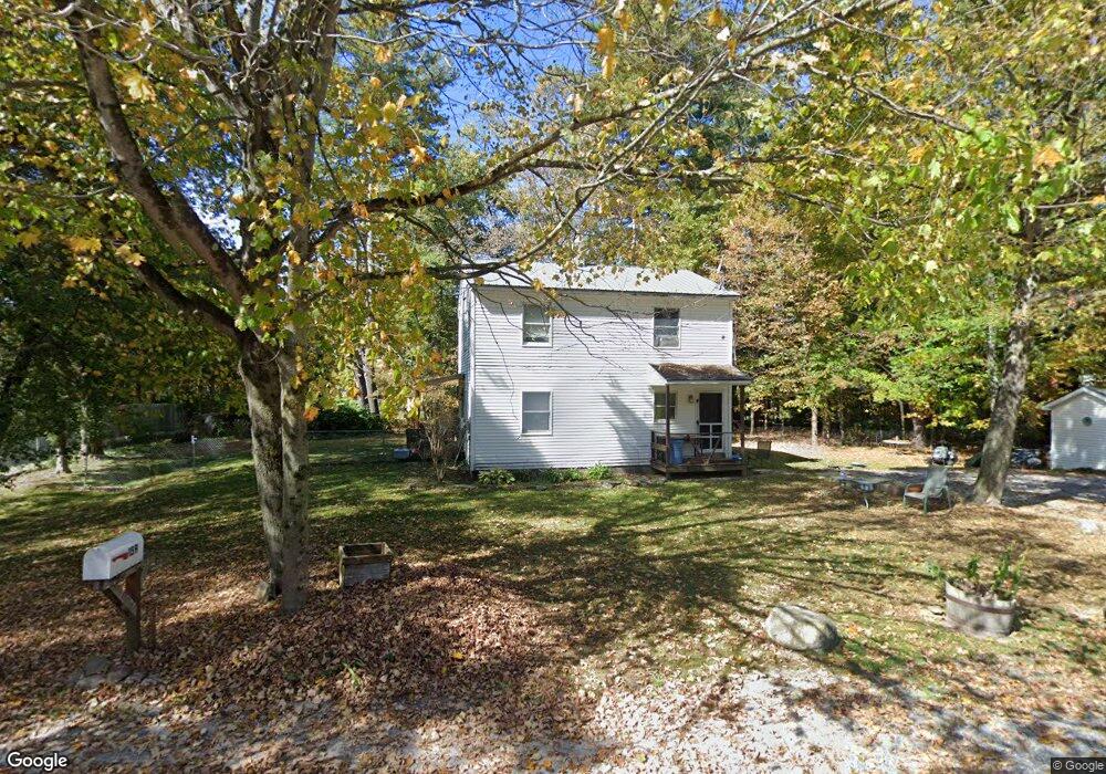
159 Andrews Ln Arlington, VT 05250
Estimated Value: $281,283 - $351,000
4
Beds
2
Baths
1,344
Sq Ft
$231/Sq Ft
Est. Value
About This Home
This home is located at 159 Andrews Ln, Arlington, VT 05250 and is currently estimated at $310,071, approximately $230 per square foot. 159 Andrews Ln is a home with nearby schools including Fisher School and Arlington Memorial Middle/High School.
Ownership History
Date
Name
Owned For
Owner Type
Purchase Details
Closed on
Jun 27, 2003
Sold by
Bennington Area Habitat For Humanity
Bought by
Slade Jacqueline D
Current Estimated Value
Create a Home Valuation Report for This Property
The Home Valuation Report is an in-depth analysis detailing your home's value as well as a comparison with similar homes in the area
Home Values in the Area
Average Home Value in this Area
Purchase History
| Date | Buyer | Sale Price | Title Company |
|---|---|---|---|
| Slade Jacqueline D | $97,000 | -- |
Source: Public Records
Tax History
| Year | Tax Paid | Tax Assessment Tax Assessment Total Assessment is a certain percentage of the fair market value that is determined by local assessors to be the total taxable value of land and additions on the property. | Land | Improvement |
|---|---|---|---|---|
| 2024 | -- | $180,400 | $36,000 | $144,400 |
| 2023 | -- | $180,400 | $36,000 | $144,400 |
| 2022 | $3,256 | $180,400 | $36,000 | $144,400 |
| 2021 | $3,136 | $180,400 | $36,000 | $144,400 |
| 2020 | $3,500 | $181,800 | $36,000 | $145,800 |
| 2019 | $3,452 | $181,800 | $36,000 | $145,800 |
| 2018 | $3,443 | $181,800 | $36,000 | $145,800 |
| 2017 | $0 | $181,800 | $36,000 | $145,800 |
| 2016 | $3,196 | $181,800 | $36,000 | $145,800 |
| 2015 | -- | $1,818 | $0 | $0 |
| 2014 | -- | $1,818 | $0 | $0 |
| 2013 | -- | $1,818 | $0 | $0 |
Source: Public Records
Map
Nearby Homes
- 569 Buck Hill Rd
- 1 & 2 Joy Ln
- 78 Carbonti Cir
- 3637 Vermont Route 7a
- 3888 Vermont Route 7a
- 51 Russell St Unit D
- 190 Cemetery Rd
- 0 North Rd Unit 5079306
- 49 Limerick Ln
- 85 Limerick Ln
- 85 Limerick Ln Unit A & B
- 1180 North Rd
- 475 Sunrise Ln
- 2023 North Rd
- 358 Birch Grove
- Lot 21 Sunderland Hill Rd
- 297 Farm Rd
- 269 Old Depot Rd
- 102 Mccormick Ln
- 384 Alden Rd
Your Personal Tour Guide
Ask me questions while you tour the home.