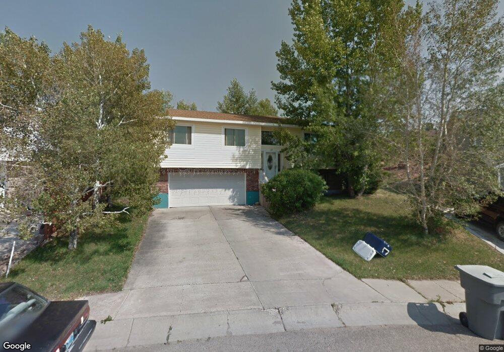
159 Comanche Ct Evanston, WY 82930
Estimated Value: $296,472 - $357,000
3
Beds
2
Baths
1,132
Sq Ft
$283/Sq Ft
Est. Value
About This Home
This home is located at 159 Comanche Ct, Evanston, WY 82930 and is currently estimated at $319,868, approximately $282 per square foot. 159 Comanche Ct is a home located in Uinta County with nearby schools including Evanston High School and Evanston Child Development Center.
Ownership History
Date
Name
Owned For
Owner Type
Purchase Details
Closed on
Dec 22, 2020
Sold by
Pasenelli Kathryn M
Bought by
Pasenelli Cassie and Pasenelli Eric C
Current Estimated Value
Home Financials for this Owner
Home Financials are based on the most recent Mortgage that was taken out on this home.
Original Mortgage
$189,050
Outstanding Balance
$167,923
Interest Rate
2.7%
Mortgage Type
New Conventional
Estimated Equity
$151,945
Create a Home Valuation Report for This Property
The Home Valuation Report is an in-depth analysis detailing your home's value as well as a comparison with similar homes in the area
Purchase History
| Date | Buyer | Sale Price | Title Company |
|---|---|---|---|
| Pasenelli Cassie | -- | None Available | |
| Pasenelli Cassie | -- | None Listed On Document |
Source: Public Records
Mortgage History
| Date | Status | Borrower | Loan Amount |
|---|---|---|---|
| Open | Pasenelli Cassie | $189,050 | |
| Closed | Pasenelli Cassie | $189,050 |
Source: Public Records
Tax History
| Year | Tax Paid | Tax Assessment Tax Assessment Total Assessment is a certain percentage of the fair market value that is determined by local assessors to be the total taxable value of land and additions on the property. | Land | Improvement |
|---|---|---|---|---|
| 2025 | $1,605 | $17,429 | $3,173 | $14,256 |
| 2024 | $1,605 | $23,616 | $4,231 | $19,385 |
| 2023 | $1,533 | $22,664 | $4,024 | $18,640 |
| 2022 | $1,405 | $20,638 | $2,370 | $18,268 |
| 2021 | $1,186 | $17,399 | $2,370 | $15,029 |
| 2020 | $1,020 | $14,971 | $2,158 | $12,813 |
| 2019 | $1,039 | $15,278 | $2,018 | $13,260 |
| 2018 | $0 | $14,114 | $2,071 | $12,043 |
| 2017 | $948 | $13,947 | $2,071 | $11,876 |
| 2016 | $992 | $14,590 | $1,818 | $12,772 |
| 2015 | -- | $14,353 | $1,569 | $12,784 |
| 2014 | -- | $13,467 | $1,377 | $12,090 |
| 2010 | -- | $14,733 | $0 | $0 |
Source: Public Records
Map
Nearby Homes
- 46 City View Dr
- 105 Zuni Ct
- 425 Main St
- 193 Southridge Rd
- 612 Sage St
- 803 7th St
- 621 Main St
- 632 Main St
- 125 Fox Point Loop Rd
- 104 Windy Ridge Ct
- 213 Grandview Citcle
- 819 Walton Ave
- 2921 Wyoming 150
- 824 Lombard St
- 633 9th St
- 427 Thayer Cir
- 106 Grandview
- 1025 Morse Lee St
- 479 Twin Ridge Ave
- 442 12th St
- 161 Comanche Ct
- 157 Comanche Ct
- 155 Comanche Ct
- 158 Comanche Ct
- 158 Comanche Ct
- 158 Comanche Ct
- 158 Comanche Ct
- 153 Comanche Ct
- 164 Comanche Ct
- 164 Comanche Ct Unit Apache
- 151 Comanche Ct
- 151 Comanche Ct Unit Sioux Drive
- 162 Comanche Ct
- 150 Comanche Ct
- 149 Apache Dr
- 151 Apache Dr
- 153 Apache Dr
- 147 Apache Dr
- 147 Apache Dr Unit Cheyenne
- 545 Cheyenne Dr