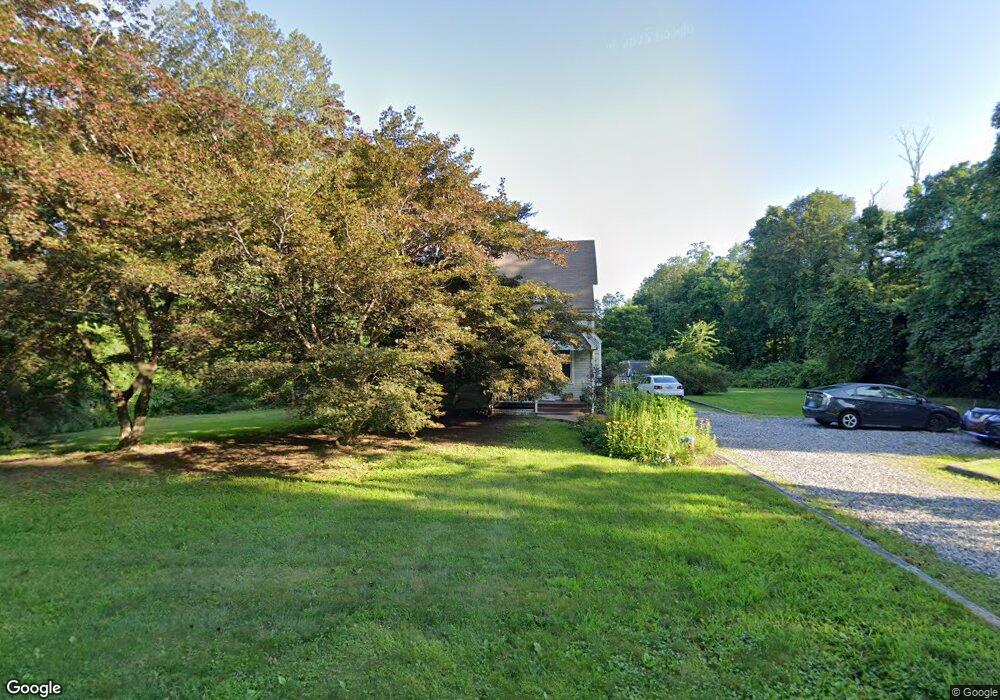
159 Cross Hwy Redding, CT 06896
Estimated Value: $548,830 - $648,000
3
Beds
1
Bath
1,467
Sq Ft
$419/Sq Ft
Est. Value
About This Home
This home is located at 159 Cross Hwy, Redding, CT 06896 and is currently estimated at $613,958, approximately $418 per square foot. 159 Cross Hwy is a home located in Fairfield County with nearby schools including Redding Elementary School, John Read Middle School, and Joel Barlow High School.
Ownership History
Date
Name
Owned For
Owner Type
Purchase Details
Closed on
Dec 13, 2000
Sold by
Eureel John B
Bought by
Alward Stephen J and Brunder-Alward Vanessa
Current Estimated Value
Purchase Details
Closed on
Jan 29, 1998
Sold by
Vierra Brendan J and Vierra Mildred M
Bought by
Eurell John B
Purchase Details
Closed on
Apr 15, 1994
Sold by
Masiello Richard and Masiello Donald
Bought by
Monda Robert and Frank Anrew
Create a Home Valuation Report for This Property
The Home Valuation Report is an in-depth analysis detailing your home's value as well as a comparison with similar homes in the area
Home Values in the Area
Average Home Value in this Area
Purchase History
| Date | Buyer | Sale Price | Title Company |
|---|---|---|---|
| Alward Stephen J | $350,000 | -- | |
| Eurell John B | $245,000 | -- | |
| Monda Robert | $260,000 | -- |
Source: Public Records
Mortgage History
| Date | Status | Borrower | Loan Amount |
|---|---|---|---|
| Closed | Monda Robert | $150,000 | |
| Closed | Monda Robert | $100,000 |
Source: Public Records
Tax History
| Year | Tax Paid | Tax Assessment Tax Assessment Total Assessment is a certain percentage of the fair market value that is determined by local assessors to be the total taxable value of land and additions on the property. | Land | Improvement |
|---|---|---|---|---|
| 2025 | $8,487 | $287,300 | $140,300 | $147,000 |
| 2024 | $8,251 | $287,300 | $140,300 | $147,000 |
| 2023 | $7,955 | $287,300 | $140,300 | $147,000 |
| 2022 | $8,185 | $245,500 | $156,000 | $89,500 |
| 2021 | $8,062 | $245,500 | $156,000 | $89,500 |
| 2020 | $8,062 | $245,500 | $156,000 | $89,500 |
| 2019 | $8,062 | $245,500 | $156,000 | $89,500 |
| 2018 | $7,787 | $245,500 | $156,000 | $89,500 |
| 2017 | $7,858 | $265,300 | $170,000 | $95,300 |
| 2016 | $7,757 | $265,300 | $170,000 | $95,300 |
| 2015 | $7,670 | $265,300 | $170,000 | $95,300 |
| 2014 | $7,670 | $265,300 | $170,000 | $95,300 |
Source: Public Records
Map
Nearby Homes
- 241 Black Rock Turnpike
- 5 South Ln
- 7 Long Meadow Ln
- 63 Turney Rd
- 41 Deer Hill Rd
- 2 Longwood Dr
- 98 Hopewell Woods Rd
- 45 Great Pasture Rd
- 9 Nicolina Way
- 18 Sebastian Tr
- 294 Maple Rd
- 54 Rock House Rd
- 41 Ridge Line Rd
- 6 Vona Way
- 429 Rock House Rd
- 235 Rock House Rd
- 766 N Park Ave
- 40 Magellan Ln
- 31 Oak Ridge Dr
- 138 Putnam Park Rd
- 160 Cross Hwy
- 153 Cross Hwy
- 162 Cross Hwy
- 163 Cross Hwy
- 168 Cross Hwy
- 401 Newtown Turnpike
- 419 Newtown Turnpike
- 7 Sullivan Dr
- 146 Cross Hwy
- 45 Sullivan Dr
- 147 Cross Hwy
- 11 Sullivan Dr
- 399 Newtown Turnpike
- 423 Newtown Turnpike
- 427 Newtown Turnpike
- 176 Cross Hwy
- 398 Newtown Turnpike
- 135 Cross Hwy
- 14 South Ln
- 143 Cross Hwy
Your Personal Tour Guide
Ask me questions while you tour the home.