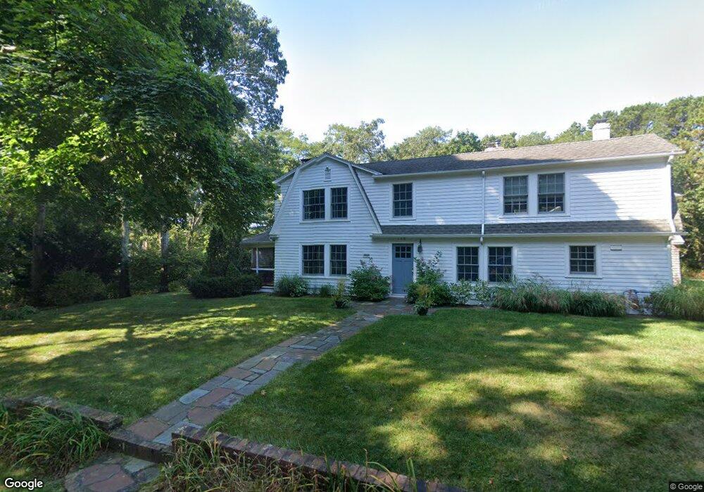
159 Little River Rd Cotuit, MA 02635
Cotuit NeighborhoodEstimated Value: $1,008,000 - $1,244,000
4
Beds
3
Baths
2,779
Sq Ft
$401/Sq Ft
Est. Value
About This Home
This home is located at 159 Little River Rd, Cotuit, MA 02635 and is currently estimated at $1,113,036, approximately $400 per square foot. 159 Little River Rd is a home located in Barnstable County with nearby schools including West Villages Elementary School, Barnstable United Elementary School, and Barnstable Intermediate School.
Ownership History
Date
Name
Owned For
Owner Type
Purchase Details
Closed on
Jun 27, 2022
Sold by
Keally Taber and Keally Mary E
Bought by
Kewlley Ft and Keally
Current Estimated Value
Purchase Details
Closed on
Aug 21, 1998
Sold by
Keally Francis T and Keally Julia B
Bought by
Keally Taber and Keally Mary E
Home Financials for this Owner
Home Financials are based on the most recent Mortgage that was taken out on this home.
Original Mortgage
$100,000
Interest Rate
6.86%
Mortgage Type
Purchase Money Mortgage
Create a Home Valuation Report for This Property
The Home Valuation Report is an in-depth analysis detailing your home's value as well as a comparison with similar homes in the area
Home Values in the Area
Average Home Value in this Area
Purchase History
| Date | Buyer | Sale Price | Title Company |
|---|---|---|---|
| Kewlley Ft | -- | None Available | |
| Keally Taber | $230,000 | -- | |
| Keally Taber | $230,000 | -- |
Source: Public Records
Mortgage History
| Date | Status | Borrower | Loan Amount |
|---|---|---|---|
| Previous Owner | Keally Taber | $100,000 |
Source: Public Records
Tax History
| Year | Tax Paid | Tax Assessment Tax Assessment Total Assessment is a certain percentage of the fair market value that is determined by local assessors to be the total taxable value of land and additions on the property. | Land | Improvement |
|---|---|---|---|---|
| 2025 | $8,298 | $993,800 | $443,900 | $549,900 |
| 2024 | $7,842 | $995,200 | $443,900 | $551,300 |
| 2023 | $6,526 | $779,700 | $312,400 | $467,300 |
| 2022 | $6,724 | $650,300 | $265,200 | $385,100 |
| 2021 | $6,176 | $559,400 | $241,100 | $318,300 |
| 2020 | $6,157 | $525,800 | $241,100 | $284,700 |
| 2019 | $6,011 | $506,000 | $241,100 | $264,900 |
| 2018 | $5,648 | $475,400 | $263,900 | $211,500 |
| 2017 | $5,705 | $483,500 | $274,100 | $209,400 |
| 2016 | $5,673 | $492,900 | $283,500 | $209,400 |
| 2015 | $5,851 | $507,900 | $267,500 | $240,400 |
Source: Public Records
Map
Nearby Homes
- 135 Putnam Avenue (Land)
- 564 Cotuit Bay Dr
- 564 Cotuit Bay Dr
- 835 Old Post Rd
- 602 Putnam Ave
- 552 Main St
- 804 Main St
- 71 Sand Point
- 165 Baxter Neck Rd
- 33 Oyster Place Rd
- 916 Main St
- 925 Main St Unit 3
- 240 Baxters Neck Rd
- 440 Grand Island Dr
- 181 School St
- 1820 Santuit Newtown Rd
- 359 Baxter Neck Rd
- 239 Oxford Dr
- 1415 Old Post Rd
- Lot 288 Seapuit River Rd A
- 177 Little River Rd
- 164 Little River Rd
- 125 Little River Rd
- 189 Little River Rd
- 146 Little River Rd
- 540 Old Post Rd
- 174 Little River Rd
- 140 Little River Rd
- 0 Little River Rd
- 0 Little River Rd
- 190 Little River Rd
- 205 Little River Rd
- 521 Old Post Rd
- 580 Old Post Rd
- 435 Cordwood Rd
- 485 Old Post Rd
- 204 Little River Rd
- 108 Little River Rd
- 499 Old Post Rd
- 81 Landers Ln
Your Personal Tour Guide
Ask me questions while you tour the home.