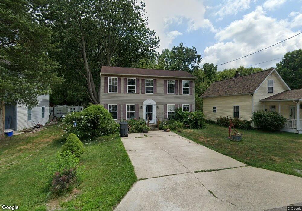
159 Railroad St SW Pataskala, OH 43062
Estimated Value: $213,000 - $262,000
3
Beds
1
Bath
1,600
Sq Ft
$148/Sq Ft
Est. Value
About This Home
This home is located at 159 Railroad St SW, Pataskala, OH 43062 and is currently estimated at $236,503, approximately $147 per square foot. 159 Railroad St SW is a home located in Licking County with nearby schools including North Elementary School, Licking Heights Central, and Licking Heights High School.
Ownership History
Date
Name
Owned For
Owner Type
Purchase Details
Closed on
Oct 31, 2003
Sold by
Select Homes Inc
Bought by
Blood Damon L and Blood Sabine G
Current Estimated Value
Home Financials for this Owner
Home Financials are based on the most recent Mortgage that was taken out on this home.
Original Mortgage
$104,037
Outstanding Balance
$47,594
Interest Rate
5.81%
Mortgage Type
FHA
Estimated Equity
$188,909
Create a Home Valuation Report for This Property
The Home Valuation Report is an in-depth analysis detailing your home's value as well as a comparison with similar homes in the area
Home Values in the Area
Average Home Value in this Area
Purchase History
| Date | Buyer | Sale Price | Title Company |
|---|---|---|---|
| Blood Damon L | $104,900 | Title First Agency |
Source: Public Records
Mortgage History
| Date | Status | Borrower | Loan Amount |
|---|---|---|---|
| Open | Blood Damon L | $104,037 |
Source: Public Records
Tax History Compared to Growth
Tax History
| Year | Tax Paid | Tax Assessment Tax Assessment Total Assessment is a certain percentage of the fair market value that is determined by local assessors to be the total taxable value of land and additions on the property. | Land | Improvement |
|---|---|---|---|---|
| 2024 | $3,073 | $59,960 | $10,290 | $49,670 |
| 2023 | $3,187 | $59,960 | $10,290 | $49,670 |
| 2022 | $3,095 | $50,230 | $5,150 | $45,080 |
| 2021 | $3,154 | $50,230 | $5,150 | $45,080 |
| 2020 | $3,118 | $50,230 | $5,150 | $45,080 |
| 2019 | $2,666 | $39,840 | $5,150 | $34,690 |
| 2018 | $2,693 | $0 | $0 | $0 |
| 2017 | $2,700 | $0 | $0 | $0 |
| 2016 | $2,773 | $0 | $0 | $0 |
| 2015 | $2,644 | $0 | $0 | $0 |
| 2014 | $3,468 | $0 | $0 | $0 |
| 2013 | $2,625 | $0 | $0 | $0 |
Source: Public Records
Map
Nearby Homes
- 55 1st St SW
- 23 1st St SW
- 11034 Broad St SW
- 303 Levi Dr Unit Lot 7
- 186 Markway Dr Unit Lot 12
- 305 Levi Dr Unit Lot 6
- 188 Markway Dr Unit Lot 13
- 210 Cedar St Unit 156b
- 405 Waterlily Ln
- 601 Hannahs SW
- 164 W Mill St
- 372 Isaac Tharp St
- 368 Isaac Tharp St
- 342 Isaac Tharp St
- 238 S Vine St
- 11666 Mill Street Rd SW
- 364 Isaac Tharp St
- 360 Isaac Tharp St
- 475 Washington St
- 81 Town St
- 179 Railroad St SW
- 129 Railroad St SW
- 119 Railroad St SW
- 261 Railroad St SW
- 150 Railroad St SW
- 109 Railroad St SW
- 154 Railroad St SW
- 160 Railroad St SW
- 140 Railroad St SW
- 116 Railroad St SW
- 126 Railroad St SW
- 106 Railroad St SW
- 27 1st St SW
- 89 Railroad St SW
- 35 1st St SW
- 35 1st St SW
- 43 1st St SW
- 69 Railroad St SW
- 90 Railroad St SW
- 47 1st St SW