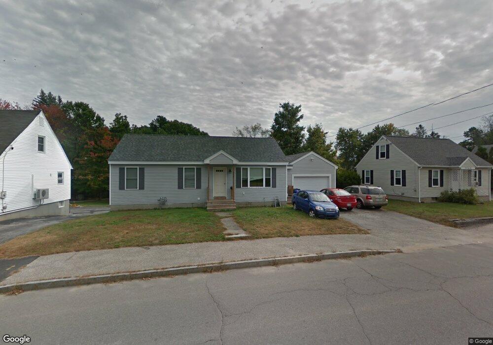
159 Rockland Ave Manchester, NH 03102
Mast Road NeighborhoodEstimated Value: $445,000 - $508,542
3
Beds
2
Baths
1,008
Sq Ft
$463/Sq Ft
Est. Value
About This Home
This home is located at 159 Rockland Ave, Manchester, NH 03102 and is currently estimated at $466,386, approximately $462 per square foot. 159 Rockland Ave is a home located in Hillsborough County with nearby schools including Parker-Varney School, Middle School at Parkside, and Manchester West High School.
Ownership History
Date
Name
Owned For
Owner Type
Purchase Details
Closed on
Jun 12, 2023
Sold by
Clegg Edward F
Bought by
Clegg Edward F and Clegg Edward F
Current Estimated Value
Purchase Details
Closed on
Apr 25, 2012
Sold by
Clegg Edward F
Bought by
Clegg Edward F and Clegg Christine H
Purchase Details
Closed on
Jun 16, 2008
Sold by
Clegg Doris G
Bought by
Clegg Doris G and Clegg Edward F
Home Financials for this Owner
Home Financials are based on the most recent Mortgage that was taken out on this home.
Original Mortgage
$82,500
Interest Rate
6.13%
Mortgage Type
Purchase Money Mortgage
Create a Home Valuation Report for This Property
The Home Valuation Report is an in-depth analysis detailing your home's value as well as a comparison with similar homes in the area
Home Values in the Area
Average Home Value in this Area
Purchase History
| Date | Buyer | Sale Price | Title Company |
|---|---|---|---|
| Clegg Edward F | -- | None Available | |
| Clegg Edward F | -- | -- | |
| Clegg Doris G | $82,500 | -- |
Source: Public Records
Mortgage History
| Date | Status | Borrower | Loan Amount |
|---|---|---|---|
| Previous Owner | Clegg Doris G | $82,500 |
Source: Public Records
Tax History Compared to Growth
Tax History
| Year | Tax Paid | Tax Assessment Tax Assessment Total Assessment is a certain percentage of the fair market value that is determined by local assessors to be the total taxable value of land and additions on the property. | Land | Improvement |
|---|---|---|---|---|
| 2024 | $6,908 | $352,800 | $97,300 | $255,500 |
| 2023 | $6,654 | $352,800 | $97,300 | $255,500 |
| 2022 | $6,435 | $352,800 | $97,300 | $255,500 |
| 2021 | $6,238 | $352,800 | $97,300 | $255,500 |
| 2020 | $5,916 | $239,900 | $67,100 | $172,800 |
| 2019 | $5,834 | $239,900 | $67,100 | $172,800 |
| 2018 | $5,681 | $239,900 | $67,100 | $172,800 |
| 2017 | $5,594 | $239,900 | $67,100 | $172,800 |
| 2016 | $5,551 | $239,900 | $67,100 | $172,800 |
| 2015 | $4,240 | $180,900 | $67,100 | $113,800 |
| 2014 | $4,251 | $180,900 | $67,100 | $113,800 |
| 2013 | $4,101 | $180,900 | $67,100 | $113,800 |
Source: Public Records
Map
Nearby Homes
- 149 Rockland Ave
- 187 Rockland Ave
- 85 Plymouth St
- 197 Rockland Ave
- 152 Rockland Ave
- 75 Plymouth St
- 133 Rockland Ave
- 162 Rockland Ave
- 86 Plymouth St
- 42/1-1 Plymouth St
- 202 Rockland Ave
- 124 Plymouth St
- 68 Plymouth St
- 131 Plymouth St
- 198 Wilkins St
- 190 Wilkins St
- 113 Rockland Ave
- 206 Wilkins St
- 180 Wilkins St
- 120 Rockland Ave