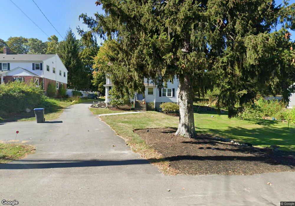
159 S Main St Natick, MA 01760
Estimated Value: $722,000 - $750,000
3
Beds
2
Baths
1,855
Sq Ft
$398/Sq Ft
Est. Value
About This Home
This home is located at 159 S Main St, Natick, MA 01760 and is currently estimated at $737,587, approximately $397 per square foot. 159 S Main St is a home located in Middlesex County with nearby schools including Natick High School, Johnson Elementary School, and J F Kennedy Middle School.
Ownership History
Date
Name
Owned For
Owner Type
Purchase Details
Closed on
Nov 12, 2025
Sold by
Hugh Barbara J
Bought by
Barbara J Hugh Irt and Roses
Current Estimated Value
Purchase Details
Closed on
Jul 16, 2020
Sold by
Roses Adam S and Roses Hugh Barbara
Bought by
Gidelson Jason and Gidelson Hilary
Purchase Details
Closed on
Nov 17, 2011
Sold by
Hugh Barbara J and Roses Adams S
Bought by
Graham David A and Graham Maureen E
Purchase Details
Closed on
Aug 1, 1983
Bought by
Roses Adam S and Hugh Barbara J
Create a Home Valuation Report for This Property
The Home Valuation Report is an in-depth analysis detailing your home's value as well as a comparison with similar homes in the area
Home Values in the Area
Average Home Value in this Area
Purchase History
| Date | Buyer | Sale Price | Title Company |
|---|---|---|---|
| Barbara J Hugh Irt | -- | -- | |
| Gidelson Jason | $2,000 | None Available | |
| Graham David A | -- | -- | |
| Graham David A | -- | -- | |
| Roses Adam S | $75,000 | -- |
Source: Public Records
Mortgage History
| Date | Status | Borrower | Loan Amount |
|---|---|---|---|
| Previous Owner | Roses Adam S | $21,000 | |
| Previous Owner | Roses Adam S | $35,000 |
Source: Public Records
Tax History
| Year | Tax Paid | Tax Assessment Tax Assessment Total Assessment is a certain percentage of the fair market value that is determined by local assessors to be the total taxable value of land and additions on the property. | Land | Improvement |
|---|---|---|---|---|
| 2025 | $6,979 | $583,500 | $426,900 | $156,600 |
| 2024 | $6,748 | $550,400 | $403,300 | $147,100 |
| 2023 | $6,812 | $538,900 | $377,500 | $161,400 |
| 2022 | $6,541 | $490,300 | $342,700 | $147,600 |
| 2021 | $6,304 | $463,200 | $324,800 | $138,400 |
| 2020 | $4,868 | $466,300 | $310,700 | $155,600 |
| 2019 | $9,119 | $466,300 | $310,700 | $155,600 |
| 2018 | $5,811 | $445,300 | $296,600 | $148,700 |
| 2017 | $5,752 | $426,400 | $270,400 | $156,000 |
| 2016 | $5,675 | $418,200 | $263,600 | $154,600 |
| 2015 | $5,205 | $376,600 | $263,600 | $113,000 |
Source: Public Records
Map
Nearby Homes
- 216-218 S Main St
- 62 Oakland St
- 14 Pinewood Ave
- 25 Forest Ave
- 16 West St
- 6 Floral Avenue Extension
- 12 Floral Ave
- 5 Reynolds Ave Unit 2
- 7 Allison Way Unit 7
- 63 Pond St
- 7 High St
- 16 Wayside Rd Unit 14
- 11 Morgan Dr Unit 404
- 13 Morgan Dr Unit 109
- 89 W Central St
- 49 Summer St
- 11 Avon St
- 45 Summer St
- 1 Fern St
- 10 Lincoln St Unit 10
- 155 S Main St
- 161 S Main St
- 0 S Main St Unit 70943864
- 0 S Main St Unit 71113487
- 0 S Main St Unit 71149099
- 0 S Main St Unit 71363508
- 0 S Main St Unit 71289829
- 0 S Main St
- 153 S Main St
- 0-153 S Main St
- 164 S Main St
- 163 S Main St
- 162 S Main St
- 1 Hunters Ln
- 160 S Main St
- 3 Hunters Ln
- 167 S Main St
- 147 S Main St
- 149 S Main St
- 154 S Main St
Your Personal Tour Guide
Ask me questions while you tour the home.