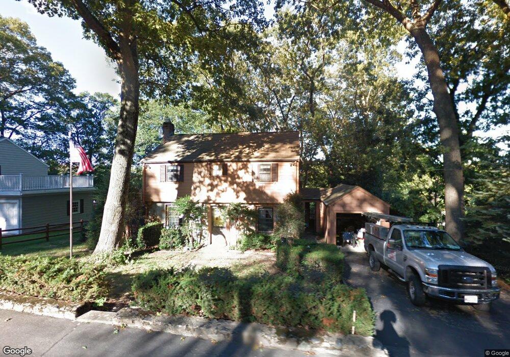
159 Thornton Rd Needham, MA 02492
Estimated Value: $2,201,000 - $2,571,000
--
Bed
6
Baths
1,580
Sq Ft
$1,555/Sq Ft
Est. Value
About This Home
This home is located at 159 Thornton Rd, Needham, MA 02492 and is currently estimated at $2,457,337, approximately $1,555 per square foot. 159 Thornton Rd is a home located in Norfolk County with nearby schools including Broadmeadow Elementary School, High Rock Middle School, and Pollard Middle School.
Ownership History
Date
Name
Owned For
Owner Type
Purchase Details
Closed on
Jun 28, 2023
Sold by
Pinewood Land Hldg Inc
Bought by
Berenson Daniel and Berenson Korinne
Current Estimated Value
Home Financials for this Owner
Home Financials are based on the most recent Mortgage that was taken out on this home.
Original Mortgage
$1,650,000
Outstanding Balance
$1,590,827
Interest Rate
5.38%
Mortgage Type
Purchase Money Mortgage
Estimated Equity
$866,510
Purchase Details
Closed on
Jun 15, 2022
Sold by
Ramrath Joseph R and Ramrath Deborah L
Bought by
Pinewood Land Hldg Inc
Home Financials for this Owner
Home Financials are based on the most recent Mortgage that was taken out on this home.
Original Mortgage
$1,625,000
Interest Rate
5.27%
Mortgage Type
Purchase Money Mortgage
Purchase Details
Closed on
Mar 2, 2020
Sold by
Hobart Lisa D
Bought by
Ramrath Joseph R and Ramrath Deborah L
Purchase Details
Closed on
May 12, 2016
Sold by
Hobart Carol J Est and Umana
Bought by
Umana Cheryl A and Ramrath Deborah L
Purchase Details
Closed on
Mar 8, 2010
Sold by
Hobart Carol J and Umana Cheryl A
Bought by
Hobart Lisa D
Purchase Details
Closed on
Jun 9, 1966
Bought by
Hobart Lisa D
Create a Home Valuation Report for This Property
The Home Valuation Report is an in-depth analysis detailing your home's value as well as a comparison with similar homes in the area
Home Values in the Area
Average Home Value in this Area
Purchase History
| Date | Buyer | Sale Price | Title Company |
|---|---|---|---|
| Berenson Daniel | $2,200,000 | None Available | |
| Pinewood Land Hldg Inc | $1,100,000 | None Available | |
| Ramrath Joseph R | $188,932 | None Available | |
| Umana Cheryl A | -- | -- | |
| Hobart Lisa D | -- | -- | |
| Hobart Lisa D | -- | -- | |
| Hobart Lisa D | -- | -- | |
| Hobart Lisa D | -- | -- |
Source: Public Records
Mortgage History
| Date | Status | Borrower | Loan Amount |
|---|---|---|---|
| Open | Berenson Daniel | $1,650,000 | |
| Previous Owner | Pinewood Land Hldg Inc | $1,625,000 |
Source: Public Records
Tax History
| Year | Tax Paid | Tax Assessment Tax Assessment Total Assessment is a certain percentage of the fair market value that is determined by local assessors to be the total taxable value of land and additions on the property. | Land | Improvement |
|---|---|---|---|---|
| 2025 | $24,019 | $2,265,900 | $806,000 | $1,459,900 |
| 2024 | $30,097 | $2,403,900 | $585,200 | $1,818,700 |
| 2023 | $10,234 | $784,800 | $585,200 | $199,600 |
| 2022 | $8,958 | $670,000 | $515,300 | $154,700 |
| 2021 | $8,730 | $670,000 | $515,300 | $154,700 |
| 2020 | $8,315 | $665,700 | $515,300 | $150,400 |
| 2019 | $7,656 | $617,900 | $468,900 | $149,000 |
| 2018 | $7,341 | $617,900 | $468,900 | $149,000 |
| 2017 | $7,124 | $599,200 | $468,900 | $130,300 |
| 2016 | $6,915 | $599,200 | $468,900 | $130,300 |
| 2015 | $6,765 | $599,200 | $468,900 | $130,300 |
| 2014 | $6,220 | $534,400 | $408,200 | $126,200 |
Source: Public Records
Map
Nearby Homes
- 26 Pinewood Rd
- 883 Greendale Ave
- 40 Otis St Unit L
- 168 Richdale Rd
- 638 Webster St
- 638 Webster St Unit 638
- 26 Gordon Rd
- 1011 Webster St
- 97 Great Plain Ave
- 68 Pleasant St Unit 68
- 233 Warren St
- 19 Highland Ct Unit 19
- 1202 Greendale Ave Unit 133
- 242 Valley Rd
- 37 Cottage Cir
- 37 Cottage Cir Unit 37
- 40 High St
- 1206 Greendale Ave Unit 201
- 7 West St
- 90 Norfolk St
- 159 Thornton Rd
- 165 Thornton Rd
- 153 Thornton Rd
- 164 Thornton Rd
- 156 Thornton Rd
- 162 Thornton Rd
- 92 Aletha Rd
- 104 Aletha Rd
- 147 Thornton Rd
- 130 Birds Hill Ave
- 170 Thornton Rd
- 84 Aletha Rd
- 90 Morningside Rd
- 83 Audrey Ave
- 84 Morningside Rd
- 122 Birds Hill Ave
- 110 Aletha Rd
- 178 Thornton Rd
- 78 Morningside Rd
- 103 Aletha Rd
Your Personal Tour Guide
Ask me questions while you tour the home.