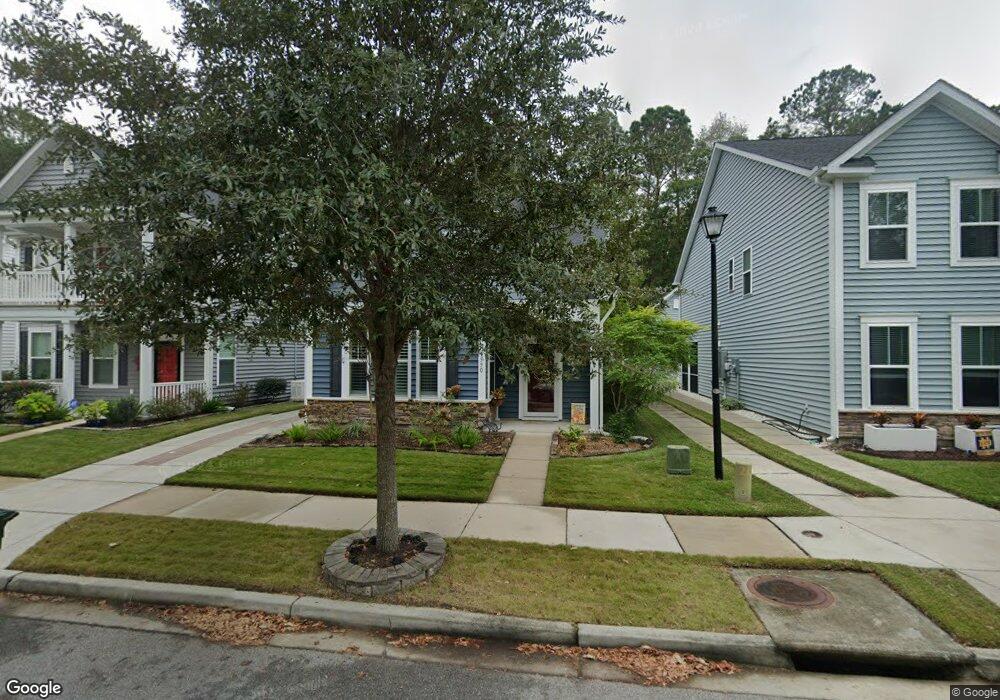
1590 Nautical Chart Dr Charleston, SC 29414
West Ashley NeighborhoodEstimated Value: $524,986 - $551,000
3
Beds
3
Baths
1,809
Sq Ft
$297/Sq Ft
Est. Value
About This Home
This home is located at 1590 Nautical Chart Dr, Charleston, SC 29414 and is currently estimated at $537,747, approximately $297 per square foot. 1590 Nautical Chart Dr is a home located in Charleston County with nearby schools including Oakland Elementary School, West Ashley High School, and Evangel Christian School.
Ownership History
Date
Name
Owned For
Owner Type
Purchase Details
Closed on
Feb 18, 2022
Sold by
Cuff Claudia
Bought by
Roe Marthe T and Roe Gregory
Current Estimated Value
Home Financials for this Owner
Home Financials are based on the most recent Mortgage that was taken out on this home.
Original Mortgage
$80,000
Outstanding Balance
$54,531
Interest Rate
3.55%
Mortgage Type
New Conventional
Estimated Equity
$483,216
Purchase Details
Closed on
Aug 24, 2016
Sold by
Beazer Homes Corp
Bought by
Cuff Claudia
Home Financials for this Owner
Home Financials are based on the most recent Mortgage that was taken out on this home.
Original Mortgage
$150,000
Interest Rate
3.42%
Mortgage Type
New Conventional
Create a Home Valuation Report for This Property
The Home Valuation Report is an in-depth analysis detailing your home's value as well as a comparison with similar homes in the area
Home Values in the Area
Average Home Value in this Area
Purchase History
| Date | Buyer | Sale Price | Title Company |
|---|---|---|---|
| Roe Marthe T | $405,000 | None Listed On Document | |
| Roe Marthe T | $405,000 | None Listed On Document | |
| Cuff Claudia | $296,385 | -- |
Source: Public Records
Mortgage History
| Date | Status | Borrower | Loan Amount |
|---|---|---|---|
| Open | Roe Marthe T | $80,000 | |
| Closed | Roe Marthe T | $80,000 | |
| Previous Owner | Cuff Claudia | $150,000 |
Source: Public Records
Tax History Compared to Growth
Tax History
| Year | Tax Paid | Tax Assessment Tax Assessment Total Assessment is a certain percentage of the fair market value that is determined by local assessors to be the total taxable value of land and additions on the property. | Land | Improvement |
|---|---|---|---|---|
| 2024 | $1,902 | $14,200 | $0 | $0 |
| 2023 | $1,902 | $14,200 | $0 | $0 |
| 2022 | $1,269 | $9,990 | $0 | $0 |
| 2021 | $1,329 | $9,990 | $0 | $0 |
| 2020 | $1,377 | $9,990 | $0 | $0 |
| 2019 | $1,381 | $9,850 | $0 | $0 |
| 2017 | $1,585 | $11,850 | $0 | $0 |
| 2016 | $752 | $2,000 | $0 | $0 |
| 2015 | -- | $0 | $0 | $0 |
Source: Public Records
Map
Nearby Homes
- 1576 Nautical Chart Dr
- 1607 Roustabout Way
- 3201 Moonlight Dr
- 2864 Conservancy Ln
- 3221 Moonlight Dr
- 2823 Conservancy Ln
- 3030 Scuba Dr
- 1410 Roustabout Way
- 775 Hitching Post Rd
- 1585 Seabago Dr
- 775 Corral Dr
- 1615 Seabago Dr
- 3142 Bonanza Rd
- 714 Ponderosa Dr
- 1615 Evening Star Place
- 1728 Manassas Dr
- 1507 Dawn Mist Way
- 3036 Hatchers Run Dr
- 1624 Shady Pine Rd
- 207 Twinleaf Ct
- 1588 Nautical Chart Dr
- 1592 Nautical Chart Dr
- 1586 Nautical Chart Dr
- 1594 Nautical Chart Dr
- 1584 Nautical Chart Dr
- 1596 Nautical Chart Dr
- 1598 Nautical Chart Dr
- 1577 Nautical Chart Dr
- 1605 Nautical Chart Dr
- 1600 Nautical Chart Dr
- 1575 Nautical Chart Dr
- 1604 Nautical Chart Dr
- 3157 Moonlight Dr
- 3155 Moonlight Dr
- 3159 Moonlight Dr
- 3151 Moonlight Dr
- 3149 Moonlight Dr
- 3161 Moonlight Dr
- 3147 Moonlight Dr
- 3163 Moonlight Dr