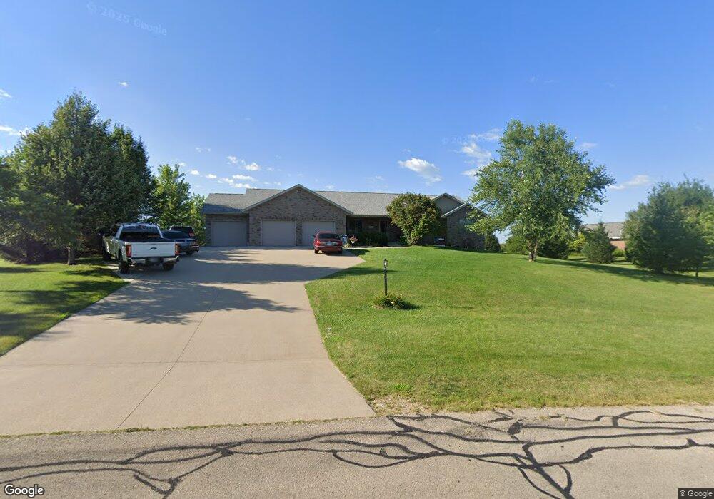
15900 Red Maple Dr Peosta, IA 52068
Estimated Value: $487,000 - $582,000
4
Beds
4
Baths
1,974
Sq Ft
$259/Sq Ft
Est. Value
About This Home
This home is located at 15900 Red Maple Dr, Peosta, IA 52068 and is currently estimated at $511,479, approximately $259 per square foot. 15900 Red Maple Dr is a home located in Dubuque County with nearby schools including Carver Elementary School, Eleanor Roosevelt Middle School, and Hempstead High School.
Ownership History
Date
Name
Owned For
Owner Type
Purchase Details
Closed on
Oct 16, 2007
Sold by
Conrad Pete R and Conard Diana L
Bought by
Fischer Edward J and Fischer Nicole M
Current Estimated Value
Home Financials for this Owner
Home Financials are based on the most recent Mortgage that was taken out on this home.
Original Mortgage
$151,921
Outstanding Balance
$95,685
Interest Rate
6.38%
Mortgage Type
New Conventional
Estimated Equity
$415,794
Purchase Details
Closed on
Jun 11, 2007
Sold by
Conrad Daniel R and Conrad Jacquelyn A
Bought by
Conrad Pete R and Conrad Diana L
Create a Home Valuation Report for This Property
The Home Valuation Report is an in-depth analysis detailing your home's value as well as a comparison with similar homes in the area
Home Values in the Area
Average Home Value in this Area
Purchase History
| Date | Buyer | Sale Price | Title Company |
|---|---|---|---|
| Fischer Edward J | $255,000 | None Available | |
| Conrad Pete R | $30,000 | None Available |
Source: Public Records
Mortgage History
| Date | Status | Borrower | Loan Amount |
|---|---|---|---|
| Open | Fischer Edward J | $151,921 |
Source: Public Records
Tax History Compared to Growth
Tax History
| Year | Tax Paid | Tax Assessment Tax Assessment Total Assessment is a certain percentage of the fair market value that is determined by local assessors to be the total taxable value of land and additions on the property. | Land | Improvement |
|---|---|---|---|---|
| 2025 | $4,768 | $436,800 | $75,800 | $361,000 |
| 2024 | $4,768 | $418,000 | $72,200 | $345,800 |
| 2023 | $4,608 | $418,000 | $72,200 | $345,800 |
| 2022 | $4,496 | $339,230 | $66,880 | $272,350 |
| 2021 | $4,496 | $339,230 | $66,880 | $272,350 |
| 2020 | $4,692 | $330,140 | $63,760 | $266,380 |
| 2019 | $4,614 | $330,140 | $63,760 | $266,380 |
| 2018 | $4,496 | $312,620 | $48,960 | $263,660 |
| 2017 | $4,212 | $312,620 | $48,960 | $263,660 |
| 2016 | $4,212 | $279,000 | $40,800 | $238,200 |
| 2015 | $4,094 | $279,000 | $40,800 | $238,200 |
| 2014 | $3,738 | $264,290 | $38,200 | $226,090 |
Source: Public Records
Map
Nearby Homes
- 10869 Cedar Ridge Ct
- 10640 Eagle Ridge Ct
- Lot 3 Thunder Hills Dr
- Lot 2 Thunder Hills Dr
- Lot 1 Thunder Hills Dr
- Lot 93 Tagan Dr
- Lot 68 Hugo Dr
- Lot 18 Ione Dr
- 277 Wyatt Dr
- 326 Solomia Ct
- 348 Solomia Ct
- 310 Solomia Ct
- 10702 Golden Oaks Dr
- 10867 Golden Oaks Dr
- 419 Angela Jean Cir
- Lot 1 Forest Ridge Dr
- lot 23 Thunder Valley Dr
- Lot 2 Thunder Valley Dr
- Lot 22 Thunder Valley Dr
- 7630 Kaia Dr
- 15886 Red Maple Dr
- 15928 Red Maple Dr
- 15887 Red Maple Dr
- 15854 Red Maple Dr
- 15857 Red Maple Dr
- 10517 Cottingham Rd
- 10551 Cottingham Rd
- 10527 Cottingham Rd
- 15826 Red Maple Dr
- 10629 Cottingham Rd
- 15813 Red Maple Dr
- 15796 Red Maple Dr
- 10405 Cottingham Rd
- 15852 White Oak Dr
- 15874 White Oak Dr
- 15812 White Oak Dr
- 15754 Red Maple Dr
- 15761 Red Maple Dr
- 10671 Cottingham Rd
- 10491 Cypress Dr