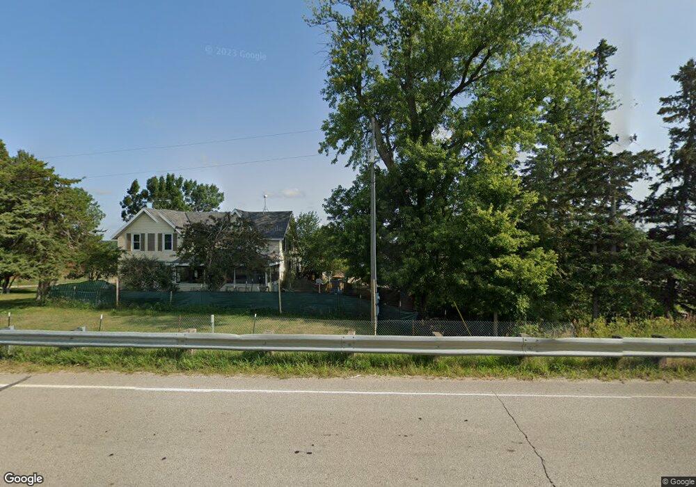
1591 1591 130th-Street-w Dundas, MN 55019
Estimated Value: $386,000 - $503,612
2
Beds
1
Bath
2,314
Sq Ft
$186/Sq Ft
Est. Value
About This Home
This home is located at 1591 1591 130th-Street-w, Dundas, MN 55019 and is currently estimated at $431,403, approximately $186 per square foot. 1591 1591 130th-Street-w is a home located in Rice County with nearby schools including Roosevelt Elementary School, Faribault Middle School, and Faribault Senior High School.
Ownership History
Date
Name
Owned For
Owner Type
Purchase Details
Closed on
Feb 9, 2024
Sold by
Tupa Nathan A and Tupa Julie A
Bought by
Nathan A Tupa And Julie A Tupa Trust and Tupa
Current Estimated Value
Purchase Details
Closed on
Apr 25, 2013
Sold by
Tupa David E and Tupa Cheryl A
Bought by
Tupa Nathan A and Tupa Julie A
Purchase Details
Closed on
Sep 22, 2010
Sold by
Federal Home Loan Mortgage Corporation
Bought by
Tupa David E and Tupa Cheryl A
Home Financials for this Owner
Home Financials are based on the most recent Mortgage that was taken out on this home.
Original Mortgage
$104,800
Interest Rate
4.36%
Mortgage Type
New Conventional
Purchase Details
Closed on
Jun 29, 2006
Sold by
Falk Thomas F and Falk Marilyn K
Bought by
Peters Daniel M
Create a Home Valuation Report for This Property
The Home Valuation Report is an in-depth analysis detailing your home's value as well as a comparison with similar homes in the area
Home Values in the Area
Average Home Value in this Area
Purchase History
| Date | Buyer | Sale Price | Title Company |
|---|---|---|---|
| Nathan A Tupa And Julie A Tupa Trust | $500 | None Listed On Document | |
| Tupa Nathan A | $182,000 | -- | |
| Tupa David E | $131,000 | -- | |
| Peters Daniel M | $318,000 | -- |
Source: Public Records
Mortgage History
| Date | Status | Borrower | Loan Amount |
|---|---|---|---|
| Previous Owner | Tupa David E | $104,800 |
Source: Public Records
Tax History Compared to Growth
Tax History
| Year | Tax Paid | Tax Assessment Tax Assessment Total Assessment is a certain percentage of the fair market value that is determined by local assessors to be the total taxable value of land and additions on the property. | Land | Improvement |
|---|---|---|---|---|
| 2025 | $3,224 | $437,700 | $167,000 | $270,700 |
| 2024 | $3,224 | $395,500 | $150,000 | $245,500 |
| 2023 | $2,770 | $395,500 | $150,000 | $245,500 |
| 2022 | $2,484 | $344,900 | $123,000 | $221,900 |
| 2021 | $2,376 | $291,400 | $105,700 | $185,700 |
| 2020 | $2,220 | $278,200 | $103,200 | $175,000 |
| 2019 | $2,222 | $271,800 | $103,200 | $168,600 |
| 2018 | $2,100 | $270,500 | $103,200 | $167,300 |
| 2017 | $2,164 | $251,400 | $103,200 | $148,200 |
| 2016 | $1,970 | $242,100 | $103,200 | $138,900 |
| 2015 | $1,888 | $217,400 | $103,200 | $114,200 |
| 2014 | -- | $216,300 | $103,200 | $113,100 |
Source: Public Records
Map
Nearby Homes
- 13701 Bagley Ave
- 3555 Culver Trail
- 13461 Fox Lake Trail
- 5561 115th St E
- 3299 Circle Bluff Trail
- XXX2 Circle Lake Ln
- XXX1 Circle Lake Ln
- Lot 2 Circle Lake Ln
- Lot 1 Circle Lake Ln
- 9816 Base Line Rd
- 16412 Ames Way
- 9XXX Elmore Ave
- 16810 Bagley Ave
- 2184 Bagley Way
- 2068 Millersburg Blvd W
- 2655 88th Ct W
- 8833 Canby Ct
- 8705 Chester Ave
- 1211 Lonsdale Blvd E
- 210 Mill St W
- 1591 130th St W
- 1635 130th St W
- 1821 130th St W
- 13048 Bagley Ave
- 1434 130th St W
- 2061 130th St W
- 12704 Base Line Rd
- 12456 Bagley Ave
- 12245 Bagley Ave
- 12605 Base Line Rd
- 12326 Base Line Rd
- 12326 Base Line Rd
- 13258 Base Line Rd
- 13417 Bagley Ave
- 12505 Base Line Rd
- 13313 Base Line Rd
- 1301 130th St E
- 1290 120th St W
- 12084 Bagley Ave
- 12100 Base Line Rd