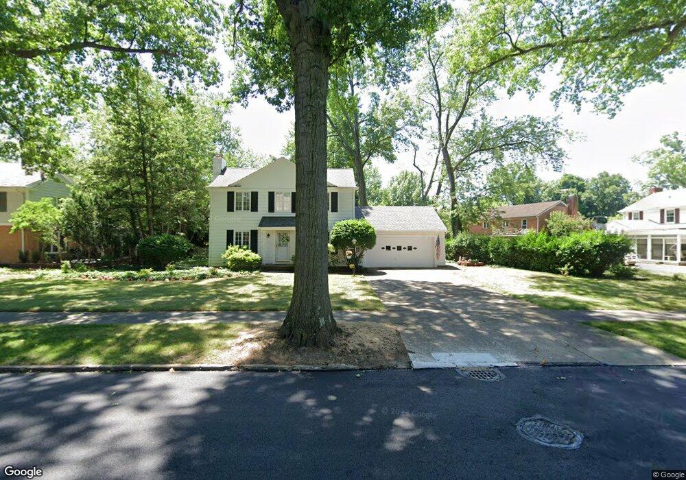
15910 Brewster Rd Cleveland, OH 44112
Estimated Value: $173,000 - $232,000
3
Beds
3
Baths
2,128
Sq Ft
$101/Sq Ft
Est. Value
About This Home
This home is located at 15910 Brewster Rd, Cleveland, OH 44112 and is currently estimated at $214,190, approximately $100 per square foot. 15910 Brewster Rd is a home located in Cuyahoga County with nearby schools including Shaw High School, Yeshiva Derech Hatorah, and Lutheran High School East.
Ownership History
Date
Name
Owned For
Owner Type
Purchase Details
Closed on
Jan 26, 2009
Sold by
Holt Carolyn G
Bought by
Holt Carolyn G
Current Estimated Value
Purchase Details
Closed on
Apr 7, 1987
Sold by
Huntsman Nancy J
Bought by
Holt Carolyn G
Purchase Details
Closed on
Jun 6, 1983
Sold by
Rydzel James A
Bought by
Huntsman Nancy J
Purchase Details
Closed on
Apr 16, 1976
Sold by
Hodgins Raymond and Hodgins Gabrielle
Bought by
Rydzel James A
Purchase Details
Closed on
Jan 1, 1975
Bought by
Hodgins Raymond and Hodgins Gabrielle
Create a Home Valuation Report for This Property
The Home Valuation Report is an in-depth analysis detailing your home's value as well as a comparison with similar homes in the area
Home Values in the Area
Average Home Value in this Area
Purchase History
| Date | Buyer | Sale Price | Title Company |
|---|---|---|---|
| Holt Carolyn G | -- | Attorney | |
| Holt Carolyn G | $44,800 | -- | |
| Huntsman Nancy J | $81,000 | -- | |
| Rydzel James A | $50,000 | -- | |
| Hodgins Raymond | -- | -- |
Source: Public Records
Tax History Compared to Growth
Tax History
| Year | Tax Paid | Tax Assessment Tax Assessment Total Assessment is a certain percentage of the fair market value that is determined by local assessors to be the total taxable value of land and additions on the property. | Land | Improvement |
|---|---|---|---|---|
| 2024 | $3,809 | $69,195 | $11,270 | $57,925 |
| 2023 | $3,423 | $46,270 | $8,890 | $37,380 |
| 2022 | $3,448 | $46,270 | $8,890 | $37,380 |
| 2021 | $3,419 | $46,270 | $8,890 | $37,380 |
| 2020 | $3,344 | $42,460 | $8,160 | $34,300 |
| 2019 | $3,495 | $121,300 | $23,300 | $98,000 |
| 2018 | $3,479 | $42,460 | $8,160 | $34,300 |
| 2017 | $2,873 | $38,050 | $4,690 | $33,360 |
| 2016 | $2,851 | $38,050 | $4,690 | $33,360 |
| 2015 | $3,181 | $38,050 | $4,690 | $33,360 |
| 2014 | $3,181 | $44,770 | $5,530 | $39,240 |
Source: Public Records
Map
Nearby Homes
- 2067 Mount Vernon Blvd
- 0 Wyatt Rd
- 15724 Wyatt Rd
- 15959 Glynn Rd
- 2186 Mount Vernon Blvd
- 2090 Newbury Dr
- 15908 Hazel Rd
- 16252 Oakhill Rd
- 15703 Hazel Rd
- 16263 Oakhill Rd
- 2188 N Taylor Rd
- 3153 Eastwick Dr
- 1148 Rutherford Rd
- 3142 Eastwick Dr
- 2145 N Taylor Rd
- 2137 N Taylor Rd
- 2195 N Taylor Rd
- 2256 N Taylor Rd
- 15018 Terrace Rd
- 1073 Hereford Rd
- 15932 Brewster Rd
- 2093 Mount Vernon Blvd
- 15911 Fenemore Rd
- 2117 Mount Vernon Blvd
- 15933 Brewster Rd
- 15903 Brewster Rd
- 15957 Brewster Rd
- 15873 Brewster Rd
- 2129 Mount Vernon Blvd
- 15981 Brewster Rd
- 2025 Mount Vernon Blvd
- 16024 Brewster Rd
- 16009 Brewster Rd
- 15928 Fenemore Rd
- 15946 Fenemore Rd
- 15916 Fenemore Rd
- 15924 Glynn Rd
- 2157 Mount Vernon Blvd
- 15942 Glynn Rd
- 16033 Brewster Rd