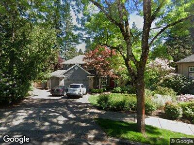
15920 SW Cormorant Dr Beaverton, OR 97007
Neighbors Southwest NeighborhoodEstimated Value: $861,112 - $959,000
4
Beds
3
Baths
2,789
Sq Ft
$331/Sq Ft
Est. Value
About This Home
This home is located at 15920 SW Cormorant Dr, Beaverton, OR 97007 and is currently estimated at $923,528, approximately $331 per square foot. 15920 SW Cormorant Dr is a home located in Washington County with nearby schools including Nancy Ryles Elementary School, Highland Park Middle School, and Mountainside High School.
Ownership History
Date
Name
Owned For
Owner Type
Purchase Details
Closed on
Aug 31, 2012
Sold by
Love Daniel A and Love Karen M
Bought by
Frank Aaron A and Frank Haven E
Current Estimated Value
Home Financials for this Owner
Home Financials are based on the most recent Mortgage that was taken out on this home.
Original Mortgage
$337,920
Interest Rate
3.47%
Mortgage Type
New Conventional
Create a Home Valuation Report for This Property
The Home Valuation Report is an in-depth analysis detailing your home's value as well as a comparison with similar homes in the area
Home Values in the Area
Average Home Value in this Area
Purchase History
| Date | Buyer | Sale Price | Title Company |
|---|---|---|---|
| Frank Aaron A | $422,400 | First American |
Source: Public Records
Mortgage History
| Date | Status | Borrower | Loan Amount |
|---|---|---|---|
| Open | Frank Aaron A | $73,185 | |
| Open | Frank Aaron A | $534,770 | |
| Closed | Frank Aaron A | $71,000 | |
| Closed | Frank Aaron A | $550,000 | |
| Closed | Frank Aaron A | $143,800 | |
| Closed | Frank Aaron A | $407,000 | |
| Closed | Frank Aaron A | $36,000 | |
| Closed | Frank Aaron A | $41,000 | |
| Closed | Frank Aaron A | $337,920 | |
| Previous Owner | Love Daniel A | $218,947 | |
| Previous Owner | Love Daniel A | $223,400 |
Source: Public Records
Tax History Compared to Growth
Tax History
| Year | Tax Paid | Tax Assessment Tax Assessment Total Assessment is a certain percentage of the fair market value that is determined by local assessors to be the total taxable value of land and additions on the property. | Land | Improvement |
|---|---|---|---|---|
| 2025 | $12,508 | $592,840 | -- | -- |
| 2024 | $11,809 | $575,580 | -- | -- |
| 2023 | $11,809 | $558,820 | $0 | $0 |
| 2022 | $11,303 | $558,820 | $0 | $0 |
| 2021 | $10,907 | $526,750 | $0 | $0 |
| 2020 | $10,575 | $511,410 | $0 | $0 |
| 2019 | $10,240 | $496,520 | $0 | $0 |
| 2018 | $9,914 | $482,060 | $0 | $0 |
| 2017 | $9,543 | $468,020 | $0 | $0 |
| 2016 | $9,211 | $454,390 | $0 | $0 |
| 2015 | $8,816 | $441,160 | $0 | $0 |
| 2014 | $8,632 | $428,320 | $0 | $0 |
Source: Public Records
Map
Nearby Homes
- 10915 SW Mourning Dove Place
- 11255 SW Chickadee Terrace
- 10975 SW Avocet Ct
- 16235 SW Falcon Dr
- 10420 SW 153rd Ave
- 10215 SW Snowgoose Place
- 15410 SW Bobwhite Cir
- 10415 SW 152nd Ave
- 15680 SW Talus Way
- 16790 SW Siler Ridge Ln
- 16555 SW Red Rock Ct
- 10553 SW Mount Adams Dr
- 15160 SW Kingbird Dr
- 15900 SW Breccia Dr
- 9765 SW 163rd Ave
- 15095 SW Weir Rd
- 9770 SW Tephra Terrace
- 16465 SW Black Bird St
- 16205 SW Blackbird Dr
- 16610 SW Sandstone Ct
- 15920 SW Cormorant Dr
- 15940 SW Cormorant Dr
- 15900 SW Cormorant Dr
- 15970 SW Cormorant Dr
- 10788 SW Oriole Cir
- 10780 SW Oriole Cir
- 15915 SW Cormorant Dr
- 15875 SW Cormorant Dr
- 15965 SW Cormorant Dr
- 10772 SW Oriole Cir
- 10785 SW Oriole Cir
- 16020 SW Cormorant Dr
- 10885 SW Falcon Ct
- 10764 SW Oriole Cir
- 16081 SW Waxwing Place
- 10920 SW Mourning Dove Place
- 16025 SW Cormorant Dr
- 10773 SW Oriole Cir
- 16067 SW Waxwing Way
- 16063 SW Waxwing Way