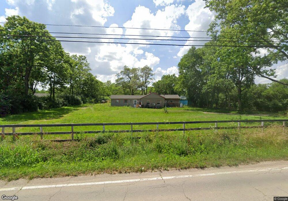
1595 N Union Rd Dayton, OH 45417
Estimated Value: $145,000 - $177,000
2
Beds
1
Bath
1,294
Sq Ft
$122/Sq Ft
Est. Value
About This Home
This home is located at 1595 N Union Rd, Dayton, OH 45417 and is currently estimated at $157,773, approximately $121 per square foot. 1595 N Union Rd is a home located in Montgomery County with nearby schools including Trotwood-Madison Middle School, Trotwood-Madison High School, and Trotwood Preparatory & Fitness Academy.
Ownership History
Date
Name
Owned For
Owner Type
Purchase Details
Closed on
Feb 28, 2017
Sold by
Espino Alvaro
Bought by
Bennett Deborah L
Current Estimated Value
Home Financials for this Owner
Home Financials are based on the most recent Mortgage that was taken out on this home.
Original Mortgage
$63,723
Outstanding Balance
$53,490
Interest Rate
4.62%
Mortgage Type
FHA
Estimated Equity
$104,283
Purchase Details
Closed on
May 16, 2016
Sold by
Ligon Samuel N
Bought by
Espino Alvaro
Purchase Details
Closed on
Aug 27, 1997
Sold by
Banc One Mtg Corp
Bought by
Ligon Samuel N
Purchase Details
Closed on
Mar 12, 1997
Sold by
Haines Gary and Beach Scott E
Bought by
Banc One Mtg Corp
Purchase Details
Closed on
Oct 12, 1994
Sold by
Bright John E
Bought by
Beach Scott E and Beach Michelle L
Create a Home Valuation Report for This Property
The Home Valuation Report is an in-depth analysis detailing your home's value as well as a comparison with similar homes in the area
Home Values in the Area
Average Home Value in this Area
Purchase History
| Date | Buyer | Sale Price | Title Company |
|---|---|---|---|
| Bennett Deborah L | $64,900 | Fidelity National Title | |
| Espino Alvaro | $11,000 | None Available | |
| Ligon Samuel N | $58,000 | -- | |
| Banc One Mtg Corp | $50,000 | -- | |
| Beach Scott E | -- | Midland Title Security Inc |
Source: Public Records
Mortgage History
| Date | Status | Borrower | Loan Amount |
|---|---|---|---|
| Open | Bennett Deborah L | $63,723 |
Source: Public Records
Tax History Compared to Growth
Tax History
| Year | Tax Paid | Tax Assessment Tax Assessment Total Assessment is a certain percentage of the fair market value that is determined by local assessors to be the total taxable value of land and additions on the property. | Land | Improvement |
|---|---|---|---|---|
| 2024 | $2,411 | $36,960 | $16,580 | $20,380 |
| 2023 | $2,411 | $36,960 | $16,580 | $20,380 |
| 2022 | $2,008 | $23,940 | $11,200 | $12,740 |
| 2021 | $2,012 | $23,940 | $11,200 | $12,740 |
| 2020 | $2,008 | $23,940 | $11,200 | $12,740 |
| 2019 | $1,720 | $18,280 | $11,200 | $7,080 |
| 2018 | $1,723 | $18,280 | $11,200 | $7,080 |
| 2017 | $1,746 | $18,280 | $11,200 | $7,080 |
| 2016 | $2,561 | $16,650 | $11,200 | $5,450 |
| 2015 | $1,790 | $16,650 | $11,200 | $5,450 |
| 2014 | $1,790 | $16,650 | $11,200 | $5,450 |
| 2012 | -- | $19,100 | $11,200 | $7,900 |
Source: Public Records
Map
Nearby Homes
- 0 Little Richmond Rd
- 6899 Little Richmond Rd
- 7534 Little Richmond Rd
- 1500 N Snyder Rd
- 316 Skinner Dr
- 6236 Carmin Ave
- 0 Meeker Woods Unit 884863
- 5328 Whaley Dr
- 33 Mario Dr
- 175 N Northampton Ave
- 17 Grand Ave
- 51 N Northampton Ave
- 201 Parsons Ave
- 204 E Main St
- 0 Northwest Pkwy
- 4 Pleasant Ave
- 217 Parsons Ave
- 0 Main
- 209 W Main St
- 764 Miller Ave
- 1571 N Union Rd
- 1529 N Union Rd
- 1467 N Union Rd
- 1648 N Union Rd
- 1415 N Union Rd
- 1777 N Union Rd
- 1783 N Union Rd
- 1857 N Union Rd
- 1857 N Union Rd
- 1869 N Union Rd
- 1947 N Union Rd
- 6840 Little Richmond Rd
- 1250 N Union Rd
- 7178 Little Richmond Rd
- 7156 Little Richmond Rd
- 7166 Little Richmond Rd
- 7206 Little Richmond Rd
- 7220 Little Richmond Rd
- 6989 Little Richmond Rd
- 6770 Little Richmond Rd