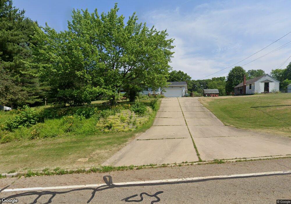
1595 W Nimisila Rd New Franklin, OH 44216
Estimated Value: $211,000 - $251,892
3
Beds
1
Bath
1,118
Sq Ft
$213/Sq Ft
Est. Value
About This Home
This home is located at 1595 W Nimisila Rd, New Franklin, OH 44216 and is currently estimated at $237,631, approximately $212 per square foot. 1595 W Nimisila Rd is a home located in Summit County.
Ownership History
Date
Name
Owned For
Owner Type
Purchase Details
Closed on
Apr 30, 2024
Sold by
Heard Bonnie J
Bought by
Heard Family Trust and Heard
Current Estimated Value
Purchase Details
Closed on
Apr 12, 2024
Sold by
Heard Bonnie J
Bought by
Heard Family Trust and Heard
Purchase Details
Closed on
Feb 14, 2008
Sold by
Heard Bonnie J
Bought by
Heard Bonnie J and The Heard Family Trust
Purchase Details
Closed on
Jan 25, 2008
Sold by
Heard Bonnie J
Bought by
Heard Bonnie J
Purchase Details
Closed on
Dec 22, 2005
Sold by
Heard Bonnie J
Bought by
Heard Bonnie J and Heard Family Trust
Purchase Details
Closed on
Dec 21, 2005
Sold by
Heard Bonnie J
Bought by
Heard Bonnie J
Purchase Details
Closed on
Oct 29, 2002
Sold by
Heard John P and Heard Bonnie J
Bought by
Heard John P and Heard Bonnie J
Purchase Details
Closed on
Dec 22, 2000
Sold by
Heard John P and Heard Bonnie J
Bought by
Heard John P and Heard Bonnie J
Create a Home Valuation Report for This Property
The Home Valuation Report is an in-depth analysis detailing your home's value as well as a comparison with similar homes in the area
Home Values in the Area
Average Home Value in this Area
Purchase History
| Date | Buyer | Sale Price | Title Company |
|---|---|---|---|
| Heard Family Trust | -- | None Listed On Document | |
| Heard Family Trust | -- | None Listed On Document | |
| Heard Bonnie J | -- | Attorney | |
| Heard Bonnie J | -- | Attorney | |
| Heard Bonnie J | -- | None Available | |
| Heard Bonnie J | -- | -- | |
| Heard John P | -- | -- | |
| Heard John P | -- | -- |
Source: Public Records
Tax History Compared to Growth
Tax History
| Year | Tax Paid | Tax Assessment Tax Assessment Total Assessment is a certain percentage of the fair market value that is determined by local assessors to be the total taxable value of land and additions on the property. | Land | Improvement |
|---|---|---|---|---|
| 2025 | $3,016 | $69,283 | $20,678 | $48,605 |
| 2024 | $3,016 | $69,283 | $20,678 | $48,605 |
| 2023 | $3,016 | $69,283 | $20,678 | $48,605 |
| 2022 | $2,896 | $53,677 | $15,432 | $38,245 |
| 2021 | $2,906 | $53,677 | $15,432 | $38,245 |
| 2020 | $2,856 | $53,680 | $15,430 | $38,250 |
| 2019 | $2,799 | $48,210 | $15,430 | $32,780 |
| 2018 | $2,417 | $48,210 | $15,430 | $32,780 |
| 2017 | $2,310 | $48,210 | $15,430 | $32,780 |
| 2016 | $2,283 | $42,880 | $15,430 | $27,450 |
| 2015 | $2,310 | $42,880 | $15,430 | $27,450 |
| 2014 | $2,293 | $42,880 | $15,430 | $27,450 |
| 2013 | $2,415 | $44,910 | $15,430 | $29,480 |
Source: Public Records
Map
Nearby Homes
- 6387 Hampsher Rd
- 1062 Stump Rd
- 6090 Manchester Rd Unit 6096
- 899 Loway Dr
- 2200 W Comet Rd
- 5776 Harter Home Dr
- 781 Leeman Dr
- 8177 S Cleveland Massillon Rd Unit 16
- 8177 S Cleveland Massillon Rd Unit 42
- 8714 Greenmeadow Ave NW
- 6407 Southview Dr
- 715 Highland Park Dr
- 7060 Manchester Rd
- 0 W Comet Rd Unit 5079117
- 5892 Woodward Dr
- 8941 Shoemaker Ave NW
- 451 Yager Rd
- 5983 Weaver Rd
- 7452 S Cleveland Massillon Rd
- 0 Babst Ave NW
- 1615 W Nimisila Rd
- 1579 W Nimisila Rd
- 1592 W Nimisila Rd
- 1570 W Nimisila Rd
- 1560 W Nimisila Rd
- 1620 W Nimisila Rd
- 1594 W Nimisila Rd
- 1639 W Nimisila Rd
- 1539 W Nimisila Rd
- 1659 W Nimisila Rd
- 1550 W Nimisila Rd
- 1536 W Nimisila Rd
- 1650 W Nimisila Rd
- 1520 W Nimisila Rd
- 1515 W Nimisila Rd
- 1670 W Nimisila Rd
- 6796 Grove Rd
- 1503 W Nimisila Rd
- 6786 Grove Rd
- 6760 Grove Rd