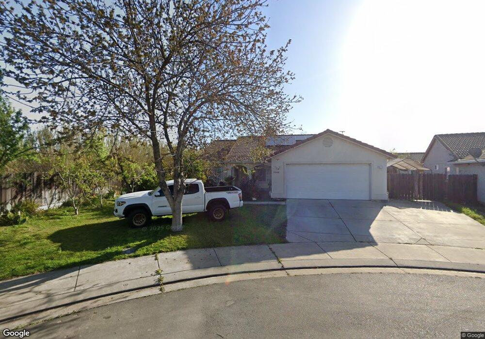
1596 Thurman Ct Merced, CA 95341
Estimated Value: $382,000 - $435,000
4
Beds
2
Baths
1,834
Sq Ft
$228/Sq Ft
Est. Value
About This Home
This home is located at 1596 Thurman Ct, Merced, CA 95341 and is currently estimated at $417,602, approximately $227 per square foot. 1596 Thurman Ct is a home located in Merced County with nearby schools including Leontine Gracey Elementary School, Tenaya Middle School, and El Capitan High School.
Ownership History
Date
Name
Owned For
Owner Type
Purchase Details
Closed on
Feb 16, 2022
Sold by
Francisco Miranda
Bought by
Francisco And Ramona Miranda Family Living Tr
Current Estimated Value
Purchase Details
Closed on
Feb 27, 2004
Sold by
Rucker Construction Inc
Bought by
Miranda Francisco R and Miranda Ramona
Home Financials for this Owner
Home Financials are based on the most recent Mortgage that was taken out on this home.
Original Mortgage
$186,360
Interest Rate
5.64%
Mortgage Type
Purchase Money Mortgage
Create a Home Valuation Report for This Property
The Home Valuation Report is an in-depth analysis detailing your home's value as well as a comparison with similar homes in the area
Purchase History
| Date | Buyer | Sale Price | Title Company |
|---|---|---|---|
| Francisco And Ramona Miranda Family Living Tr | -- | L Carmen Ramirez | |
| Miranda Francisco R | $233,000 | Transcounty Title Company |
Source: Public Records
Mortgage History
| Date | Status | Borrower | Loan Amount |
|---|---|---|---|
| Previous Owner | Miranda Francisco R | $186,360 |
Source: Public Records
Tax History
| Year | Tax Paid | Tax Assessment Tax Assessment Total Assessment is a certain percentage of the fair market value that is determined by local assessors to be the total taxable value of land and additions on the property. | Land | Improvement |
|---|---|---|---|---|
| 2025 | $3,500 | $331,186 | $56,859 | $274,327 |
| 2024 | $3,500 | $324,694 | $55,745 | $268,949 |
| 2023 | $3,451 | $318,328 | $54,652 | $263,676 |
| 2022 | $3,401 | $312,087 | $53,581 | $258,506 |
| 2021 | $3,261 | $294,500 | $70,000 | $224,500 |
| 2020 | $3,022 | $267,500 | $60,000 | $207,500 |
| 2019 | $2,725 | $240,000 | $55,000 | $185,000 |
| 2018 | $2,494 | $235,000 | $45,000 | $190,000 |
| 2017 | $2,302 | $206,000 | $45,000 | $161,000 |
| 2016 | $2,117 | $189,000 | $40,000 | $149,000 |
| 2015 | $2,294 | $205,000 | $40,000 | $165,000 |
| 2014 | $1,763 | $158,000 | $30,000 | $128,000 |
Source: Public Records
Map
Nearby Homes
- 2044 W State Highway 140
- 1973 Shadowbrook Dr
- 1963 Shadowbrook Dr
- 1646 W North Bear Creek Dr
- 1648 W North Bear Creek Dr
- 2500 N State Highway 59 Unit 36
- 2500 N State Highway 59 Unit 239
- 2500 N State Highway 59 Unit 18
- 2500 N State Highway 59
- 1803 Lopes Ave
- 2790 N State Highway 59
- 965 N Bryant
- 2440 Crystal Springs Ave
- 1844 Springfield Ct
- 1541 W North Bear Creek Dr
- 1437 W North Bear Creek Dr
- 2051 Wardrobe Ave
- 1438 W 19th St
- 1441 W 20th St
- 817 T St
- 1592 Thurman Ct
- 1575 Morse Ct
- 1561 Morse Ct
- 1588 Thurman Ct
- 1547 Morse Dr
- 1591 Thurman Ct
- 1584 Thurman Ct
- 1587 Thurman Ct
- 1525 Morse Dr
- 1580 Thurman Ct
- 1583 Thurman Ct
- 1945 Sandoz Ct
- 1519 Morse Dr
- 1592 Massasso St
- 1579 Thurman Ct
- 1942 Sandoz Ct
- 1592 Massasso Ct
- 1576 Thurman Ct
- 1931 Sandoz Ct
- 1507 Morse Dr