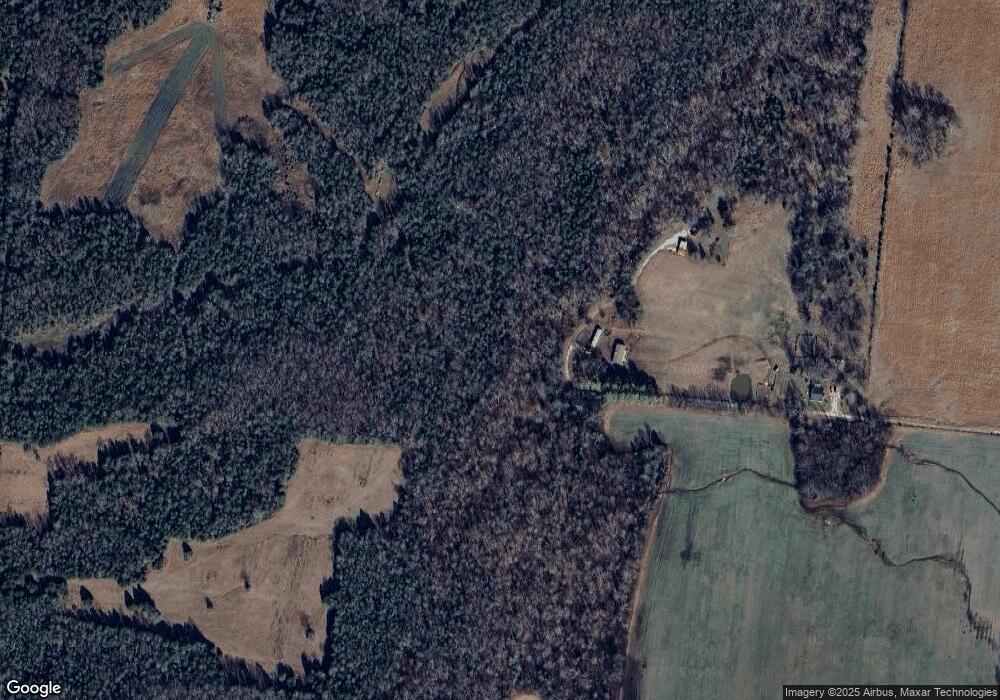
1596 Wilburn Phillips Rd Lewisburg, TN 37091
Estimated Value: $463,000 - $469,705
--
Bed
1
Bath
1,184
Sq Ft
$394/Sq Ft
Est. Value
About This Home
This home is located at 1596 Wilburn Phillips Rd, Lewisburg, TN 37091 and is currently estimated at $466,353, approximately $393 per square foot. 1596 Wilburn Phillips Rd is a home located in Marshall County with nearby schools including Oak Grove Elementary School, Marshall Elementary School, and Westhills Elementary School.
Ownership History
Date
Name
Owned For
Owner Type
Purchase Details
Closed on
Jun 30, 2021
Sold by
Phillips Louise
Bought by
Poarch Courtney
Current Estimated Value
Purchase Details
Closed on
Jan 15, 1999
Sold by
Tomlinson Michaele F
Bought by
Foster Patricia G
Purchase Details
Closed on
May 21, 1996
Sold by
Foster Patricia G
Bought by
Tomlinson Michaele F
Create a Home Valuation Report for This Property
The Home Valuation Report is an in-depth analysis detailing your home's value as well as a comparison with similar homes in the area
Home Values in the Area
Average Home Value in this Area
Purchase History
| Date | Buyer | Sale Price | Title Company |
|---|---|---|---|
| Poarch Courtney | -- | None Available | |
| Phillips Lisa Michelle | -- | None Available | |
| Foster Patricia G | -- | -- | |
| Tomlinson Michaele F | -- | -- |
Source: Public Records
Tax History Compared to Growth
Tax History
| Year | Tax Paid | Tax Assessment Tax Assessment Total Assessment is a certain percentage of the fair market value that is determined by local assessors to be the total taxable value of land and additions on the property. | Land | Improvement |
|---|---|---|---|---|
| 2024 | $570 | $31,350 | $16,775 | $14,575 |
| 2023 | $706 | $31,350 | $16,775 | $14,575 |
| 2022 | $570 | $31,350 | $16,775 | $14,575 |
| 2021 | $706 | $25,100 | $15,325 | $9,775 |
| 2020 | $706 | $25,100 | $15,325 | $9,775 |
| 2019 | $706 | $25,100 | $15,325 | $9,775 |
| 2018 | $708 | $25,100 | $15,325 | $9,775 |
| 2017 | $708 | $25,625 | $15,325 | $10,300 |
| 2016 | $688 | $21,375 | $12,850 | $8,525 |
| 2015 | $688 | $21,375 | $12,850 | $8,525 |
| 2014 | $688 | $21,375 | $12,850 | $8,525 |
Source: Public Records
Map
Nearby Homes
- 2996 Verona Caney Rd
- 2512 Verona Caney Rd
- 2661 Anes Station Rd
- 2421 Anes Station Rd
- 2829 Anes Station Rd
- 2989 Stegall Rd
- 2159 Verona Caney Rd
- 1133 Milltown Rd
- 0 Arthur Sampson Rd
- 1510 Wade Brown Rd
- 3469 Gillespie Ln
- 1520 Powell Ln
- 0 Powell Ln
- 1470 Milltown Rd
- 3520 Arthur Sampson Rd
- 1180 Snell Rd
- 3617 Tom Littlejohn Rd
- 0 Franklin Pike Unit RTC2943645
- 0 Tom Littlejohn Rd Unit RTC2925084
- 3666 Clark Rd
- 0 Ownby Rd
- 2880 Ownby Rd
- 1430 Finley Rd
- 1136 John Lunn Rd
- 2896 Ownby Rd
- 0 Finley Rd
- 1212 John Lunn Rd
- 1340 Finley Rd
- 1135 John Lunn Rd
- 1182 John Lunn Rd
- 2971 Ownby Rd
- 2929 Ownby Rd
- 1074 John Lunn Rd
- 1200 John Lunn Rd
- 1350 Finley Rd
- 1359 Wiles Ln
- 1326 Finley Rd
- 2964 Ownby Rd
- 0 John Lunn Rd
- 1069 John Lunn Rd
