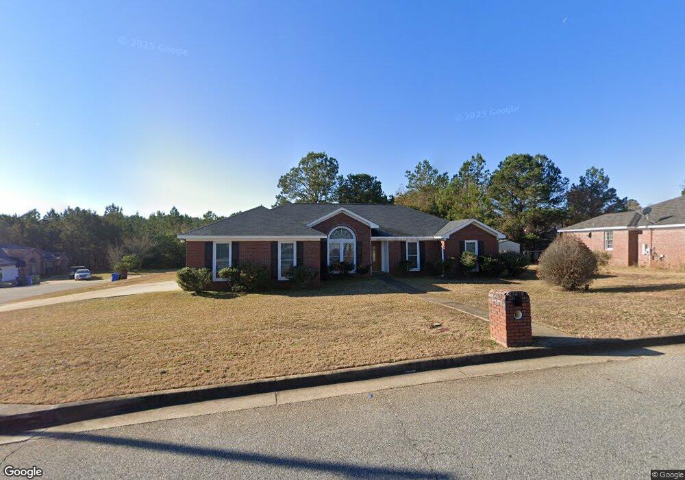
1597 Bunker Hill Rd Columbus, GA 31907
Eastern Columbus NeighborhoodEstimated Value: $206,000 - $222,000
4
Beds
3
Baths
1,766
Sq Ft
$122/Sq Ft
Est. Value
About This Home
This home is located at 1597 Bunker Hill Rd, Columbus, GA 31907 and is currently estimated at $215,081, approximately $121 per square foot. 1597 Bunker Hill Rd is a home located in Muscogee County with nearby schools including Dawson Elementary School, East Columbus Magnet Academy, and Spencer High School.
Ownership History
Date
Name
Owned For
Owner Type
Purchase Details
Closed on
Sep 24, 2007
Sold by
Sec Of Veterans Affa
Bought by
Cary Anthony T
Current Estimated Value
Home Financials for this Owner
Home Financials are based on the most recent Mortgage that was taken out on this home.
Original Mortgage
$126,000
Outstanding Balance
$79,409
Interest Rate
6.57%
Mortgage Type
Purchase Money Mortgage
Estimated Equity
$135,672
Purchase Details
Closed on
Aug 23, 2007
Sold by
Va
Bought by
Cary Anthony T
Home Financials for this Owner
Home Financials are based on the most recent Mortgage that was taken out on this home.
Original Mortgage
$126,000
Outstanding Balance
$79,409
Interest Rate
6.57%
Mortgage Type
Purchase Money Mortgage
Estimated Equity
$135,672
Purchase Details
Closed on
May 1, 2007
Sold by
Bancorpsouth Bank
Bought by
Va
Create a Home Valuation Report for This Property
The Home Valuation Report is an in-depth analysis detailing your home's value as well as a comparison with similar homes in the area
Home Values in the Area
Average Home Value in this Area
Purchase History
| Date | Buyer | Sale Price | Title Company |
|---|---|---|---|
| Cary Anthony T | -- | -- | |
| Cary Anthony T | -- | None Available | |
| Va | -- | None Available | |
| Bancorpsouth Bank | $120,004 | None Available |
Source: Public Records
Mortgage History
| Date | Status | Borrower | Loan Amount |
|---|---|---|---|
| Open | Cary Anthony T | $126,000 |
Source: Public Records
Tax History Compared to Growth
Tax History
| Year | Tax Paid | Tax Assessment Tax Assessment Total Assessment is a certain percentage of the fair market value that is determined by local assessors to be the total taxable value of land and additions on the property. | Land | Improvement |
|---|---|---|---|---|
| 2025 | $1,403 | $68,828 | $13,180 | $55,648 |
| 2024 | $1,402 | $68,828 | $13,180 | $55,648 |
| 2023 | $717 | $68,828 | $13,180 | $55,648 |
| 2022 | $1,462 | $52,884 | $13,180 | $39,704 |
| 2021 | $1,455 | $53,232 | $13,180 | $40,052 |
| 2020 | $1,456 | $53,232 | $13,180 | $40,052 |
| 2019 | $1,462 | $53,232 | $13,180 | $40,052 |
| 2018 | $1,462 | $53,232 | $13,180 | $40,052 |
| 2017 | $1,468 | $53,232 | $13,180 | $40,052 |
| 2016 | $1,475 | $49,028 | $8,800 | $40,228 |
| 2015 | $2,025 | $49,028 | $8,800 | $40,228 |
| 2014 | $2,027 | $49,028 | $8,800 | $40,228 |
| 2013 | -- | $49,028 | $8,800 | $40,228 |
Source: Public Records
Map
Nearby Homes
- 1340 Bunker Ridge Ln
- 5310 Stoney Point Rd
- 1238 Brandywine Dr
- 5090 Lexington Ln
- 5109 Lexington Ln
- 5613 Quebec Dr
- 1210 Bunker Hill Rd
- 5644 Quebec Dr
- 5219 Argonne Dr
- 5336 Gettysburg Way
- 1513 Alamo Dr
- 5664 St Marys Rd
- 5728 Lexington Dr
- 4462 Walking Stick Way
- 4408 Walking Stick Way
- 849 Bunker Hill Rd
- 1225 Rowell St
- 1025 Belmar St
- 4939 Aaron Dr
- 780 Honey Do Ct
- 1591 Bunker Hill Rd
- 1203 Bunker Valley Dr
- 2004 Bunker Way Dr
- 1607 Bunker Hill Rd
- 1594 Bunker Hill Rd
- 1204 Bunker Valley Dr
- 1600 Bunker Hill Rd
- 1590 Bunker Hill Rd
- 2008 Bunker Way Dr
- 1613 Bunker Hill Rd
- 1606 Bunker Hill Rd
- 1581 Bunker Hill Rd
- 1586 Bunker Hill Rd
- 1203 Bunker Ridge Dr
- 1612 Bunker Hill Rd
- 2003 Bunker Way Dr
- 2012 Bunker Way Dr
- 5480 Saratoga Dr
- 1582 Bunker Hill Rd
- 5484 Saratoga Dr