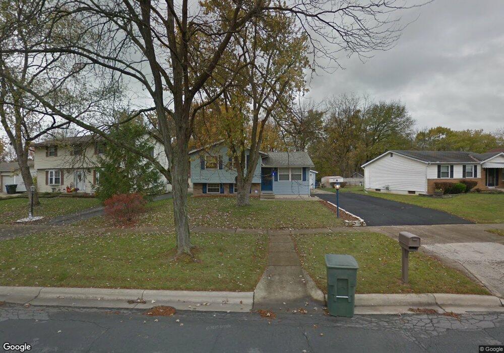
1597 River Bend Rd Columbus, OH 43223
Riverbend NeighborhoodEstimated Value: $231,349 - $248,000
3
Beds
2
Baths
1,444
Sq Ft
$167/Sq Ft
Est. Value
About This Home
This home is located at 1597 River Bend Rd, Columbus, OH 43223 and is currently estimated at $241,837, approximately $167 per square foot. 1597 River Bend Rd is a home located in Franklin County with nearby schools including James A Harmon Elementary School, Franklin Woods Intermediate School, and Finland Middle School.
Ownership History
Date
Name
Owned For
Owner Type
Purchase Details
Closed on
Mar 10, 2015
Sold by
Stallard David R
Bought by
Stallard David R and Stallard Mary E
Current Estimated Value
Purchase Details
Closed on
Jul 22, 2010
Sold by
Stallard Aymee R
Bought by
Stallard David R
Purchase Details
Closed on
Feb 20, 2001
Sold by
Schiebrel Shawn W
Bought by
Stallard David R and Stallard Aymee R
Home Financials for this Owner
Home Financials are based on the most recent Mortgage that was taken out on this home.
Original Mortgage
$98,777
Interest Rate
7.06%
Mortgage Type
VA
Create a Home Valuation Report for This Property
The Home Valuation Report is an in-depth analysis detailing your home's value as well as a comparison with similar homes in the area
Home Values in the Area
Average Home Value in this Area
Purchase History
| Date | Buyer | Sale Price | Title Company |
|---|---|---|---|
| Stallard David R | -- | None Available | |
| Stallard David R | -- | Attorney | |
| Stallard David R | $95,900 | -- |
Source: Public Records
Mortgage History
| Date | Status | Borrower | Loan Amount |
|---|---|---|---|
| Previous Owner | Stallard David R | $98,777 |
Source: Public Records
Tax History
| Year | Tax Paid | Tax Assessment Tax Assessment Total Assessment is a certain percentage of the fair market value that is determined by local assessors to be the total taxable value of land and additions on the property. | Land | Improvement |
|---|---|---|---|---|
| 2025 | $2,449 | $67,170 | $18,590 | $48,580 |
| 2024 | $2,449 | $67,170 | $18,590 | $48,580 |
| 2023 | $2,406 | $67,170 | $18,590 | $48,580 |
| 2022 | $2,028 | $41,550 | $10,820 | $30,730 |
| 2021 | $2,069 | $41,550 | $10,820 | $30,730 |
| 2020 | $2,057 | $41,550 | $10,820 | $30,730 |
| 2019 | $1,919 | $34,200 | $9,030 | $25,170 |
| 2018 | $1,862 | $34,200 | $9,030 | $25,170 |
| 2017 | $1,901 | $34,200 | $9,030 | $25,170 |
| 2016 | $1,764 | $29,160 | $5,220 | $23,940 |
| 2015 | $1,815 | $29,160 | $5,220 | $23,940 |
| 2014 | $1,766 | $29,160 | $5,220 | $23,940 |
| 2013 | $972 | $32,375 | $5,775 | $26,600 |
Source: Public Records
Map
Nearby Homes
- 1638 Tall Meadows Dr
- 3116 Musket Ridge Dr
- 1605 Greenville Rd
- 2112 Sondra Ln
- 2937 Rundell Dr
- 3407 Western Hill Rd
- 0 Glencreek Rd
- 1657 Ripplebrook Rd
- 2870 Chesfield Dr
- 2856 Chesfield Dr
- 1360 Hafton Woods Dr
- 1335 Hafton Woods Dr
- 1722 Hollow Run Dr
- 1147 Parma Ave
- 1309 Treehaven Ln
- 2255 Harrisburg Pike
- 1490 Demorest Rd
- 3586 Alkire Rd
- 2600 Plainview Ave
- 2103 Keller Place W
- 1597 Riverbend Rd
- 1601 Riverbend Rd
- 1593 Riverbend Rd
- 1609 River Bend Rd
- 1609 Riverbend Rd
- 1587 River Bend Rd
- 1587 Riverbend Rd
- 3085 Riverbend Place
- 1617 Riverbend Rd
- 1581 Riverbend Rd
- 1574 Riverbend Rd
- 1604 Riverbend Rd
- 1612 Riverbend Rd
- 1625 Riverbend Rd
- 1562 Riverbend Rd
- 1562 River Bend Rd
- 3073 Riverbend Place
- 1575 Riverbend Rd
- 3084 Riverbend Place
- 1639 Fall Brook Rd
Your Personal Tour Guide
Ask me questions while you tour the home.