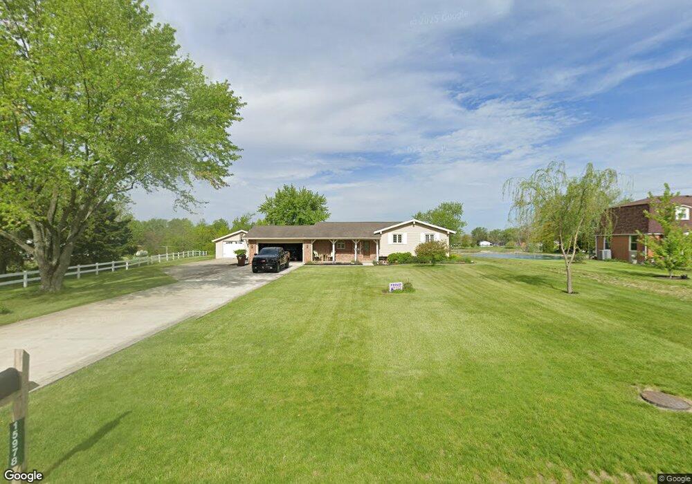
15978 Power Dam Rd Defiance, OH 43512
Estimated Value: $222,000 - $297,000
3
Beds
2
Baths
2,000
Sq Ft
$128/Sq Ft
Est. Value
About This Home
This home is located at 15978 Power Dam Rd, Defiance, OH 43512 and is currently estimated at $255,302, approximately $127 per square foot. 15978 Power Dam Rd is a home located in Defiance County with nearby schools including Defiance Elementary School, Defiance Middle School, and Defiance High School.
Ownership History
Date
Name
Owned For
Owner Type
Purchase Details
Closed on
May 12, 2021
Sold by
Stanley Pamela S
Bought by
Stanley John A
Current Estimated Value
Purchase Details
Closed on
Jun 25, 2007
Sold by
Sealscott Lisa M
Bought by
Stanley John A and Stanley Pamela S
Home Financials for this Owner
Home Financials are based on the most recent Mortgage that was taken out on this home.
Original Mortgage
$90,000
Interest Rate
6.2%
Mortgage Type
Unknown
Purchase Details
Closed on
Aug 7, 1997
Bought by
Stanley John A and Stanley Pamela S
Create a Home Valuation Report for This Property
The Home Valuation Report is an in-depth analysis detailing your home's value as well as a comparison with similar homes in the area
Home Values in the Area
Average Home Value in this Area
Purchase History
| Date | Buyer | Sale Price | Title Company |
|---|---|---|---|
| Stanley John A | -- | None Available | |
| Stanley John A | $114,600 | -- | |
| Stanley John A | $110,000 | -- |
Source: Public Records
Mortgage History
| Date | Status | Borrower | Loan Amount |
|---|---|---|---|
| Closed | Stanley John A | $90,000 |
Source: Public Records
Tax History Compared to Growth
Tax History
| Year | Tax Paid | Tax Assessment Tax Assessment Total Assessment is a certain percentage of the fair market value that is determined by local assessors to be the total taxable value of land and additions on the property. | Land | Improvement |
|---|---|---|---|---|
| 2024 | $2,317 | $60,430 | $4,820 | $55,610 |
| 2023 | $2,317 | $60,430 | $4,820 | $55,610 |
| 2022 | $1,950 | $44,850 | $4,770 | $40,080 |
| 2021 | $1,950 | $44,850 | $4,770 | $40,080 |
| 2020 | $1,964 | $44,850 | $4,770 | $40,080 |
| 2019 | $1,760 | $39,130 | $4,750 | $34,380 |
| 2018 | $1,713 | $39,130 | $4,750 | $34,380 |
| 2017 | $1,689 | $39,130 | $4,749 | $34,381 |
| 2016 | $1,723 | $38,636 | $4,749 | $33,887 |
| 2015 | $812 | $38,636 | $4,749 | $33,887 |
| 2014 | $812 | $38,636 | $4,749 | $33,887 |
| 2013 | $812 | $38,636 | $4,749 | $33,887 |
| 2012 | $812 | $38,637 | $4,750 | $33,887 |
Source: Public Records
Map
Nearby Homes
- 18228
- 14817 Road 171
- 14428 Singer Rd
- 14354 Road 171
- 14363 County Road 171
- 14326 Road 171
- 22585 Defiance-Paulding County Line Rd
- 17341 Road 139
- 2021 S Clinton St
- 12288 Road 179
- 15939 S State Route 66
- 2208 Riviera Rd
- 1910 Waterford Ln
- 1430 Avalon Ct
- 24220 County Road 196
- 1649 Terrawenda Dr
- 2930 S State Route 66
- 0 Tract 3 - Rr 111 Unit 10000391
- 786 Miami Dr
- 229 Glenwood Dr
- 15998 Power Dam Rd
- 15962 Power Dam Rd
- 0 Power Dam Rd Unit 4640862
- 0 Power Dam Rd Unit 5024131
- 0 Power Dam Rd Unit 4607119
- 0 Power Dam Rd Unit 4596848
- 0 Power Dam Rd Unit 4636459
- 15950 Power Dam Rd
- 15928 Power Dam Rd
- 15900 Power Dam Rd
- 15862 Power Dam Rd
- 15827 Power Dam Rd
- 15828 Power Dam Rd
- 20252 County Road 10
- 15851 Us St Rt 111
- 15851 State Route 111
- 15829 State Route 111
- 19990 State Route 111
- 15805 State Route 111
- 15779 State Route 111