Estimated Value: $283,000 - $358,000
3
Beds
2
Baths
1,588
Sq Ft
$206/Sq Ft
Est. Value
About This Home
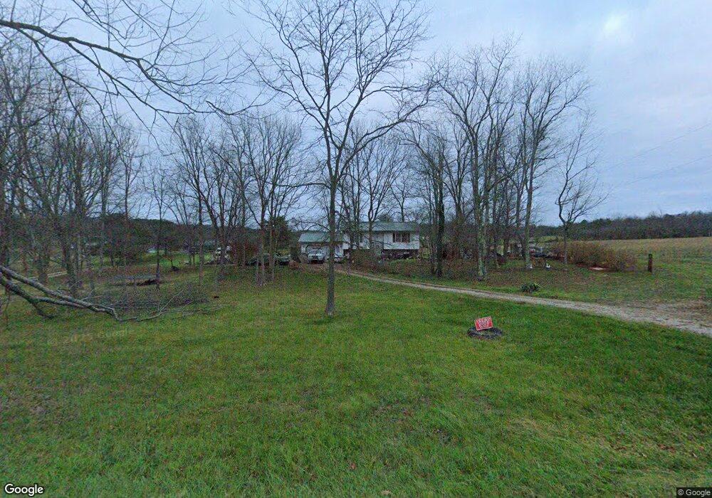
This home is located at 15980 State Route 93 S, Logan, OH 43138 and is currently estimated at $326,738, approximately $205 per square foot. 15980 State Route 93 S is a home located in Hocking County with nearby schools including Union Furnace Elementary School, Logan Christian School, and St. John the Evangelist School.
Ownership History
Date
Name
Owned For
Owner Type
Purchase Details
Closed on
Apr 29, 2009
Sold by
Blankenship Vaughn L and Blankenship Patricia M
Bought by
Barnett Carlos D
Current Estimated Value
Home Financials for this Owner
Home Financials are based on the most recent Mortgage that was taken out on this home.
Original Mortgage
$130,591
Outstanding Balance
$82,421
Interest Rate
4.83%
Mortgage Type
FHA
Estimated Equity
$244,317
Create a Home Valuation Report for This Property
The Home Valuation Report is an in-depth analysis detailing your home's value as well as a comparison with similar homes in the area
Home Values in the Area
Average Home Value in this Area
Purchase History
| Date | Buyer | Sale Price | Title Company |
|---|---|---|---|
| Barnett Carlos D | $133,000 | Title First |
Source: Public Records
Mortgage History
| Date | Status | Borrower | Loan Amount |
|---|---|---|---|
| Open | Barnett Carlos D | $130,591 |
Source: Public Records
Tax History Compared to Growth
Tax History
| Year | Tax Paid | Tax Assessment Tax Assessment Total Assessment is a certain percentage of the fair market value that is determined by local assessors to be the total taxable value of land and additions on the property. | Land | Improvement |
|---|---|---|---|---|
| 2024 | $2,069 | $55,060 | $15,640 | $39,420 |
| 2023 | $2,069 | $55,060 | $15,640 | $39,420 |
| 2022 | $2,073 | $55,060 | $15,640 | $39,420 |
| 2021 | $1,879 | $46,860 | $11,900 | $34,960 |
| 2020 | $1,871 | $46,860 | $11,900 | $34,960 |
| 2019 | $1,871 | $46,860 | $11,900 | $34,960 |
| 2018 | $1,746 | $44,740 | $9,780 | $34,960 |
| 2017 | $1,713 | $44,740 | $9,780 | $34,960 |
| 2016 | $1,701 | $44,740 | $9,780 | $34,960 |
| 2015 | $1,752 | $44,450 | $8,730 | $35,720 |
| 2014 | $1,752 | $44,450 | $8,730 | $35,720 |
| 2013 | $1,760 | $44,450 | $8,730 | $35,720 |
Source: Public Records
Map
Nearby Homes
- 31440 Deerfield Dr
- 15155 Sauerkraut Rd
- 15050 Old McArthur Rd
- 33461 Barker Rd
- 0 Nixon Rd
- 15817 Nickel Plate Rd
- 82 Pineywood Trail
- 30574 Strawn Rd
- 0 Redbud Ln Unit LOT 62 224020754
- 14180 Ohio 664
- 29593 Big Pine Rd
- 32366 Lilac Ln
- 32268 Cedar Ln
- 14121 State Route 664 S
- 13464 State Route 664 S
- 849 Mohican Ave
- 13493 Hildebrandt Rd
- 743 Summit Dr
- 29838 Strawn Rd
- 13534 Hildebrandt Rd
- 15958 State Route 93 S
- 15930 State Route 93 S
- 31649 Mays Rd
- 15880 State Route 93 S
- 15880 Ohio 93
- 15899 State Route 93 S
- 31572 Mays Rd
- 31549 Mays Rd
- 15841 State Route 93 S
- 15840 State Route 93 S
- 15794 State Route 93 S
- 31520 Mays Rd
- 15799 State Route 93 S
- 16386 Burcham Rd
- 15762 State Route 93 S
- 31476 Mays Rd
- 15761 State Route 93 S
- 16241 State Route 93 S
- 31438 Mays Rd
- 16414 Burcham Rd