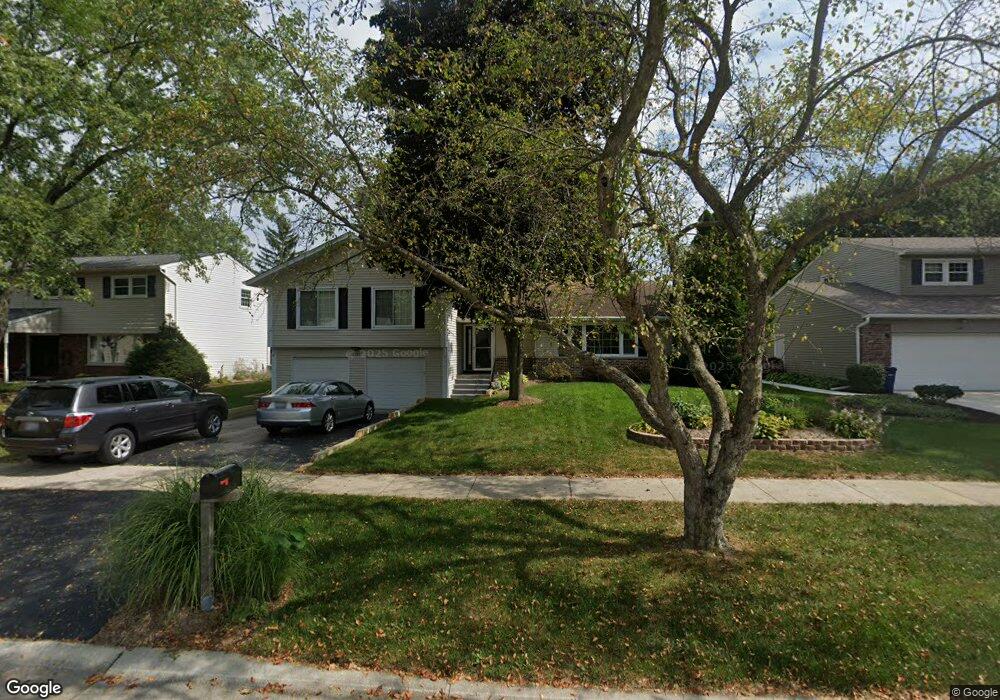
1599 Leabrook Ln Wheaton, IL 60189
West Wheaton NeighborhoodEstimated Value: $636,752 - $676,000
4
Beds
3
Baths
2,200
Sq Ft
$302/Sq Ft
Est. Value
About This Home
This home is located at 1599 Leabrook Ln, Wheaton, IL 60189 and is currently estimated at $664,438, approximately $302 per square foot. 1599 Leabrook Ln is a home located in DuPage County with nearby schools including Madison Elementary School, Edison Middle School, and Wheaton Warrenville South High School.
Ownership History
Date
Name
Owned For
Owner Type
Purchase Details
Closed on
Jul 10, 2008
Sold by
Gushue Daniel E and Gushue April D
Bought by
Mcnellis Patrick E and Bley Maria Lizette
Current Estimated Value
Home Financials for this Owner
Home Financials are based on the most recent Mortgage that was taken out on this home.
Original Mortgage
$336,000
Outstanding Balance
$221,439
Interest Rate
6.5%
Mortgage Type
Purchase Money Mortgage
Estimated Equity
$442,999
Purchase Details
Closed on
Sep 24, 2007
Sold by
Gabcik John F and Gabcik Edwina J
Bought by
Gushue Daniel E and Gushue April D
Home Financials for this Owner
Home Financials are based on the most recent Mortgage that was taken out on this home.
Original Mortgage
$340,000
Interest Rate
6.49%
Mortgage Type
Purchase Money Mortgage
Create a Home Valuation Report for This Property
The Home Valuation Report is an in-depth analysis detailing your home's value as well as a comparison with similar homes in the area
Home Values in the Area
Average Home Value in this Area
Purchase History
| Date | Buyer | Sale Price | Title Company |
|---|---|---|---|
| Mcnellis Patrick E | $420,000 | Attorneys Title Guaranty Fun | |
| Gushue Daniel E | $425,000 | Attorneys Title Guaranty Fun |
Source: Public Records
Mortgage History
| Date | Status | Borrower | Loan Amount |
|---|---|---|---|
| Open | Mcnellis Patrick E | $336,000 | |
| Previous Owner | Gushue Daniel E | $340,000 |
Source: Public Records
Tax History
| Year | Tax Paid | Tax Assessment Tax Assessment Total Assessment is a certain percentage of the fair market value that is determined by local assessors to be the total taxable value of land and additions on the property. | Land | Improvement |
|---|---|---|---|---|
| 2024 | $11,423 | $185,231 | $36,579 | $148,652 |
| 2023 | $10,982 | $170,500 | $33,670 | $136,830 |
| 2022 | $10,353 | $155,490 | $31,820 | $123,670 |
| 2021 | $10,319 | $151,800 | $31,060 | $120,740 |
| 2020 | $10,288 | $150,390 | $30,770 | $119,620 |
| 2019 | $10,053 | $146,420 | $29,960 | $116,460 |
| 2018 | $9,839 | $141,840 | $28,540 | $113,300 |
| 2017 | $9,694 | $136,610 | $27,490 | $109,120 |
| 2016 | $9,566 | $131,150 | $26,390 | $104,760 |
| 2015 | $9,494 | $125,120 | $25,180 | $99,940 |
| 2014 | $8,686 | $113,130 | $22,210 | $90,920 |
| 2013 | $8,463 | $113,470 | $22,280 | $91,190 |
Source: Public Records
Map
Nearby Homes
- 1605 Burning Trail
- 1620 Hemstock Ave
- 1601 W Wiesbrook Rd
- 1612 Stonebridge Trail
- 2043 Spring Green Dr
- 1442 Stonebridge Cir Unit I8
- 1462 Stonebridge Cir Unit F10
- Lot 1 Foothill Dr
- 1533 S County Farm Rd Unit 1-4
- 1110 S Gables Blvd
- 1S728 Shaffner Rd
- 1S710 Shaffner Rd
- 1028 Lodalia Ct
- 1478 Timber Trail Unit 15C
- 1474 Timber Trail Unit D
- 615 Polo Dr
- 1021 Greenwood Dr
- 76 Somerset Cir
- 1219 Golf Ln
- 705 S Gables Blvd
- 1605 Leabrook Ln
- 1593 Leabrook Ln
- 1613 Leabrook Ln
- 1589 Leabrook Ln
- 1596 Burning Trail
- 1592 Burning Trail
- 1602 Burning Trail
- 1604 Leabrook Ln
- 1598 Leabrook Ln
- 1619 Leabrook Ln
- 1586 Burning Trail
- 1610 Leabrook Ln
- 1592 Leabrook Ln
- 1608 Burning Trail
- 1581 Leabrook Ln Unit 2
- 1616 Leabrook Ln
- 1588 Leabrook Ln
- 1580 Burning Trail
- 1612 Burning Trail
- 1625 Leabrook Ln
Your Personal Tour Guide
Ask me questions while you tour the home.