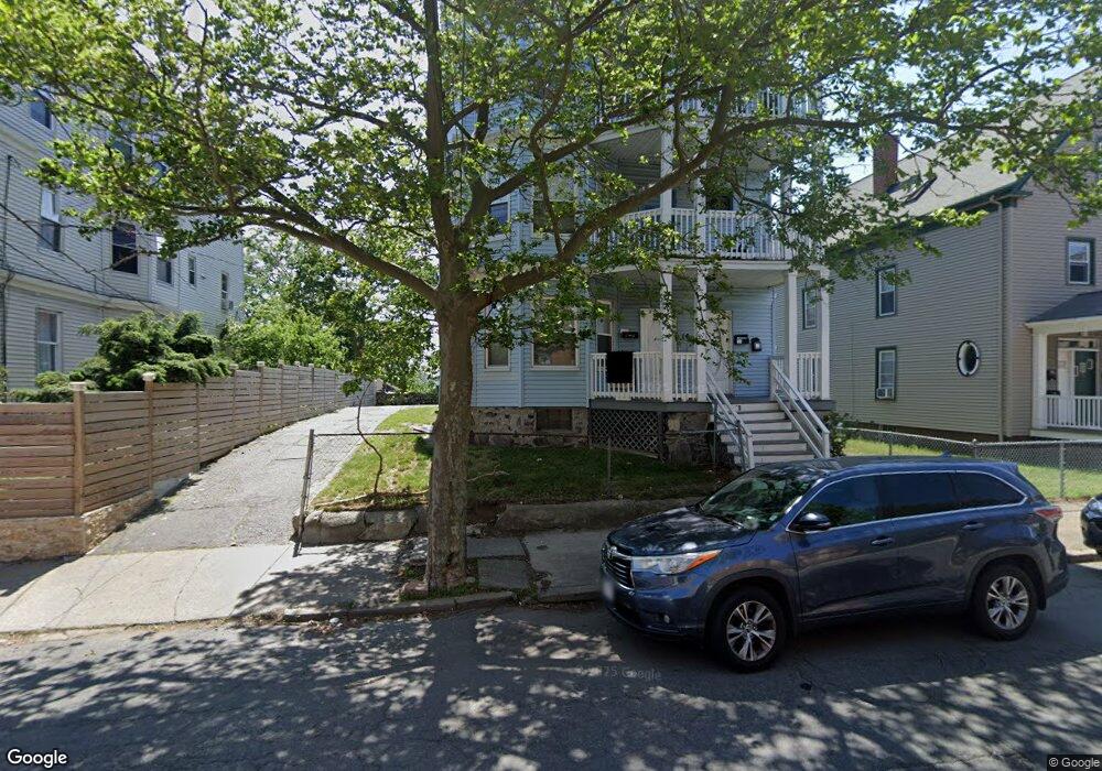
16 1/2 Rock Ave Lynn, MA 01902
Highlands NeighborhoodEstimated Value: $820,284 - $943,000
6
Beds
3
Baths
3,732
Sq Ft
$244/Sq Ft
Est. Value
About This Home
This home is located at 16 1/2 Rock Ave, Lynn, MA 01902 and is currently estimated at $909,571, approximately $243 per square foot. 16 1/2 Rock Ave is a home located in Essex County with nearby schools including Robert L. Ford Elementary School, William R. Fallon School, and Fecteau-Leary Junior/Senior High School.
Ownership History
Date
Name
Owned For
Owner Type
Purchase Details
Closed on
Apr 27, 2023
Sold by
Abreu Tanya I
Bought by
16 Rock Avenue 2023 Rt
Current Estimated Value
Purchase Details
Closed on
Aug 30, 2016
Sold by
Double Y Rt and Stiros
Bought by
Iris-Abreu Tanya
Home Financials for this Owner
Home Financials are based on the most recent Mortgage that was taken out on this home.
Original Mortgage
$441,849
Interest Rate
3.37%
Mortgage Type
FHA
Purchase Details
Closed on
May 28, 2010
Sold by
Stiros Eleni F
Bought by
Double Y Rt and Stiros Paul
Purchase Details
Closed on
Jan 1, 1975
Bought by
Double Y Rt
Create a Home Valuation Report for This Property
The Home Valuation Report is an in-depth analysis detailing your home's value as well as a comparison with similar homes in the area
Home Values in the Area
Average Home Value in this Area
Purchase History
| Date | Buyer | Sale Price | Title Company |
|---|---|---|---|
| 16 Rock Avenue 2023 Rt | -- | None Available | |
| 16 Rock Avenue 2023 Rt | -- | None Available | |
| 16 Rock Avenue 2023 Rt | -- | None Available | |
| Iris-Abreu Tanya | $450,000 | -- | |
| Double Y Rt | -- | -- | |
| Double Y Rt | -- | -- | |
| Double Y Rt | -- | -- |
Source: Public Records
Mortgage History
| Date | Status | Borrower | Loan Amount |
|---|---|---|---|
| Previous Owner | Iris-Abreu Tanya | $441,849 | |
| Previous Owner | Double Y Rt | $75,000 | |
| Previous Owner | Double Y Rt | $260,100 |
Source: Public Records
Tax History Compared to Growth
Tax History
| Year | Tax Paid | Tax Assessment Tax Assessment Total Assessment is a certain percentage of the fair market value that is determined by local assessors to be the total taxable value of land and additions on the property. | Land | Improvement |
|---|---|---|---|---|
| 2025 | $9,018 | $870,500 | $202,100 | $668,400 |
| 2024 | $8,881 | $843,400 | $182,400 | $661,000 |
| 2023 | $8,603 | $771,600 | $182,400 | $589,200 |
| 2022 | $8,393 | $675,200 | $149,200 | $526,000 |
| 2021 | $8,004 | $614,300 | $136,100 | $478,200 |
| 2020 | $7,307 | $545,300 | $106,300 | $439,000 |
| 2019 | $7,156 | $500,400 | $103,700 | $396,700 |
| 2018 | $6,598 | $435,500 | $100,200 | $335,300 |
| 2017 | $5,685 | $364,400 | $77,900 | $286,500 |
| 2016 | $5,192 | $320,900 | $65,600 | $255,300 |
| 2015 | $4,821 | $287,800 | $70,400 | $217,400 |
Source: Public Records
Map
Nearby Homes
- 16 Hollingsworth St
- 69 Hawthorne St
- 199 Allen Ave
- 6-8 Beede Ave
- 105 Lawton Ave
- 94 Sheridan St
- 325 Western Ave
- 30 Adams St
- 440 Essex St
- 14 Mount Pleasant Place
- 0 High St
- 106 Goodridge St
- 58 Laighton St
- 191-193 Washington St
- 5 Whittier St
- 344 Essex St
- 200 Locust St Unit 302
- 589 Essex St Unit 102
- 57 Johnson St
- 12 Chestnut Ave
- 16 Rock Ave Unit 3
- 20 Rock Ave
- 14 Rock Ave
- 14 1/2 Rock Ave
- 151 Hamilton Ave Unit 153
- 10 Rock Ave
- 147 Hamilton Ave
- 28 Rock Ave
- 30 Rock Ave
- 30 Rock Ave Unit 1
- 30 Rock Ave Unit 1st fl
- 69 Hollingsworth St Unit 69A
- 71 Hollingsworth St
- 71 Hollingsworth St Unit 1
- 71 Hollingsworth St Unit 2
- 143 Hamilton Ave
- 156 Hamilton Ave
- 34 Rock Ave
- 29 Rock Ave
- 152 Hamilton Ave