Estimated Value: $150,000 - $242,000
3
Beds
2
Baths
1,492
Sq Ft
$128/Sq Ft
Est. Value
About This Home
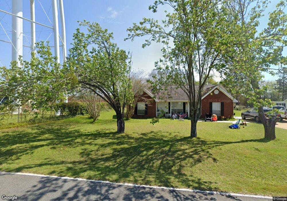
This home is located at 16 26th St NE, Cairo, GA 39828 and is currently estimated at $191,470, approximately $128 per square foot. 16 26th St NE is a home located in Grady County with nearby schools including Cairo High School.
Ownership History
Date
Name
Owned For
Owner Type
Purchase Details
Closed on
Jun 14, 2021
Sold by
Harrison Cynthia S
Bought by
Cook Justin Carland and Cook Leaanna Lynn
Current Estimated Value
Purchase Details
Closed on
Nov 4, 1997
Bought by
Harrison Cynthia S
Purchase Details
Closed on
Oct 22, 1996
Sold by
Bass Joel Farrar
Bought by
Decatur Construction And
Purchase Details
Closed on
Apr 16, 1991
Bought by
Bass Joel Farrar
Create a Home Valuation Report for This Property
The Home Valuation Report is an in-depth analysis detailing your home's value as well as a comparison with similar homes in the area
Home Values in the Area
Average Home Value in this Area
Purchase History
| Date | Buyer | Sale Price | Title Company |
|---|---|---|---|
| Cook Justin Carland | $145,000 | -- | |
| Harrison Cynthia S | $71,000 | -- | |
| Decatur Construction And | $5,500 | -- | |
| Bass Joel Farrar | $1,800 | -- |
Source: Public Records
Tax History Compared to Growth
Tax History
| Year | Tax Paid | Tax Assessment Tax Assessment Total Assessment is a certain percentage of the fair market value that is determined by local assessors to be the total taxable value of land and additions on the property. | Land | Improvement |
|---|---|---|---|---|
| 2024 | $2,273 | $59,177 | $3,872 | $55,305 |
| 2023 | $1,479 | $41,628 | $4,800 | $36,828 |
| 2022 | $1,541 | $41,628 | $4,800 | $36,828 |
| 2021 | $1,545 | $41,628 | $4,800 | $36,828 |
| 2020 | $1,549 | $41,628 | $4,800 | $36,828 |
| 2019 | $1,549 | $41,628 | $4,800 | $36,828 |
| 2018 | $1,473 | $41,628 | $4,800 | $36,828 |
| 2017 | $1,417 | $41,628 | $4,800 | $36,828 |
| 2016 | $1,215 | $35,112 | $4,800 | $30,312 |
| 2015 | $1,203 | $35,112 | $4,800 | $30,312 |
| 2014 | $1,203 | $35,112 | $4,800 | $30,312 |
| 2013 | -- | $31,800 | $4,800 | $27,000 |
Source: Public Records
Map
Nearby Homes
- 78.6 Ac Strickland Rd
- 2600 U S 84
- 66 22nd St NE
- 0 NE Airport Rd Unit 145784
- 00 20th St NE
- 00 20th St NE
- 00 #10 Oak Bend Circle 4 38 Acres
- 3109 U S 84
- 3109 U S 84
- 711 2nd Ave NE
- 00 NW 9th Ave
- 530 6th St
- 530 6th Ave SE
- 508 9th Ave SE
- Lot #15, 3 64 Acres Oakbend Cir
- 471 4th St SE
- 0 State Route 188
- 309 3rd St SE
- 303 4th Ave SE
- 1310 Stone Ave
- 8 26th St NE
- 6 26th St NE
- 15 26th St NE
- 9 26th St NE
- 7 26th St NE
- 25 26th St NE
- 2582 MacIvor Dr NE
- 18 25th St NE
- 2580 Pecan Dr
- 24 25th St NE
- 50 26th St NE
- 32 25th St NE
- 4 25th St NE
- 2540 Pecan Dr
- 2580 MacIvor Dr NE
- 65 27th St NE
- 2520 Pecan Dr
- 2506 MacIvor Dr NE
- 2506 MacIvor Dr NE Unit 1
- 9 25th St NE