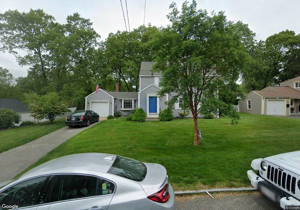
16 Arvesta St Springfield, MA 01118
East Forest Park NeighborhoodEstimated Value: $368,396 - $397,000
3
Beds
2
Baths
1,768
Sq Ft
$217/Sq Ft
Est. Value
About This Home
This home is located at 16 Arvesta St, Springfield, MA 01118 and is currently estimated at $384,099, approximately $217 per square foot. 16 Arvesta St is a home located in Hampden County with nearby schools including Mary A. Dryden Veterans Memorial School, M Marcus Kiley Middle, and Springfield High School of Science and Technology.
Ownership History
Date
Name
Owned For
Owner Type
Purchase Details
Closed on
Jan 18, 2023
Sold by
Griffin Elizabeth J Est and Griffin
Bought by
Griffin James J
Current Estimated Value
Home Financials for this Owner
Home Financials are based on the most recent Mortgage that was taken out on this home.
Original Mortgage
$188,237
Outstanding Balance
$181,699
Interest Rate
6.5%
Mortgage Type
FHA
Estimated Equity
$202,400
Purchase Details
Closed on
Jun 28, 2016
Sold by
Griffin Elizabeth J and Griffin James
Bought by
Griffin Elizabeth J
Purchase Details
Closed on
May 18, 2015
Sold by
Griffin Elizabeth J
Bought by
Griffin Elizabeth J and Griffin James
Create a Home Valuation Report for This Property
The Home Valuation Report is an in-depth analysis detailing your home's value as well as a comparison with similar homes in the area
Home Values in the Area
Average Home Value in this Area
Purchase History
| Date | Buyer | Sale Price | Title Company |
|---|---|---|---|
| Griffin James J | -- | None Available | |
| Griffin James J | -- | None Available | |
| Griffin Elizabeth J | -- | -- | |
| Griffin Elizabeth J | -- | -- | |
| Griffin Elizabeth J | -- | -- | |
| Griffin Elizabeth J | -- | -- |
Source: Public Records
Mortgage History
| Date | Status | Borrower | Loan Amount |
|---|---|---|---|
| Open | Griffin James J | $188,237 | |
| Closed | Griffin James J | $188,237 | |
| Previous Owner | Griffin Elizabeth J | $123,000 | |
| Previous Owner | Griffin Elizabeth J | $30,000 |
Source: Public Records
Tax History
| Year | Tax Paid | Tax Assessment Tax Assessment Total Assessment is a certain percentage of the fair market value that is determined by local assessors to be the total taxable value of land and additions on the property. | Land | Improvement |
|---|---|---|---|---|
| 2025 | $6,062 | $386,600 | $57,700 | $328,900 |
| 2024 | $5,733 | $357,000 | $57,700 | $299,300 |
| 2023 | $5,567 | $326,500 | $54,900 | $271,600 |
| 2022 | $5,420 | $288,000 | $54,900 | $233,100 |
| 2021 | $3,076 | $263,600 | $49,900 | $213,700 |
| 2020 | $2,961 | $254,200 | $49,900 | $204,300 |
| 2019 | $2,919 | $247,200 | $49,900 | $197,300 |
| 2018 | $4,871 | $247,500 | $49,900 | $197,600 |
| 2017 | $2,936 | $233,100 | $54,900 | $178,200 |
| 2016 | $4,636 | $235,800 | $54,900 | $180,900 |
| 2015 | -- | $232,600 | $54,900 | $177,700 |
Source: Public Records
Map
Nearby Homes
- 54 S Shore Dr
- 384 Abbott St
- 75 Gillette Cir
- 236 Pondview Dr
- 7 Ashbrook St
- 37 Chesterfield Ave
- 509 Plumtree Rd
- 118 Pilgrim Rd
- 170 Plumtree Rd
- 44 Amanda St
- 22 Amanda St
- 30 W Hill Rd
- 11 Ina St
- 309 Island Pond Rd
- 134 Eddywood St
- 647 Plumtree Rd
- 87 Fenwick St
- 79 Roosevelt Ave
- 47 Hartford Terrace
- 34 Elsie St
- 24 Arvesta St
- 465 Roosevelt Ave
- 75 S Branch Pkwy
- 69 S Branch Pkwy
- 81 S Branch Pkwy
- 32 Arvesta St
- 477 Roosevelt Ave
- 453 Roosevelt Ave
- 17 Arvesta St
- 63 S Branch Pkwy
- 87 S Branch Pkwy
- 25 Arvesta St
- 40 Arvesta St
- 445 Roosevelt Ave
- 491 Roosevelt Ave
- 33 Arvesta St
- 460 Roosevelt Ave
- 470 Roosevelt Ave
- 95 S Branch Pkwy
- 18 Kipling St
Your Personal Tour Guide
Ask me questions while you tour the home.