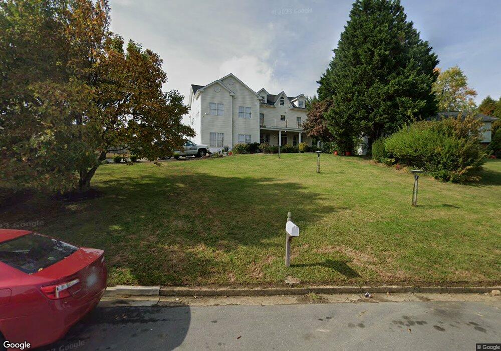
16 Bausum Dr Annapolis, MD 21401
Forest Villa NeighborhoodEstimated Value: $489,000 - $803,000
Studio
2
Baths
3,232
Sq Ft
$190/Sq Ft
Est. Value
About This Home
This home is located at 16 Bausum Dr, Annapolis, MD 21401 and is currently estimated at $615,403, approximately $190 per square foot. 16 Bausum Dr is a home located in Anne Arundel County with nearby schools including Walter S. Mills-Parole Elementary School, Annapolis Middle School, and Annapolis High School.
Ownership History
Date
Name
Owned For
Owner Type
Purchase Details
Closed on
Feb 3, 2005
Sold by
Jones Sylvanus B
Bought by
Carranza Ana R and Carranza Manual A
Current Estimated Value
Home Financials for this Owner
Home Financials are based on the most recent Mortgage that was taken out on this home.
Original Mortgage
$260,000
Outstanding Balance
$132,328
Interest Rate
5.77%
Mortgage Type
New Conventional
Estimated Equity
$483,075
Create a Home Valuation Report for This Property
The Home Valuation Report is an in-depth analysis detailing your home's value as well as a comparison with similar homes in the area
Home Values in the Area
Average Home Value in this Area
Purchase History
| Date | Buyer | Sale Price | Title Company |
|---|---|---|---|
| Carranza Ana R | $325,000 | -- |
Source: Public Records
Mortgage History
| Date | Status | Borrower | Loan Amount |
|---|---|---|---|
| Open | Carranza Ana R | $260,000 | |
| Closed | Carranza Ana R | $32,500 |
Source: Public Records
Tax History
| Year | Tax Paid | Tax Assessment Tax Assessment Total Assessment is a certain percentage of the fair market value that is determined by local assessors to be the total taxable value of land and additions on the property. | Land | Improvement |
|---|---|---|---|---|
| 2025 | $6,587 | $503,400 | -- | -- |
| 2024 | $6,587 | $458,400 | $0 | $0 |
| 2023 | $5,936 | $413,400 | $139,600 | $273,800 |
| 2022 | $5,667 | $402,167 | $0 | $0 |
| 2021 | $5,354 | $390,933 | $0 | $0 |
| 2020 | $5,354 | $379,700 | $139,600 | $240,100 |
| 2019 | $5,358 | $379,700 | $139,600 | $240,100 |
| 2018 | $5,282 | $379,700 | $139,600 | $240,100 |
| 2017 | $5,658 | $433,600 | $0 | $0 |
| 2016 | -- | $401,167 | $0 | $0 |
| 2015 | -- | $368,733 | $0 | $0 |
| 2014 | -- | $336,300 | $0 | $0 |
Source: Public Records
Map
Nearby Homes
- 14 A Dorsey Ave
- 8 Dorsey Ave
- 706 Agnes Dorsey Place
- 606 James Walker Place
- 612 Severn Island Ct
- 1915 Towne Centre Blvd Unit 1001
- 1915 Towne Centre Blvd Unit 301
- 1915 Towne Centre Blvd Unit 606
- 1915 Towne Centre Blvd Unit 807
- 1915 Towne Centre Blvd Unit 309
- 1915 Towne Centre Blvd Unit 406
- 1915 Towne Centre Blvd Unit 707
- 1915 Towne Centre Blvd Unit 402
- 1915 Towne Centre Blvd Unit 1210
- 1915 Towne Centre Blvd Unit 1004
- 1915 Towne Centre Blvd Unit 502
- 206 Admiral Dr
- 1808 Lincoln Dr
- 1403 Corey Ln
- 1402 S Virginia St
- 1972 Dominoe Rd
- 14 Bausum Dr
- 1974 Dominoe Rd
- 1980 Dominoe Rd
- 1970 Dominoe Rd
- 1976 Dominoe Rd
- 1982 Dominoe Rd
- 1978 Dominoe Rd
- 15 Bausum Dr
- 2001 Forest Dr
- 11 Bausum Dr
- 17 Bausum Dr
- 1999 Forest Dr
- 1973 Dominoe Rd
- 2003 Forest Dr
- 1984 Dominoe Rd
- 1975 Dominoe Rd
- 2005 Forest Dr
- 1977 Dominoe Rd
- 1967 Dominoe Rd
Your Personal Tour Guide
Ask me questions while you tour the home.