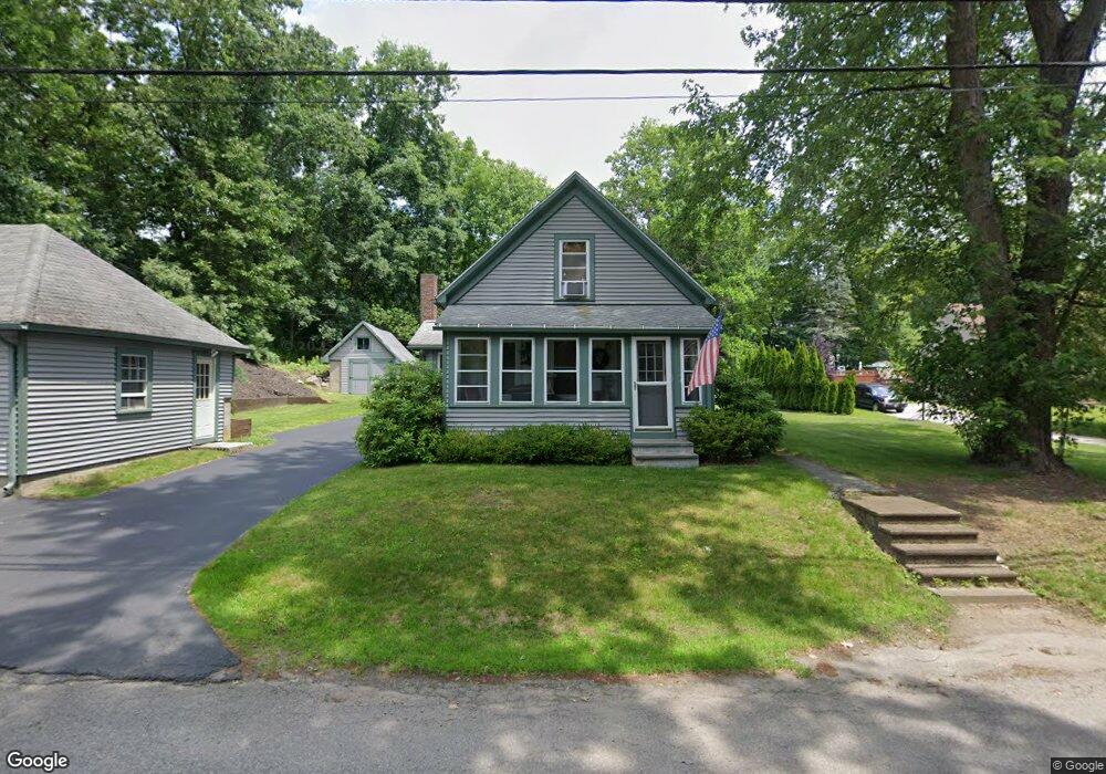
16 Blackstone St Sutton, MA 01590
Estimated Value: $412,000 - $516,000
4
Beds
1
Bath
1,313
Sq Ft
$347/Sq Ft
Est. Value
About This Home
This home is located at 16 Blackstone St, Sutton, MA 01590 and is currently estimated at $455,439, approximately $346 per square foot. 16 Blackstone St is a home located in Worcester County with nearby schools including Sutton Elementary School, Sutton Middle School, and Sutton High School.
Ownership History
Date
Name
Owned For
Owner Type
Purchase Details
Closed on
Aug 29, 2008
Sold by
Olson Ruby C
Bought by
Murray Timothy P
Current Estimated Value
Home Financials for this Owner
Home Financials are based on the most recent Mortgage that was taken out on this home.
Original Mortgage
$50,000
Outstanding Balance
$32,889
Interest Rate
6.29%
Mortgage Type
Purchase Money Mortgage
Estimated Equity
$422,550
Purchase Details
Closed on
Aug 19, 2008
Sold by
Olson Alfred O and Wahlgren Carol A
Bought by
Olson Ruby C
Home Financials for this Owner
Home Financials are based on the most recent Mortgage that was taken out on this home.
Original Mortgage
$50,000
Outstanding Balance
$32,889
Interest Rate
6.29%
Mortgage Type
Purchase Money Mortgage
Estimated Equity
$422,550
Purchase Details
Closed on
Oct 20, 2006
Sold by
Olson Ft and Olson Ruby C
Bought by
Olson Alfred O and Wahlgren Carol A
Create a Home Valuation Report for This Property
The Home Valuation Report is an in-depth analysis detailing your home's value as well as a comparison with similar homes in the area
Home Values in the Area
Average Home Value in this Area
Purchase History
| Date | Buyer | Sale Price | Title Company |
|---|---|---|---|
| Murray Timothy P | $152,000 | -- | |
| Olson Ruby C | -- | -- | |
| Olson Alfred O | -- | -- |
Source: Public Records
Mortgage History
| Date | Status | Borrower | Loan Amount |
|---|---|---|---|
| Open | Murray Timothy P | $50,000 |
Source: Public Records
Tax History
| Year | Tax Paid | Tax Assessment Tax Assessment Total Assessment is a certain percentage of the fair market value that is determined by local assessors to be the total taxable value of land and additions on the property. | Land | Improvement |
|---|---|---|---|---|
| 2025 | $4,879 | $391,600 | $159,800 | $231,800 |
| 2024 | $4,892 | $379,500 | $152,500 | $227,000 |
| 2023 | $4,877 | $346,400 | $137,800 | $208,600 |
| 2022 | $4,363 | $281,100 | $105,000 | $176,100 |
| 2021 | $3,498 | $255,000 | $105,000 | $150,000 |
| 2020 | $4,027 | $246,300 | $105,000 | $141,300 |
| 2019 | $3,791 | $223,500 | $101,200 | $122,300 |
| 2018 | $4,424 | $216,300 | $101,200 | $115,100 |
| 2017 | $3,954 | $206,400 | $88,400 | $118,000 |
| 2016 | $3,540 | $206,400 | $88,400 | $118,000 |
| 2015 | $3,430 | $200,600 | $88,400 | $112,200 |
| 2014 | $3,504 | $200,900 | $91,200 | $109,700 |
Source: Public Records
Map
Nearby Homes
- 150 Ariel Cir
- 115 Ariel Cir
- 8 Autumn Gate Cir
- Lot 1 Cooper Rd
- 20 Millers Way Unit C
- 7 Millers Way Unit C
- 11 Coldspring Dr Unit B
- 58 Fisherville Terrace
- 55 Fisherville Terrace
- 12 Village Green
- 5 Wildflower Dr
- 13 Braney Rd
- 20 Woodridge Rd
- 90 Leland Hill Rd
- 175 Armsby Rd
- 5 Mogren Dr
- 2 Jessica j Dr
- 229 Worcester-Providence Turnpike
- 4 Jessica j Dr
- 191 Hartness Rd
- 14 Blackstone St
- 7 Marks Way
- 20 Blackstone St
- 17 Blackstone St
- 11 Marks Way
- 34 Ariel Cir Unit 34
- 33 Ariel Cir Unit 33
- 32 Ariel Cir Unit 32
- 3 Marks Way
- 19 Blackstone St
- 9 Blackstone St
- 44 Ariel Cir Unit 44
- 46 Ariel Cir Unit 46
- 12 Mark's Way
- 12 Marks Way
- 24 Blackstone St
- 23 Blackstone St
- 6 Marks Way
- 8 Blackstone St
- 8 Marks Way