
Seller's Agent in 2025
Esther Zamudio
Zamudio Realty Group
(847) 508-7500
587 Total Sales
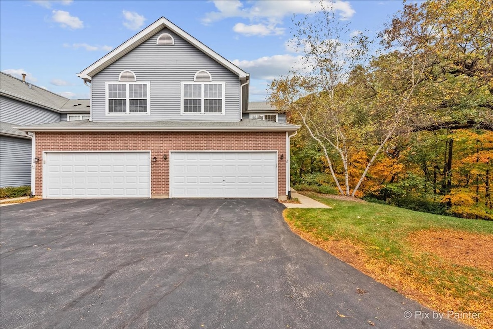
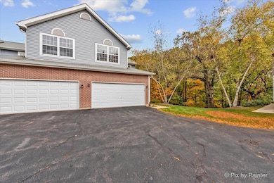
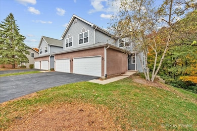
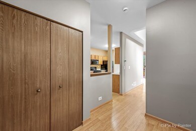
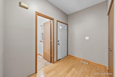
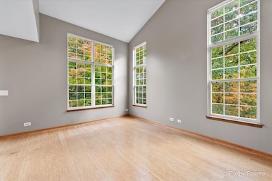
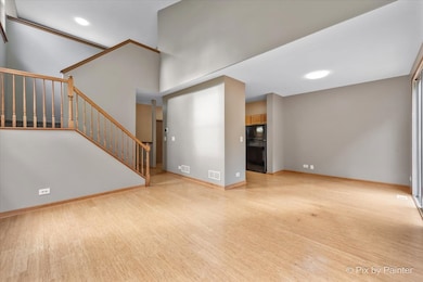
Recently refreshed and move-in ready! Entire home professionally painted and cleaned, including windows and vents. Newer carpet throughout. Highly desirable end unit offering enhanced privacy with no rear neighbors, surrounded by a tranquil green space with mature trees and shrubs. Walk-out basement offers incredible potential, ready to be finished for additional living space or entertainment area. The spacious loft can easily be converted into a 3rd bedroom or used as a home office, playroom, gym, etc. Large 2-car attached garage with great storage space. Property sold As-Is. Easy to show, schedule your appointment today!
Last Agent to Sell the Property
Zamudio Realty Group License #471021065 Listed on: 10/29/2025
| Date | Type | Sale Price | Title Company |
|---|---|---|---|
| Warranty Deed | $290,000 | First American Title | |
| Quit Claim Deed | -- | None Listed On Document | |
| Interfamily Deed Transfer | -- | -- | |
| Trustee Deed | $136,000 | -- |
| Date | Status | Loan Amount | Loan Type |
|---|---|---|---|
| Open | $124,900 | New Conventional | |
| Previous Owner | $133,027 | FHA |
| Date | Event | Price | List to Sale | Price per Sq Ft |
|---|---|---|---|---|
| 12/17/2025 12/17/25 | Sold | $289,900 | -1.7% | $207 / Sq Ft |
| 11/05/2025 11/05/25 | Pending | -- | -- | -- |
| 10/29/2025 10/29/25 | For Sale | $294,900 | -- | $211 / Sq Ft |
| Year | Tax Paid | Tax Assessment Tax Assessment Total Assessment is a certain percentage of the fair market value that is determined by local assessors to be the total taxable value of land and additions on the property. | Land | Improvement |
|---|---|---|---|---|
| 2024 | $5,609 | $79,705 | $13,825 | $65,880 |
| 2023 | $5,298 | $71,286 | $12,365 | $58,921 |
| 2022 | $4,664 | $60,386 | $11,160 | $49,226 |
| 2021 | $4,459 | $56,257 | $10,397 | $45,860 |
| 2020 | $4,334 | $54,266 | $10,029 | $44,237 |
| 2019 | $4,218 | $51,939 | $9,599 | $42,340 |
| 2018 | $4,108 | $49,095 | $8,867 | $40,228 |
| 2017 | $4,008 | $46,250 | $8,353 | $37,897 |
| 2016 | $3,931 | $43,378 | $7,834 | $35,544 |
| 2013 | -- | $51,850 | $7,308 | $44,542 |
Seller's Agent in 2025
Esther Zamudio
Zamudio Realty Group
(847) 508-7500
587 Total Sales
S
Seller Co-Listing Agent in 2025
Saul Martinez
Zamudio Realty Group
(847) 608-6600
20 Total Sales
Buyer's Agent in 2025
Amy Foote
Compass
(847) 602-9979
372 Total Sales
Source: Midwest Real Estate Data (MRED)
MLS Number: 12505927
APN: 19-28-302-133
Disclaimer: Certain information contained herein is derived from information provided by parties other than Homes.com. All information provided is deemed reliable, but is not guaranteed to be accurate and should be independently verified.
![]() Based on information submitted to the MLS GRID. All data is obtained from various sources and may not have been verified by broker or MLS GRID. Supplied Open House Information is subject to change without notice. All information should be independently reviewed and verified for accuracy. Properties may or may not be listed by the office/agent presenting the information. Some IDX listings have been excluded from this website.
Based on information submitted to the MLS GRID. All data is obtained from various sources and may not have been verified by broker or MLS GRID. Supplied Open House Information is subject to change without notice. All information should be independently reviewed and verified for accuracy. Properties may or may not be listed by the office/agent presenting the information. Some IDX listings have been excluded from this website.
Based on information submitted to the MLS GRID
Ask me questions while you tour the home.