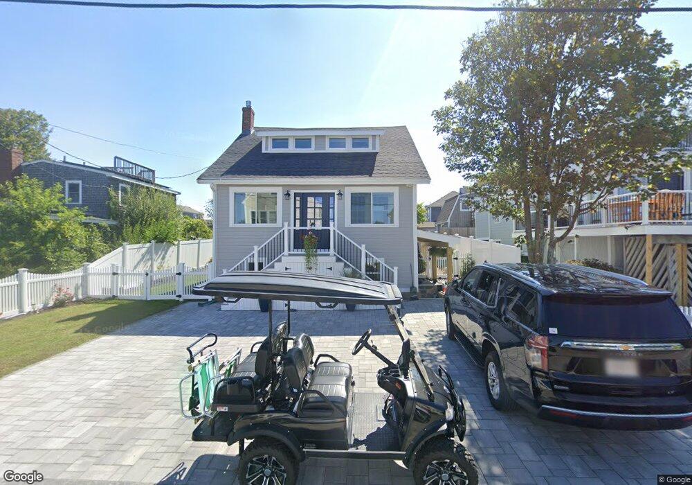
16 Carver Ave Scituate, MA 02066
Estimated Value: $710,000 - $852,602
4
Beds
3
Baths
1,094
Sq Ft
$708/Sq Ft
Est. Value
About This Home
This home is located at 16 Carver Ave, Scituate, MA 02066 and is currently estimated at $774,901, approximately $708 per square foot. 16 Carver Ave is a home located in Plymouth County with nearby schools including Wampatuck Elementary School, Lester J. Gates Middle School, and Scituate High School.
Ownership History
Date
Name
Owned For
Owner Type
Purchase Details
Closed on
Aug 1, 2012
Sold by
Bourgue Basil H
Bought by
Mein Jacinda A and Bohn Jacqueline K
Current Estimated Value
Home Financials for this Owner
Home Financials are based on the most recent Mortgage that was taken out on this home.
Original Mortgage
$280,000
Outstanding Balance
$194,244
Interest Rate
3.7%
Mortgage Type
New Conventional
Estimated Equity
$580,657
Purchase Details
Closed on
Oct 21, 2003
Sold by
Driscoll Jane
Bought by
Bourque Basil H
Create a Home Valuation Report for This Property
The Home Valuation Report is an in-depth analysis detailing your home's value as well as a comparison with similar homes in the area
Home Values in the Area
Average Home Value in this Area
Purchase History
| Date | Buyer | Sale Price | Title Company |
|---|---|---|---|
| Mein Jacinda A | $360,000 | -- | |
| Bourque Basil H | -- | -- | |
| Bourque Basil H | -- | -- |
Source: Public Records
Mortgage History
| Date | Status | Borrower | Loan Amount |
|---|---|---|---|
| Open | Mein Jacinda A | $280,000 | |
| Closed | Bourque Basil H | $280,000 | |
| Previous Owner | Bourque Basil H | $100,000 |
Source: Public Records
Tax History Compared to Growth
Tax History
| Year | Tax Paid | Tax Assessment Tax Assessment Total Assessment is a certain percentage of the fair market value that is determined by local assessors to be the total taxable value of land and additions on the property. | Land | Improvement |
|---|---|---|---|---|
| 2025 | $7,210 | $721,700 | $460,300 | $261,400 |
| 2024 | $7,132 | $688,400 | $418,400 | $270,000 |
| 2023 | $6,908 | $620,700 | $380,400 | $240,300 |
| 2022 | $6,490 | $514,300 | $309,900 | $204,400 |
| 2021 | $6,221 | $466,700 | $295,200 | $171,500 |
| 2020 | $6,039 | $447,300 | $283,800 | $163,500 |
| 2019 | $5,973 | $434,700 | $278,200 | $156,500 |
| 2018 | $5,841 | $418,700 | $277,900 | $140,800 |
| 2017 | $5,760 | $408,800 | $268,000 | $140,800 |
| 2016 | $5,714 | $404,100 | $268,000 | $136,100 |
| 2015 | $5,164 | $394,200 | $258,100 | $136,100 |
Source: Public Records
Map
Nearby Homes
- 209 Hatherly Rd
- 55 Seaside Rd
- 30 Irving Rd
- 7 Borden Rd
- 355 Tilden Rd
- 378 Tilden Rd
- 23 Lois Ann Ct Unit 23
- 50 Oceanside Dr
- 2 Windward Ln
- 22 Kings Way
- 105 Turner Rd
- 148 Tilden Rd
- 1 Hillside Rd
- 46 Marys Ln
- 12 Richfield Rd
- 54 Woodland Rd
- 32 Barker Rd Unit 3
- 59 Captain Peirce Rd
- 18 James Way
- 74 Tilden Rd