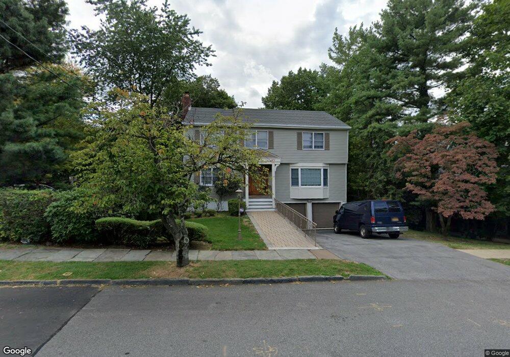
16 Clinton Ave Unit B-5 Dobbs Ferry, NY 10522
Estimated Value: $921,206 - $1,941,000
3
Beds
3
Baths
3,000
Sq Ft
$488/Sq Ft
Est. Value
About This Home
This home is located at 16 Clinton Ave Unit B-5, Dobbs Ferry, NY 10522 and is currently estimated at $1,465,402, approximately $488 per square foot. 16 Clinton Ave Unit B-5 is a home located in Westchester County with nearby schools including Springhurst Elementary School, Dobbs Ferry High School, and The Masters School.
Ownership History
Date
Name
Owned For
Owner Type
Purchase Details
Closed on
Jul 3, 2019
Sold by
Mikdadi Salem D and Mikdadi Zena K
Bought by
The Mikdadi Family Trust
Current Estimated Value
Create a Home Valuation Report for This Property
The Home Valuation Report is an in-depth analysis detailing your home's value as well as a comparison with similar homes in the area
Home Values in the Area
Average Home Value in this Area
Purchase History
| Date | Buyer | Sale Price | Title Company |
|---|---|---|---|
| The Mikdadi Family Trust | -- | Benchmark Title |
Source: Public Records
Tax History Compared to Growth
Tax History
| Year | Tax Paid | Tax Assessment Tax Assessment Total Assessment is a certain percentage of the fair market value that is determined by local assessors to be the total taxable value of land and additions on the property. | Land | Improvement |
|---|---|---|---|---|
| 2024 | $16,187 | $545,300 | $201,900 | $343,400 |
| 2023 | $15,150 | $514,400 | $201,900 | $312,500 |
| 2022 | $14,250 | $474,500 | $201,900 | $272,600 |
| 2021 | $17,172 | $433,300 | $201,900 | $231,400 |
| 2020 | $16,878 | $504,700 | $182,800 | $321,900 |
| 2019 | $16,726 | $504,700 | $182,800 | $321,900 |
| 2018 | $19,267 | $504,700 | $182,800 | $321,900 |
| 2017 | $2,166 | $476,800 | $182,800 | $294,000 |
| 2016 | $391,266 | $476,800 | $182,800 | $294,000 |
| 2015 | -- | $14,615 | $3,200 | $11,415 |
| 2014 | -- | $14,615 | $3,200 | $11,415 |
| 2013 | -- | $16,810 | $3,200 | $13,610 |
Source: Public Records
Map
Nearby Homes
- 18 Eldredge Place
- 100 Cedar St Unit B33
- 63 Grandview Ave
- 36 Belden Ave
- 10 Sherman Ave
- 50 Belden Ave
- 33 Livingston Ave
- 78 Oliphant Ave
- 13 English Ln Unit B
- 177 Clinton Ave
- 31 Hudson Dr
- 23 Seneca St
- 66 Landing Dr
- 101 Beacon Hill Dr Unit 13
- 17 Manor House Dr Unit K13
- 14 Manor House Dr Unit G29
- 70 Washington Ave
- 0 Sherman Ave Unit KEY841006
- 72 Magnolia Dr
- 5 Forkland Ln
- 2 Clinton Ave
- 16 Clinton Ave
- 12 Clinton Ave Unit B
- 12 Clinton Ave Unit 12B
- 12 Clinton Ave Unit C
- 12 Clinton Ave Unit 12A
- 12 Clinton Ave
- 4 Clinton Ave
- 4 Clinton Ave Unit 4
- 334 Broadway
- 18 Clinton Ave
- 333 Broadway
- 329 Broadway
- 34 Clinton Ave Unit 4
- 34 Clinton Ave Unit 9
- 34 Clinton Ave Unit 2
- 34 Clinton Ave Unit 5D
- 34 Clinton Ave Unit 10
- 34 Clinton Ave
- 321 Broadway