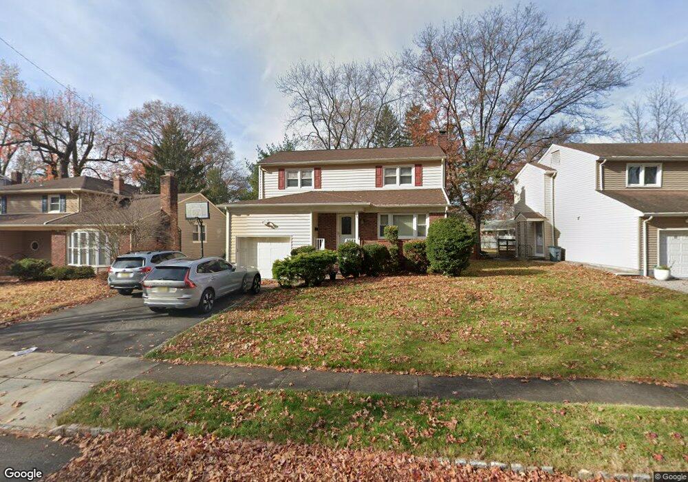
16 Elmwood Rd Springfield, NJ 07081
Estimated Value: $586,000 - $815,000
--
Bed
--
Bath
1,800
Sq Ft
$398/Sq Ft
Est. Value
About This Home
This home is located at 16 Elmwood Rd, Springfield, NJ 07081 and is currently estimated at $716,387, approximately $397 per square foot. 16 Elmwood Rd is a home located in Union County with nearby schools including Jonathan Dayton High School and St James The Apostle School.
Ownership History
Date
Name
Owned For
Owner Type
Purchase Details
Closed on
May 18, 2004
Sold by
Levine Anita Sanyour
Bought by
Mlawski Neil and Mlawski Elisabeth
Current Estimated Value
Home Financials for this Owner
Home Financials are based on the most recent Mortgage that was taken out on this home.
Original Mortgage
$210,000
Outstanding Balance
$100,189
Interest Rate
5.75%
Estimated Equity
$616,198
Create a Home Valuation Report for This Property
The Home Valuation Report is an in-depth analysis detailing your home's value as well as a comparison with similar homes in the area
Home Values in the Area
Average Home Value in this Area
Purchase History
| Date | Buyer | Sale Price | Title Company |
|---|---|---|---|
| Mlawski Neil | $429,000 | -- |
Source: Public Records
Mortgage History
| Date | Status | Borrower | Loan Amount |
|---|---|---|---|
| Open | Mlawski Neil | $210,000 |
Source: Public Records
Tax History Compared to Growth
Tax History
| Year | Tax Paid | Tax Assessment Tax Assessment Total Assessment is a certain percentage of the fair market value that is determined by local assessors to be the total taxable value of land and additions on the property. | Land | Improvement |
|---|---|---|---|---|
| 2025 | $13,830 | $582,300 | $225,200 | $357,100 |
| 2024 | $13,603 | $582,300 | $225,200 | $357,100 |
| 2023 | $13,603 | $582,300 | $225,200 | $357,100 |
| 2022 | $12,630 | $582,300 | $225,200 | $357,100 |
| 2021 | $12,426 | $166,900 | $71,300 | $95,600 |
| 2020 | $12,232 | $166,900 | $71,300 | $95,600 |
| 2019 | $12,067 | $166,900 | $71,300 | $95,600 |
| 2018 | $11,850 | $166,900 | $71,300 | $95,600 |
| 2017 | $11,524 | $166,900 | $71,300 | $95,600 |
| 2016 | $11,301 | $166,900 | $71,300 | $95,600 |
| 2015 | $11,169 | $166,900 | $71,300 | $95,600 |
| 2014 | $10,959 | $166,900 | $71,300 | $95,600 |
Source: Public Records
Map
Nearby Homes
- 216 Milltown Rd
- 380 Meisel Ave
- 2857 Willard Place
- 33 Country Club Ln
- 504 Meisel Ave
- 767 Hemlock Rd
- 18 Evergreen Ave
- 807 Andover Rd
- 66 Fieldstone Dr
- 64 S Springfield Ave
- 296 Northview Terrace
- 126 Fieldstone Dr
- 120 S Maple Ave
- 97 Battle Hill Ave
- 18 Oakland Ave
- 359 Mountain Ave
- 6 Joanne Way
- 298 Mountain Ave
- 26 Benjamin Dr
- 262 Mountain Ave