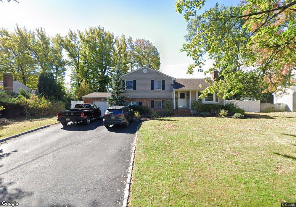
16 Fieldcrest Dr Scotch Plains, NJ 07076
Estimated Value: $701,524 - $1,175,000
--
Bed
--
Bath
1,982
Sq Ft
$469/Sq Ft
Est. Value
About This Home
This home is located at 16 Fieldcrest Dr, Scotch Plains, NJ 07076 and is currently estimated at $930,131, approximately $469 per square foot. 16 Fieldcrest Dr is a home located in Union County with nearby schools including William J. McGinn Elementary School, Terrill Middle School, and Scotch Plains-Fanwood High School.
Ownership History
Date
Name
Owned For
Owner Type
Purchase Details
Closed on
Dec 13, 2001
Sold by
Miller Craig R
Bought by
Luce David and Luce Terri M
Current Estimated Value
Home Financials for this Owner
Home Financials are based on the most recent Mortgage that was taken out on this home.
Original Mortgage
$153,000
Outstanding Balance
$59,652
Interest Rate
6.54%
Mortgage Type
Stand Alone First
Estimated Equity
$870,479
Create a Home Valuation Report for This Property
The Home Valuation Report is an in-depth analysis detailing your home's value as well as a comparison with similar homes in the area
Home Values in the Area
Average Home Value in this Area
Purchase History
| Date | Buyer | Sale Price | Title Company |
|---|---|---|---|
| Luce David | $355,000 | -- |
Source: Public Records
Mortgage History
| Date | Status | Borrower | Loan Amount |
|---|---|---|---|
| Open | Luce David | $153,000 |
Source: Public Records
Tax History Compared to Growth
Tax History
| Year | Tax Paid | Tax Assessment Tax Assessment Total Assessment is a certain percentage of the fair market value that is determined by local assessors to be the total taxable value of land and additions on the property. | Land | Improvement |
|---|---|---|---|---|
| 2025 | $16,040 | $136,300 | $41,400 | $94,900 |
| 2024 | $15,567 | $136,300 | $41,400 | $94,900 |
| 2023 | $15,567 | $136,300 | $41,400 | $94,900 |
| 2022 | $15,381 | $136,300 | $41,400 | $94,900 |
| 2021 | $15,356 | $136,300 | $41,400 | $94,900 |
| 2020 | $15,282 | $136,300 | $41,400 | $94,900 |
| 2019 | $15,169 | $136,300 | $41,400 | $94,900 |
| 2018 | $14,914 | $136,300 | $41,400 | $94,900 |
| 2017 | $14,583 | $136,300 | $41,400 | $94,900 |
| 2016 | $14,302 | $136,300 | $41,400 | $94,900 |
| 2015 | $14,068 | $136,300 | $41,400 | $94,900 |
| 2014 | $13,604 | $136,300 | $41,400 | $94,900 |
Source: Public Records
Map
Nearby Homes
- 2116 Newark Ave
- 2154 W Broad St
- 119 Lamberts Mill Rd
- 1933 W Broad St
- 1933 Mary Ellen Ln
- 2 Brookside Ct
- 2212 Shady Ln
- 1466 Lamberts Mill Rd
- 314 Highgate Ave
- 2314 Longfellow Ave
- 2219 North Ave Unit 6
- 524 Edgar Rd
- 187 King St
- 525 Edgar Rd
- 345 La Grande Ave
- 350 W Dudley Ave
- 120 S Martine Ave
- 5 Robin Rd
- 724 South Ave W Unit 724A
- 21 Old South Ave
- 18 Fieldcrest Dr
- 14 Fieldcrest Dr
- 1259 Woodside Rd
- 1253 Woodside Rd
- 1265 Woodside Rd
- 17 Fieldcrest Dr
- 1 Liquor Way
- 12 Fieldcrest Dr
- 11 Fieldcrest Dr
- 20 Fieldcrest Dr
- 19 Fieldcrest Dr
- 1271 Woodside Rd
- 1247 Woodside Rd
- 10 Fieldcrest Dr
- 1260 Woodside Rd
- 1254 Woodside Rd
- 22 Fieldcrest Dr
- 37 Fieldcrest Dr
- 29 Fieldcrest Dr
- 8 Fieldcrest Dr