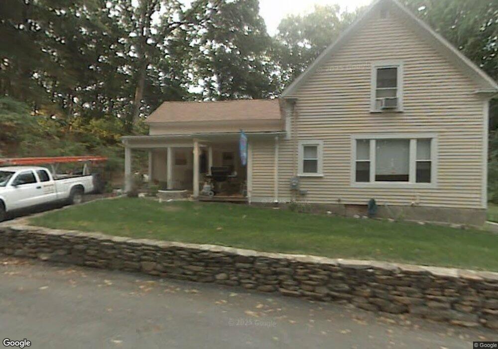
16 High St West Boylston, MA 01583
Estimated Value: $403,324 - $478,000
3
Beds
2
Baths
1,266
Sq Ft
$351/Sq Ft
Est. Value
About This Home
This home is located at 16 High St, West Boylston, MA 01583 and is currently estimated at $444,081, approximately $350 per square foot. 16 High St is a home located in Worcester County with nearby schools including Major Edwards Elementary School and West Boylston Junior/Senior High School.
Ownership History
Date
Name
Owned For
Owner Type
Purchase Details
Closed on
Feb 27, 2003
Sold by
Erickson Joanne R
Bought by
Reilly Thomas and Reilly Diane
Current Estimated Value
Home Financials for this Owner
Home Financials are based on the most recent Mortgage that was taken out on this home.
Original Mortgage
$173,500
Outstanding Balance
$75,132
Interest Rate
5.98%
Mortgage Type
Purchase Money Mortgage
Estimated Equity
$368,949
Create a Home Valuation Report for This Property
The Home Valuation Report is an in-depth analysis detailing your home's value as well as a comparison with similar homes in the area
Home Values in the Area
Average Home Value in this Area
Purchase History
| Date | Buyer | Sale Price | Title Company |
|---|---|---|---|
| Reilly Thomas | $193,000 | -- |
Source: Public Records
Mortgage History
| Date | Status | Borrower | Loan Amount |
|---|---|---|---|
| Open | Reilly Thomas | $173,500 |
Source: Public Records
Tax History Compared to Growth
Tax History
| Year | Tax Paid | Tax Assessment Tax Assessment Total Assessment is a certain percentage of the fair market value that is determined by local assessors to be the total taxable value of land and additions on the property. | Land | Improvement |
|---|---|---|---|---|
| 2025 | $43 | $309,100 | $86,600 | $222,500 |
| 2024 | $4,125 | $279,100 | $86,600 | $192,500 |
| 2023 | $4,414 | $283,300 | $86,100 | $197,200 |
| 2022 | $3,973 | $224,700 | $86,100 | $138,600 |
| 2021 | $5,373 | $214,500 | $81,000 | $133,500 |
| 2020 | $4,308 | $197,300 | $81,000 | $116,300 |
| 2019 | $4,968 | $187,200 | $81,000 | $106,200 |
| 2018 | $3,338 | $179,100 | $81,000 | $98,100 |
| 2017 | $2,812 | $177,100 | $81,000 | $96,100 |
| 2016 | $3,218 | $174,400 | $75,300 | $99,100 |
| 2015 | $3,087 | $168,300 | $74,500 | $93,800 |
Source: Public Records
Map
Nearby Homes
- 16 N Main St
- 20 Winthrop St
- 287 Laurel St
- 136 Sterling St Unit A3
- 0 Boutelle Rd
- 0 North St
- 156 Prospect St
- 2 Lakeview Ave
- 18 Laurel Ave
- 61 Boutelle Rd
- 21 Myrtle Ave
- Lot 1 Manning St
- 223 Worcester Rd
- 152 Worcester St Unit 8
- 54 Maple St
- 62 Maple St
- 4 Jewett Rd Unit B
- 4 Jewett Rd Unit A
- 39 Davidson Rd
- 47 Preservation Ln
- 12 High St
- 8 High St Unit 8
- 23 High St
- 23 N Main St
- 10 Green St
- 26 High St
- 6 Green St
- 20 May St
- 20 May St Unit A
- 14 May St
- 18 May St
- 10 May St
- 10 May St Unit 1
- 0 Laurel St Unit 71338047
- 0 Laurel St Unit 30628939
- 11 N Main St Unit 5
- 11 N Main St Unit 4
- 11 N Main St Unit 3
- 11 N Main St Unit 2
- 11 N Main St Unit 1