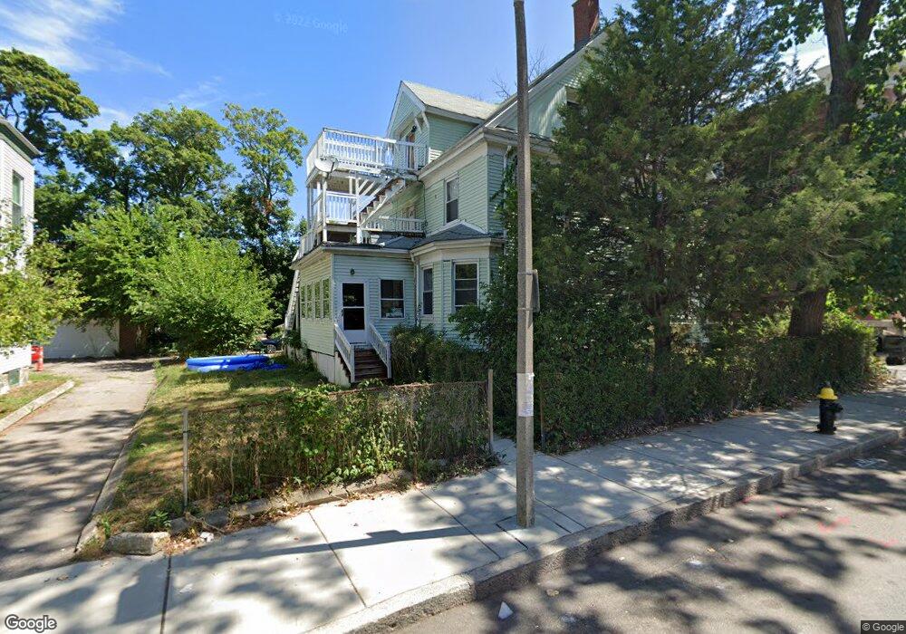
16 Homestead St Dorchester, MA 02121
Washington Park NeighborhoodEstimated Value: $776,000 - $1,067,452
6
Beds
4
Baths
3,610
Sq Ft
$246/Sq Ft
Est. Value
About This Home
This home is located at 16 Homestead St, Dorchester, MA 02121 and is currently estimated at $888,863, approximately $246 per square foot. 16 Homestead St is a home located in Suffolk County with nearby schools including Bridge Boston Charter School, Neighborhood School, and Mother Caroline Academy & Education Center.
Ownership History
Date
Name
Owned For
Owner Type
Purchase Details
Closed on
May 10, 2019
Sold by
Wheeler James B
Bought by
Wheeler James B and Wheeler Patricia W
Current Estimated Value
Home Financials for this Owner
Home Financials are based on the most recent Mortgage that was taken out on this home.
Original Mortgage
$328,000
Outstanding Balance
$286,587
Interest Rate
4.1%
Mortgage Type
New Conventional
Estimated Equity
$602,276
Purchase Details
Closed on
Dec 16, 2016
Sold by
Wheeler Robert H
Bought by
Wheeler James B
Home Financials for this Owner
Home Financials are based on the most recent Mortgage that was taken out on this home.
Original Mortgage
$684,000
Interest Rate
3.54%
Mortgage Type
Reverse Mortgage Home Equity Conversion Mortgage
Create a Home Valuation Report for This Property
The Home Valuation Report is an in-depth analysis detailing your home's value as well as a comparison with similar homes in the area
Home Values in the Area
Average Home Value in this Area
Purchase History
| Date | Buyer | Sale Price | Title Company |
|---|---|---|---|
| Wheeler James B | -- | -- | |
| Wheeler James B | -- | -- | |
| Wheeler Robert H | -- | -- |
Source: Public Records
Mortgage History
| Date | Status | Borrower | Loan Amount |
|---|---|---|---|
| Open | Wheeler James B | $328,000 | |
| Previous Owner | Wheeler Robert H | $684,000 |
Source: Public Records
Tax History Compared to Growth
Tax History
| Year | Tax Paid | Tax Assessment Tax Assessment Total Assessment is a certain percentage of the fair market value that is determined by local assessors to be the total taxable value of land and additions on the property. | Land | Improvement |
|---|---|---|---|---|
| 2025 | $10,371 | $895,600 | $351,300 | $544,300 |
| 2024 | $8,776 | $805,100 | $232,300 | $572,800 |
| 2023 | $8,084 | $752,700 | $217,200 | $535,500 |
| 2022 | $7,444 | $684,200 | $197,400 | $486,800 |
| 2021 | $6,823 | $639,500 | $184,500 | $455,000 |
| 2020 | $5,347 | $506,300 | $166,600 | $339,700 |
| 2019 | $4,988 | $473,200 | $123,800 | $349,400 |
| 2018 | $4,593 | $438,300 | $123,800 | $314,500 |
| 2017 | $4,462 | $421,300 | $123,800 | $297,500 |
| 2016 | $4,138 | $376,200 | $123,800 | $252,400 |
| 2015 | $4,246 | $350,600 | $126,200 | $224,400 |
| 2014 | $3,813 | $303,100 | $126,200 | $176,900 |
Source: Public Records
Map
Nearby Homes
- 9 Abbotsford St Unit 1
- 4 Ruthven St
- 75 Ruthven St
- 214 Humboldt Ave
- 41 W Walnut Park
- 78 Hutchings St Unit 1
- 27 Dixwell St Unit 11
- 27 Dixwell St Unit 12
- 27 Dixwell St Unit 4
- 1-3 Glines Ave
- 164 Ruthven St Unit 1
- 28 Wabon St
- 20 Chilcott Place
- 99 Harrishof St
- 3 Atherton St
- 151 Townsend St
- 35-37 Notre Dame St
- 26-28-30 Notre Dame St
- 39 W Walnut Park
- 90 Munroe St
- 20 Homestead St
- 20 Homestead St Unit 2
- 12 Homestead St
- 24 Homestead St Unit 6
- 24 Homestead St Unit 5
- 24 Homestead St Unit 4
- 24 Homestead St Unit 3
- 24 Homestead St Unit 2
- 24 Homestead St Unit 1
- 9A Ruthven St
- 9A Ruthven St Unit 2
- 26 Homestead St
- 7 Ruthven St
- 9 Ruthven St
- 9 Ruthven St Unit 2
- 9 Ruthven St Unit 1
- 9 Ruthven St Unit 3
- 5 Ruthven St
- 5 Ruthven St Unit 2
- 5 Ruthven St Unit 1