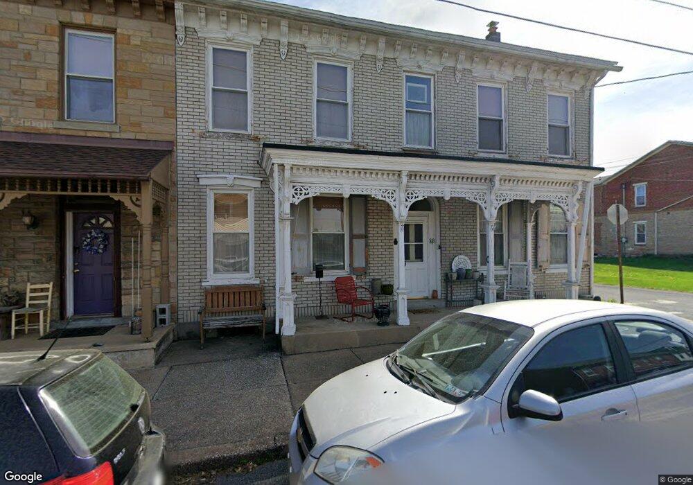
16 Kemp St Lyons, PA 19536
Maxatawny NeighborhoodEstimated Value: $261,000 - $368,000
3
Beds
3
Baths
2,576
Sq Ft
$122/Sq Ft
Est. Value
About This Home
This home is located at 16 Kemp St, Lyons, PA 19536 and is currently estimated at $313,680, approximately $121 per square foot. 16 Kemp St is a home located in Berks County with nearby schools including Kutztown Area Senior High School, Pleasant Hills Mennonite School, and LIGHTHOUSE ISLAND ACADEMY.
Ownership History
Date
Name
Owned For
Owner Type
Purchase Details
Closed on
May 29, 2018
Sold by
Schwover Virginia F and Estate Of Ronald G Schwoyer
Bought by
Borman Emerson E and Hamilton Kaylynn
Current Estimated Value
Home Financials for this Owner
Home Financials are based on the most recent Mortgage that was taken out on this home.
Original Mortgage
$117,500
Outstanding Balance
$37,609
Interest Rate
4.4%
Mortgage Type
Seller Take Back
Estimated Equity
$276,071
Purchase Details
Closed on
Aug 25, 1959
Bought by
% Sch Schwoyer W and % Sch Ronald G
Create a Home Valuation Report for This Property
The Home Valuation Report is an in-depth analysis detailing your home's value as well as a comparison with similar homes in the area
Home Values in the Area
Average Home Value in this Area
Purchase History
| Date | Buyer | Sale Price | Title Company |
|---|---|---|---|
| Borman Emerson E | $179,000 | Stewart Abstract | |
| % Sch Schwoyer W | -- | -- |
Source: Public Records
Mortgage History
| Date | Status | Borrower | Loan Amount |
|---|---|---|---|
| Open | Borman Emerson E | $117,500 |
Source: Public Records
Tax History
| Year | Tax Paid | Tax Assessment Tax Assessment Total Assessment is a certain percentage of the fair market value that is determined by local assessors to be the total taxable value of land and additions on the property. | Land | Improvement |
|---|---|---|---|---|
| 2025 | $1,057 | $97,300 | $25,600 | $71,700 |
| 2024 | $3,907 | $97,300 | $25,600 | $71,700 |
| 2023 | $3,840 | $97,300 | $25,600 | $71,700 |
| 2022 | $3,840 | $97,300 | $25,600 | $71,700 |
| 2021 | $3,840 | $97,300 | $25,600 | $71,700 |
| 2020 | $3,840 | $97,300 | $25,600 | $71,700 |
| 2019 | $3,840 | $97,300 | $25,600 | $71,700 |
| 2018 | $3,840 | $97,300 | $25,600 | $71,700 |
| 2017 | $3,812 | $97,300 | $25,600 | $71,700 |
| 2016 | $879 | $97,300 | $25,600 | $71,700 |
| 2015 | $879 | $97,300 | $25,600 | $71,700 |
| 2014 | $879 | $97,300 | $25,600 | $71,700 |
Source: Public Records
Map
Nearby Homes
- 119 Smoketown Rd
- 147 Smoketown Rd
- 13 Davids Dr
- 164 W Main St
- 113 W Main St
- 201 Lucille Way
- 209 Lucille Way
- 207 Lucille Way
- 203 Lucille Way
- 205 Lucille Way
- 530 E Linden St
- 97 S Kemp Rd
- 504-512 E Main St
- 410 E Main St
- 32 N Main St
- 112 Portia Blvd
- 122 Portia Blvd
- 602 Seem Dr
- 647 Seem Dr
- 111 Portia Blvd