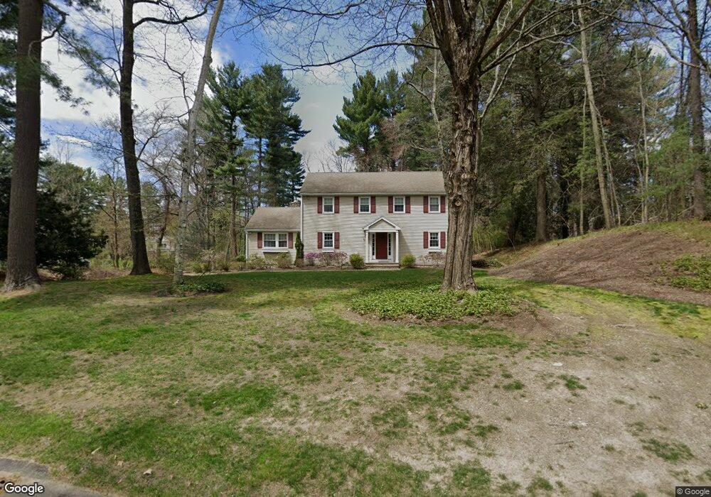
16 Lands End Ln Sudbury, MA 01776
Estimated Value: $1,145,237 - $1,517,000
4
Beds
3
Baths
2,828
Sq Ft
$473/Sq Ft
Est. Value
About This Home
This home is located at 16 Lands End Ln, Sudbury, MA 01776 and is currently estimated at $1,337,059, approximately $472 per square foot. 16 Lands End Ln is a home located in Middlesex County with nearby schools including Israel Loring Elementary School, Ephraim Curtis Middle School, and Lincoln-Sudbury Regional High School.
Ownership History
Date
Name
Owned For
Owner Type
Purchase Details
Closed on
Nov 10, 2023
Sold by
Katcher Michael S and Katcher Donna H
Bought by
Michael Katcher T and Michael Katcher
Current Estimated Value
Purchase Details
Closed on
Sep 27, 1994
Sold by
Rogers John N and Rogers Betty J
Bought by
Katcher Michael S and Katcher Donna H
Home Financials for this Owner
Home Financials are based on the most recent Mortgage that was taken out on this home.
Original Mortgage
$304,000
Interest Rate
8.56%
Mortgage Type
Purchase Money Mortgage
Create a Home Valuation Report for This Property
The Home Valuation Report is an in-depth analysis detailing your home's value as well as a comparison with similar homes in the area
Home Values in the Area
Average Home Value in this Area
Purchase History
| Date | Buyer | Sale Price | Title Company |
|---|---|---|---|
| Michael Katcher T | -- | None Available | |
| Michael Katcher T | -- | None Available | |
| Katcher Michael S | $358,500 | -- | |
| Katcher Michael S | $358,500 | -- |
Source: Public Records
Mortgage History
| Date | Status | Borrower | Loan Amount |
|---|---|---|---|
| Previous Owner | Katcher Michael S | $293,000 | |
| Previous Owner | Katcher Michael S | $304,000 |
Source: Public Records
Tax History Compared to Growth
Tax History
| Year | Tax Paid | Tax Assessment Tax Assessment Total Assessment is a certain percentage of the fair market value that is determined by local assessors to be the total taxable value of land and additions on the property. | Land | Improvement |
|---|---|---|---|---|
| 2025 | $17,464 | $1,192,900 | $501,000 | $691,900 |
| 2024 | $16,828 | $1,151,800 | $486,600 | $665,200 |
| 2023 | $15,630 | $991,100 | $434,600 | $556,500 |
| 2022 | $15,281 | $846,600 | $398,600 | $448,000 |
| 2021 | $14,565 | $773,500 | $398,600 | $374,900 |
| 2020 | $14,271 | $773,500 | $398,600 | $374,900 |
| 2019 | $13,853 | $773,500 | $398,600 | $374,900 |
| 2018 | $13,733 | $765,900 | $424,200 | $341,700 |
| 2017 | $13,463 | $758,900 | $420,600 | $338,300 |
| 2016 | $13,047 | $733,000 | $404,600 | $328,400 |
| 2015 | $12,524 | $711,600 | $393,000 | $318,600 |
| 2014 | $12,500 | $693,300 | $381,400 | $311,900 |
Source: Public Records
Map
Nearby Homes
- 84 Hopestill Brown Rd
- 14 Eisenhower Rd
- 91 Eaton Rd W
- 19 Nob Hill Dr
- 32 Eaton Rd W
- 0 Wagonwheel Rd
- 128 Nobscot Rd
- 27 Sloane Dr
- 30 Nobscot Rd Unit 14
- 63 Landham Rd
- 1011 Boston Post Rd
- 41 James St
- 216 Landham Rd
- 30 Edith Rd
- 40 Gregory Rd
- 24 Woodland Rd
- 53 Davidson Rd
- 106 Baldwin Ave
- 78 Apple d or Rd
- 23 Massasoit Ave
- 24 Lands End Ln
- 30 Robert Frost Rd
- 8 Lands End Ln
- 15 Lands End Ln
- 21 Lands End Ln
- 9 Lands End Ln
- 27 Robert Frost Rd
- 27 Lands End Ln
- 19 Robert Frost Rd
- 35 Robert Frost Rd
- 38 Robert Frost Rd
- 38 Lands End Ln
- 33 Lands End Ln
- 46 Lands End Ln
- 39 Lands End Ln
- 26 Lombard Ln
- 11 Robert Frost Rd
- 6 Robert Frost Rd
- 66 Raymond Rd
- 60 Raymond Rd