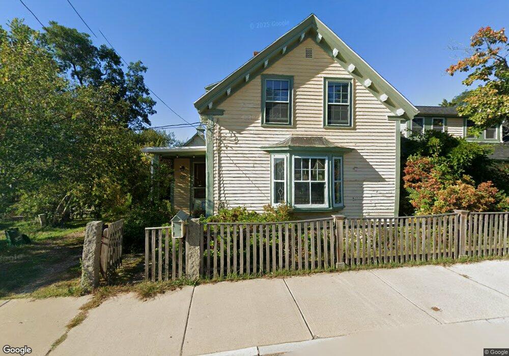
16 Langsford St Gloucester, MA 01930
Estimated Value: $892,000 - $1,447,000
4
Beds
2
Baths
2,268
Sq Ft
$514/Sq Ft
Est. Value
About This Home
This home is located at 16 Langsford St, Gloucester, MA 01930 and is currently estimated at $1,166,493, approximately $514 per square foot. 16 Langsford St is a home located in Essex County with nearby schools including Plum Cove School, Ralph B O'maley Middle School, and Gloucester High School.
Ownership History
Date
Name
Owned For
Owner Type
Purchase Details
Closed on
Jan 28, 2008
Sold by
Carter Edward Rinaldo and Carter Marion Elizabet
Bought by
Steer Jonathan P
Current Estimated Value
Purchase Details
Closed on
Sep 29, 1995
Sold by
Lanesville Rt
Bought by
Stevens William N and Collins Sara
Create a Home Valuation Report for This Property
The Home Valuation Report is an in-depth analysis detailing your home's value as well as a comparison with similar homes in the area
Purchase History
| Date | Buyer | Sale Price | Title Company |
|---|---|---|---|
| Steer Jonathan P | $564,000 | -- | |
| Stevens William N | $185,000 | -- |
Source: Public Records
Mortgage History
| Date | Status | Borrower | Loan Amount |
|---|---|---|---|
| Closed | Stevens William N | $10,000 | |
| Closed | Stevens William N | $116,000 |
Source: Public Records
Tax History
| Year | Tax Paid | Tax Assessment Tax Assessment Total Assessment is a certain percentage of the fair market value that is determined by local assessors to be the total taxable value of land and additions on the property. | Land | Improvement |
|---|---|---|---|---|
| 2025 | $7,600 | $781,900 | $252,900 | $529,000 |
| 2024 | $7,490 | $769,800 | $240,800 | $529,000 |
| 2023 | $7,206 | $680,500 | $215,000 | $465,500 |
| 2022 | $6,966 | $593,900 | $182,800 | $411,100 |
| 2021 | $6,744 | $542,100 | $166,200 | $375,900 |
| 2020 | $6,726 | $545,500 | $166,200 | $379,300 |
| 2019 | $6,483 | $510,900 | $166,200 | $344,700 |
| 2018 | $6,305 | $487,600 | $166,200 | $321,400 |
| 2017 | $6,124 | $464,300 | $158,200 | $306,100 |
| 2016 | $5,963 | $438,100 | $158,700 | $279,400 |
| 2015 | $5,715 | $418,700 | $158,700 | $260,000 |
Source: Public Records
Map
Nearby Homes
- 10 Emerald St
- 43 High St Unit B
- 9 Hickory St
- 1030 Washington St
- 4 Ciaramitaro Ct
- 136 Leonard St
- 94 Phillips Ave
- 13 Phillips Ave
- 32 Haven Ave
- 5 Boulder Top
- 33 Quarry Ridge Ln Unit 33
- 13 Rowe Point
- 5 Smith St Unit R
- 672 Washington St
- 1 Charte Ct
- 1 Main St Unit R
- 1 Main St Unit C
- 1 Jewett St Unit 2
- 177 Main St
- 1 High St
- 13 Langsford St
- 20 Langsford St
- 8 Old Farm Ln
- 6 Old Farm Ln
- 4 Old Farm Ln
- 8 Langsford St
- 15 Langsford St
- 9 Langsford St
- 7 Langsford St
- 24 Langsford St
- 12 Langsford Way
- 10 Langsford Way
- 8 Munsey Ln
- 4 Langsford St
- 5 Langsford St
- 19 Langsford St
- 6 Langsford St
- 6 Langsford St Unit 1
- 6 Langsford St Unit 2
- 6R Langsford St
Your Personal Tour Guide
Ask me questions while you tour the home.