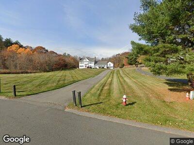
16 Little Pond Rd Merrimac, MA 01860
Rocks Village NeighborhoodEstimated Value: $994,648 - $1,295,000
4
Beds
4
Baths
4,025
Sq Ft
$276/Sq Ft
Est. Value
About This Home
This home is located at 16 Little Pond Rd, Merrimac, MA 01860 and is currently estimated at $1,112,162, approximately $276 per square foot. 16 Little Pond Rd is a home located in Essex County with nearby schools including Pentucket Regional High School.
Ownership History
Date
Name
Owned For
Owner Type
Purchase Details
Closed on
May 15, 2012
Sold by
Spellman Robert M and Spellman Amanda J
Bought by
Spellman Robert M and Spellman Amanda J
Current Estimated Value
Purchase Details
Closed on
Sep 24, 2004
Sold by
16 Little Pond Road Rt and Mansour Eugenia C
Bought by
Spellman Robert M
Create a Home Valuation Report for This Property
The Home Valuation Report is an in-depth analysis detailing your home's value as well as a comparison with similar homes in the area
Home Values in the Area
Average Home Value in this Area
Purchase History
| Date | Buyer | Sale Price | Title Company |
|---|---|---|---|
| Spellman Robert M | -- | -- | |
| Spellman Robert M | $715,000 | -- |
Source: Public Records
Mortgage History
| Date | Status | Borrower | Loan Amount |
|---|---|---|---|
| Open | Spellman Amanda J | $500,000 | |
| Previous Owner | Mansour Louis E | $380,000 | |
| Previous Owner | Mansour Louis E | $500,000 | |
| Previous Owner | Mansour Louis E | $155,000 | |
| Previous Owner | Mansour Louis E | $86,500 |
Source: Public Records
Tax History Compared to Growth
Tax History
| Year | Tax Paid | Tax Assessment Tax Assessment Total Assessment is a certain percentage of the fair market value that is determined by local assessors to be the total taxable value of land and additions on the property. | Land | Improvement |
|---|---|---|---|---|
| 2025 | $12,969 | $978,800 | $383,900 | $594,900 |
| 2024 | $12,833 | $950,600 | $362,500 | $588,100 |
| 2023 | $12,264 | $830,300 | $332,700 | $497,600 |
| 2022 | $11,490 | $703,200 | $277,200 | $426,000 |
| 2021 | $10,838 | $664,900 | $238,900 | $426,000 |
| 2020 | $9,894 | $664,900 | $238,900 | $426,000 |
| 2019 | $10,256 | $648,700 | $238,900 | $409,800 |
| 2018 | $10,107 | $641,300 | $238,900 | $402,400 |
| 2017 | $9,879 | $604,600 | $213,300 | $391,300 |
| 2016 | $9,652 | $597,300 | $213,300 | $384,000 |
| 2015 | $9,316 | $573,300 | $213,300 | $360,000 |
| 2014 | $8,635 | $543,400 | $183,400 | $360,000 |
Source: Public Records
Map
Nearby Homes
- 21 River Rd
- 1A Carriage Town Park
- 0 Mountain View Ave
- 2 River Rd
- 889 Amesbury Rd
- 0 W Main St
- 19 W Main St Unit 16
- 19 W Main St Unit 8
- 169 Brandy Brow Rd
- 95 River Rd
- 19 Broad St Unit 105
- 6 Prospect St
- 22 Heath Rd
- 5 Jamaica Ln
- 11 S Pleasant St
- 137 River Rd
- 151 River Rd
- 118 River Rd
- 72 E Main St
- 3 Bear Hill Rd
- 16 Little Pond Rd
- 18 Little Pond Rd
- 14 Little Pond Rd
- 3 Spring Hill Rd
- 11 Spring Hill Rd
- 13 Spring Hill Rd
- 9 Little Pond Rd
- 5 Spring Hill Rd
- 20 Little Pond Rd
- 6 Spring Hill Rd
- 22 Spring Hill Rd
- 22 Spring Hill Rd
- 4 Spring Hill Rd
- 28 Spring Hill Rd
- 30 Spring Hill Rd
- 13 Little Pond Rd
- 9 Spring Hill Rd
- 26 Spring Hill Rd
- 2 Spring Hill Rd
- 20 Spring Hill Rd