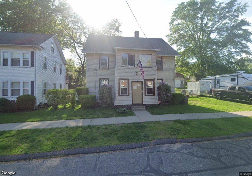
16 Lockhouse Rd Westfield, MA 01085
Estimated Value: $308,885 - $358,000
5
Beds
2
Baths
1,736
Sq Ft
$189/Sq Ft
Est. Value
About This Home
This home is located at 16 Lockhouse Rd, Westfield, MA 01085 and is currently estimated at $328,721, approximately $189 per square foot. 16 Lockhouse Rd is a home located in Hampden County with nearby schools including Westfield High School and Saint Mary High School.
Ownership History
Date
Name
Owned For
Owner Type
Purchase Details
Closed on
Feb 14, 2022
Sold by
Voisine Carl B
Bought by
Voisine Carl B and Voisine Johanna V
Current Estimated Value
Purchase Details
Closed on
May 27, 2010
Sold by
Morin Michael P
Bought by
Voisine Carl B
Home Financials for this Owner
Home Financials are based on the most recent Mortgage that was taken out on this home.
Original Mortgage
$159,065
Interest Rate
5.25%
Mortgage Type
FHA
Purchase Details
Closed on
Sep 15, 2006
Sold by
Leary John D
Bought by
Morin Michael P
Home Financials for this Owner
Home Financials are based on the most recent Mortgage that was taken out on this home.
Original Mortgage
$149,600
Interest Rate
6.71%
Mortgage Type
Purchase Money Mortgage
Create a Home Valuation Report for This Property
The Home Valuation Report is an in-depth analysis detailing your home's value as well as a comparison with similar homes in the area
Home Values in the Area
Average Home Value in this Area
Purchase History
| Date | Buyer | Sale Price | Title Company |
|---|---|---|---|
| Voisine Carl B | -- | None Available | |
| Voisine Carl B | $162,000 | -- | |
| Morin Michael P | $187,000 | -- |
Source: Public Records
Mortgage History
| Date | Status | Borrower | Loan Amount |
|---|---|---|---|
| Previous Owner | Voisine Carl B | $159,065 | |
| Previous Owner | Morin Michael P | $149,600 |
Source: Public Records
Tax History
| Year | Tax Paid | Tax Assessment Tax Assessment Total Assessment is a certain percentage of the fair market value that is determined by local assessors to be the total taxable value of land and additions on the property. | Land | Improvement |
|---|---|---|---|---|
| 2025 | $3,692 | $243,200 | $97,400 | $145,800 |
| 2024 | $3,555 | $222,600 | $88,600 | $134,000 |
| 2023 | $3,297 | $202,100 | $84,400 | $117,700 |
| 2022 | $3,297 | $178,300 | $75,300 | $103,000 |
| 2021 | $3,166 | $167,700 | $71,000 | $96,700 |
| 2020 | $3,086 | $160,300 | $71,000 | $89,300 |
| 2019 | $3,000 | $152,500 | $67,600 | $84,900 |
| 2018 | $2,952 | $152,500 | $67,600 | $84,900 |
| 2017 | $2,923 | $150,500 | $68,600 | $81,900 |
| 2016 | $2,926 | $150,500 | $68,600 | $81,900 |
| 2015 | $2,790 | $150,500 | $68,600 | $81,900 |
| 2014 | $2,084 | $150,500 | $68,600 | $81,900 |
Source: Public Records
Map
Nearby Homes
- 0 Lockhouse Rd Unit 73473161
- 19 Arch Rd
- 13 Furrow St
- 24 Sunflower Ln Unit B
- 9 Montgomery St
- Lot 3 Montgomery
- 67 Woodside Terrace
- 119 Union St Unit 4
- 24 Francis St
- 357 Southampton Rd
- 12 Sibley Ave
- 83 Mechanic St
- 3 Belmont St
- 19 Kellogg St
- 25 Dubois St
- 63 George St
- 113 Franklin St
- 33 George St
- 163 Prospect Street Extension
- 26 Washington St
- 12 Lockhouse Rd
- 24 Lockhouse Rd
- 39 Hillside Ave
- 12 Hillside Ave
- 8 Lockhouse Rd
- 40 Hillside Ave
- 44 Hillside Ave
- 11 Lockhouse Rd
- 9 Ridgeway Ave
- 34 Ridgeway Ave
- 9 Lockhouse Rd
- 25 Ridgeway Ave
- 6 Lockhouse Rd
- 2 Lockhouse Rd Unit 20
- 0:B Lockhouse Rd
- 0 Lockhouse Rd
- 0 Lockhouse Rd Unit 73293185
- 0 Lockhouse Rd Unit 72925499
- 360 N Elm St
- 27 Ridgeway Ave
Your Personal Tour Guide
Ask me questions while you tour the home.