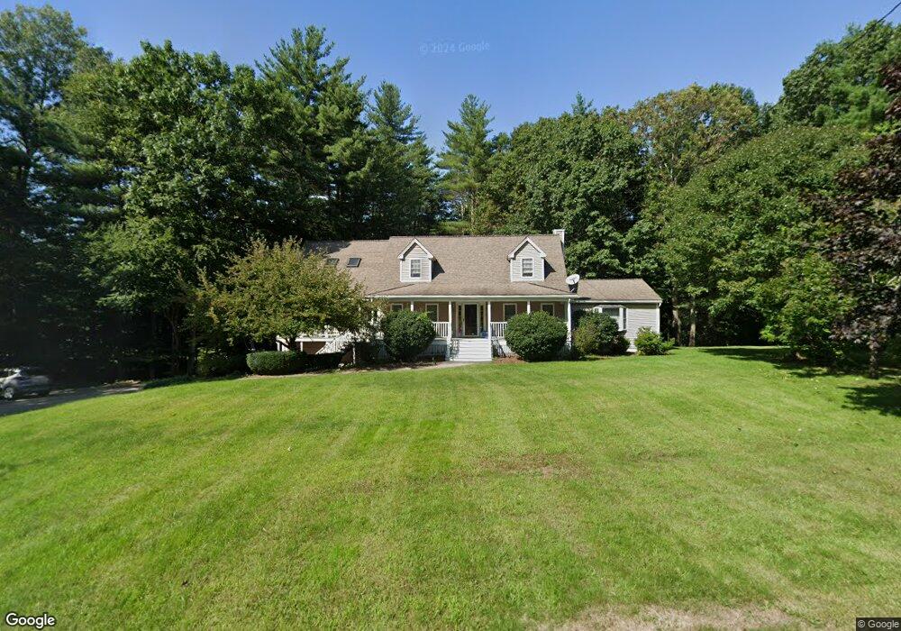
16 Lynette Ln Fremont, NH 03044
Estimated Value: $756,000 - $796,879
4
Beds
4
Baths
3,162
Sq Ft
$247/Sq Ft
Est. Value
About This Home
This home is located at 16 Lynette Ln, Fremont, NH 03044 and is currently estimated at $780,220, approximately $246 per square foot. 16 Lynette Ln is a home located in Rockingham County with nearby schools including Ellis School.
Ownership History
Date
Name
Owned For
Owner Type
Purchase Details
Closed on
Dec 17, 1999
Sold by
Best Homes Inc
Bought by
Coleman Charles E
Current Estimated Value
Home Financials for this Owner
Home Financials are based on the most recent Mortgage that was taken out on this home.
Original Mortgage
$143,900
Interest Rate
7.81%
Create a Home Valuation Report for This Property
The Home Valuation Report is an in-depth analysis detailing your home's value as well as a comparison with similar homes in the area
Home Values in the Area
Average Home Value in this Area
Purchase History
| Date | Buyer | Sale Price | Title Company |
|---|---|---|---|
| Coleman Charles E | $159,900 | -- |
Source: Public Records
Mortgage History
| Date | Status | Borrower | Loan Amount |
|---|---|---|---|
| Open | Coleman Charles E | $170,000 | |
| Closed | Coleman Charles E | $150,000 | |
| Closed | Coleman Charles E | $143,900 |
Source: Public Records
Tax History Compared to Growth
Tax History
| Year | Tax Paid | Tax Assessment Tax Assessment Total Assessment is a certain percentage of the fair market value that is determined by local assessors to be the total taxable value of land and additions on the property. | Land | Improvement |
|---|---|---|---|---|
| 2024 | $11,450 | $434,200 | $120,600 | $313,600 |
| 2023 | $10,243 | $434,200 | $120,600 | $313,600 |
| 2022 | $10,069 | $434,200 | $120,600 | $313,600 |
| 2021 | $9,705 | $434,800 | $120,600 | $314,200 |
| 2020 | $10,057 | $434,800 | $120,600 | $314,200 |
| 2019 | $10,200 | $328,500 | $89,900 | $238,600 |
| 2018 | $9,658 | $328,500 | $89,900 | $238,600 |
| 2017 | $8,416 | $328,500 | $89,900 | $238,600 |
| 2016 | $9,899 | $331,300 | $89,900 | $241,400 |
| 2015 | $9,608 | $331,300 | $89,900 | $241,400 |
| 2014 | $9,626 | $341,100 | $85,700 | $255,400 |
| 2013 | $9,725 | $341,100 | $85,700 | $255,400 |
Source: Public Records
Map
Nearby Homes
- 75 Leavitt Rd
- 28 Leavitt Rd
- 38 Bluefish Dr
- 1 Annika Lee Dr Unit B
- 266 Route 125
- 164 Hall Rd
- 62 Lyford Ln
- 454 Main St
- 40 Depot Rd
- 564 Main St
- 308 Main St
- 98 Copp Dr
- The Laurel Plan at Pleasant View Farm
- The Ridgemont Plan at Pleasant View Farm
- The Leyland Plan at Pleasant View Farm
- The Rosewood Plan at Pleasant View Farm
- 11 Walker Rd Unit 11B
- 3 Walker Rd Unit 3A
- 240 Main St
- 188 Main St
- 145 Gristmill Rd
- 26 Lynette Ln
- 92 Lynette Ln
- 62 Tavern Rd
- 3 Lynette Ln
- 2-1 Risloves Way
- 2-1 Risloves Way
- 2-1 Risloves Way Unit 2
- 33 Lynette Ln
- 38 Lynette Ln
- 0 Tavern Road (Ridge Road) Unit 4187311
- 1-2 Risloves Way
- 1-1 Risloves Way Unit 1-1
- 1-1 Risloves Way Unit 1-1
- 1-1 Risloves Way
- 2 Risloves Way Unit 1
- 2 Risloves Way Unit 2
- 55 Tavern Rd
- 14 Risloves Way Unit 14-1
- 14 Risloves Way Unit 2