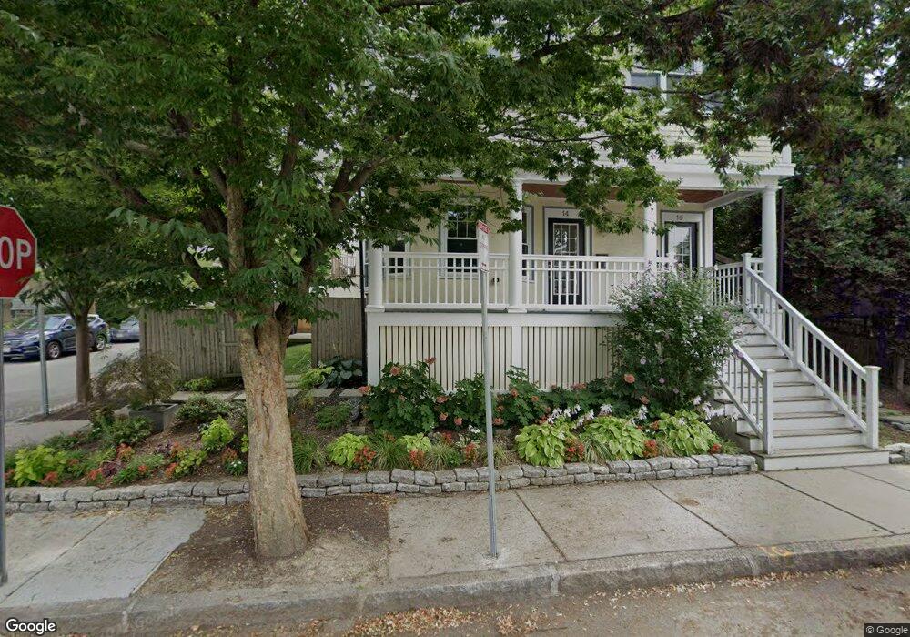
16 Malcolm Rd Cambridge, MA 02138
West Cambridge NeighborhoodEstimated Value: $1,377,000 - $1,793,607
3
Beds
3
Baths
2,077
Sq Ft
$795/Sq Ft
Est. Value
About This Home
This home is located at 16 Malcolm Rd, Cambridge, MA 02138 and is currently estimated at $1,651,402, approximately $795 per square foot. 16 Malcolm Rd is a home located in Middlesex County with nearby schools including Benjamin Banneker Charter Public School, Cambridge Montessori School, and St Peter School.
Ownership History
Date
Name
Owned For
Owner Type
Purchase Details
Closed on
Apr 5, 2007
Sold by
14-16 Malcolm Street L
Bought by
Hirsh Susan J
Current Estimated Value
Home Financials for this Owner
Home Financials are based on the most recent Mortgage that was taken out on this home.
Original Mortgage
$760,000
Outstanding Balance
$450,554
Interest Rate
6.25%
Mortgage Type
Purchase Money Mortgage
Estimated Equity
$1,200,848
Create a Home Valuation Report for This Property
The Home Valuation Report is an in-depth analysis detailing your home's value as well as a comparison with similar homes in the area
Home Values in the Area
Average Home Value in this Area
Purchase History
| Date | Buyer | Sale Price | Title Company |
|---|---|---|---|
| Hirsh Susan J | $950,000 | -- | |
| Hirsh Susan J | $950,000 | -- | |
| Hirsh Susan J | $950,000 | -- |
Source: Public Records
Mortgage History
| Date | Status | Borrower | Loan Amount |
|---|---|---|---|
| Open | Hirsh Susan J | $760,000 | |
| Closed | Hirsh Susan J | $760,000 |
Source: Public Records
Tax History
| Year | Tax Paid | Tax Assessment Tax Assessment Total Assessment is a certain percentage of the fair market value that is determined by local assessors to be the total taxable value of land and additions on the property. | Land | Improvement |
|---|---|---|---|---|
| 2025 | $11,233 | $1,768,900 | $0 | $1,768,900 |
| 2024 | $10,540 | $1,780,400 | $0 | $1,780,400 |
| 2023 | $9,558 | $1,631,100 | $0 | $1,631,100 |
| 2022 | $9,453 | $1,596,800 | $0 | $1,596,800 |
| 2021 | $9,178 | $1,568,900 | $0 | $1,568,900 |
| 2020 | $8,604 | $1,496,400 | $0 | $1,496,400 |
| 2019 | $8,334 | $1,403,100 | $0 | $1,403,100 |
| 2018 | $8,187 | $1,301,600 | $0 | $1,301,600 |
| 2017 | $8,039 | $1,238,700 | $0 | $1,238,700 |
| 2016 | $8,011 | $1,146,100 | $0 | $1,146,100 |
| 2015 | $7,947 | $1,016,300 | $0 | $1,016,300 |
| 2014 | $7,851 | $936,900 | $0 | $936,900 |
Source: Public Records
Map
Nearby Homes
- 382 Huron Ave
- 59-61 Reservoir St Unit 2
- 117 Lexington Ave Unit 117
- 180 Larch Rd
- 318 Concord Ave Unit 1
- 318 Concord Ave Unit 2
- 32 Copley St Unit 2
- 281 Concord Ave
- 14-16 Field St
- 172 Brattle St
- 204 Garden St
- 153 Brattle St
- 140 Huron Ave
- 1 Aberdeen Way Unit 102
- 1 Aberdeen Way Unit 113
- 12 Gray Gardens W Unit 14
- 84 Garden St
- 35 Homer Ave Unit 7
- 1010 Memorial Dr Unit 6F
- 29 Wheeler St Unit 108
- 14-16 Malcolm Rd
- 14 Malcolm Rd
- 14 Malcolm Rd Unit 1
- 10 Malcolm Rd Unit 12
- 6 Standish St Unit 2
- 6 Standish St Unit 1
- 17 Standish St
- 17 Standish St Unit 3
- 17 Standish St Unit 2
- 17 Standish St Unit 1
- 68 Malcolm Rd
- 377 Huron Ave
- 9 Malcolm Rd
- 9 Malcolm Rd Unit 1
- 7 Standish St
- 7 Malcolm Rd
- 13 Standish St
- 13 Standish St
- 13 Standish St Unit 2
- 381 Huron Ave Unit B
Your Personal Tour Guide
Ask me questions while you tour the home.