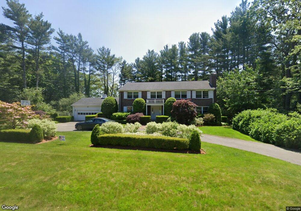
16 Mohawk Rd Canton, MA 02021
Estimated Value: $1,120,612 - $1,335,000
5
Beds
3
Baths
3,120
Sq Ft
$395/Sq Ft
Est. Value
About This Home
This home is located at 16 Mohawk Rd, Canton, MA 02021 and is currently estimated at $1,232,653, approximately $395 per square foot. 16 Mohawk Rd is a home located in Norfolk County with nearby schools including Canton High School, St. John the Evangelist School, and Beacon Scholastic Academy.
Ownership History
Date
Name
Owned For
Owner Type
Purchase Details
Closed on
Jan 24, 1994
Sold by
Nau Gerald G and Nau Janet K
Bought by
Kayserman Mark and Kayserman Irina
Current Estimated Value
Purchase Details
Closed on
Sep 3, 1987
Sold by
Cataldo Jennie B
Bought by
Nau Gerald G
Create a Home Valuation Report for This Property
The Home Valuation Report is an in-depth analysis detailing your home's value as well as a comparison with similar homes in the area
Home Values in the Area
Average Home Value in this Area
Purchase History
| Date | Buyer | Sale Price | Title Company |
|---|---|---|---|
| Kayserman Mark | $287,500 | -- | |
| Nau Gerald G | $346,000 | -- |
Source: Public Records
Mortgage History
| Date | Status | Borrower | Loan Amount |
|---|---|---|---|
| Closed | Nau Gerald G | $192,000 | |
| Closed | Nau Gerald G | $225,000 | |
| Closed | Nau Gerald G | $200,000 |
Source: Public Records
Tax History
| Year | Tax Paid | Tax Assessment Tax Assessment Total Assessment is a certain percentage of the fair market value that is determined by local assessors to be the total taxable value of land and additions on the property. | Land | Improvement |
|---|---|---|---|---|
| 2025 | $9,482 | $958,700 | $371,100 | $587,600 |
| 2024 | $9,194 | $922,200 | $356,900 | $565,300 |
| 2023 | $9,016 | $853,000 | $356,900 | $496,100 |
| 2022 | $8,602 | $757,900 | $339,900 | $418,000 |
| 2021 | $8,520 | $698,400 | $309,000 | $389,400 |
| 2020 | $8,139 | $665,500 | $294,300 | $371,200 |
| 2019 | $7,929 | $639,400 | $267,400 | $372,000 |
| 2018 | $7,841 | $631,300 | $267,900 | $363,400 |
| 2017 | $7,921 | $619,300 | $262,700 | $356,600 |
| 2016 | $8,257 | $645,600 | $287,000 | $358,600 |
| 2015 | $7,998 | $623,900 | $278,700 | $345,200 |
Source: Public Records
Map
Nearby Homes
- 30 Green Lodge St
- 1904 Washington St
- 1 Sassamon St
- 2253 Washington St Unit 2
- 35 Turnpike St
- 2204 Davenport Ave Unit 2204
- 42 Oakdale Rd
- 130 University Ave Unit 1405
- 22 Oakdale Rd
- 78 Cedarcrest Rd
- 74 Cedarcrest Rd
- 25 Edward St
- 36 Cedarcrest Rd
- 360 Blue Hill Dr
- 350 Blue Hill Dr
- 215 Blue Hill Dr
- 355 Canton St
- 9 Evergreen Cir
- 26 Pequit St
- 140 York St
Your Personal Tour Guide
Ask me questions while you tour the home.