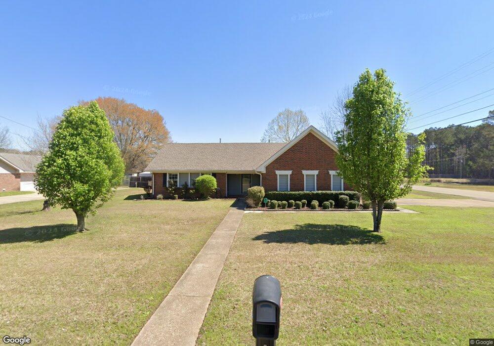
16 N Butternut Dr Columbus, MS 39705
Estimated Value: $214,000 - $272,000
--
Bed
--
Bath
1,808
Sq Ft
$131/Sq Ft
Est. Value
About This Home
This home is located at 16 N Butternut Dr, Columbus, MS 39705 and is currently estimated at $236,966, approximately $131 per square foot. 16 N Butternut Dr is a home.
Ownership History
Date
Name
Owned For
Owner Type
Purchase Details
Closed on
May 7, 2024
Sold by
Prinslow Thomas A
Bought by
Xander Karlee Alexis
Current Estimated Value
Home Financials for this Owner
Home Financials are based on the most recent Mortgage that was taken out on this home.
Original Mortgage
$182,094
Outstanding Balance
$178,806
Interest Rate
7.1%
Mortgage Type
New Conventional
Estimated Equity
$58,160
Purchase Details
Closed on
Jul 29, 2021
Sold by
Robertson John and Robertson Shelly A
Bought by
Prinslow Thomas A
Home Financials for this Owner
Home Financials are based on the most recent Mortgage that was taken out on this home.
Original Mortgage
$182,094
Interest Rate
2.9%
Mortgage Type
FHA
Create a Home Valuation Report for This Property
The Home Valuation Report is an in-depth analysis detailing your home's value as well as a comparison with similar homes in the area
Home Values in the Area
Average Home Value in this Area
Purchase History
| Date | Buyer | Sale Price | Title Company |
|---|---|---|---|
| Xander Karlee Alexis | -- | None Listed On Document | |
| Xander Karlee Alexis | -- | None Listed On Document | |
| Prinslow Thomas A | -- | None Available |
Source: Public Records
Mortgage History
| Date | Status | Borrower | Loan Amount |
|---|---|---|---|
| Open | Xander Karlee Alexis | $182,094 | |
| Closed | Xander Karlee Alexis | $182,094 | |
| Previous Owner | Prinslow Thomas A | $182,094 |
Source: Public Records
Tax History Compared to Growth
Tax History
| Year | Tax Paid | Tax Assessment Tax Assessment Total Assessment is a certain percentage of the fair market value that is determined by local assessors to be the total taxable value of land and additions on the property. | Land | Improvement |
|---|---|---|---|---|
| 2025 | $1,530 | $25,556 | $0 | $0 |
| 2024 | $1,530 | $15,771 | $0 | $0 |
| 2023 | $1,332 | $13,787 | $0 | $0 |
| 2022 | $1,333 | $13,787 | $0 | $0 |
| 2021 | $292 | $10,644 | $0 | $0 |
| 2020 | $251 | $10,361 | $0 | $0 |
| 2019 | $258 | $10,389 | $0 | $0 |
| 2018 | $258 | $10,347 | $0 | $0 |
| 2017 | $247 | $10,347 | $0 | $0 |
| 2016 | $247 | $10,347 | $0 | $0 |
| 2015 | $277 | $10,689 | $0 | $0 |
| 2014 | $627 | $10,689 | $0 | $0 |
Source: Public Records
Map
Nearby Homes
- 55 Wood Glen Ln
- 73 Hazelnut Cir
- 6904 Highway 45 N
- 6900 Highway 45 N
- 309 Jess Lyons Rd
- 297 Jess Lyons Rd
- 295 Jess Lyons Rd
- 5 W Jess Lyons Rd
- 6 W Jess Lyons Rd
- 3 W Jess Lyons Rd
- 4 W Jess Lyons Rd
- 1 W Jess Lyons Rd
- 0 Rd Unit 25-1952
- 0 N Frontage Rd Unit 24-2372
- 0 N Frontage Rd Unit 25-1416
- 0 Jess Lyons Rd
- 1372 Mike Parra Rd
- 0 Downs Rd
- 134 S Perkins Rd
- 240 Thomas Cir
- 36 N Butternut Dr
- 15 Butternut Dr
- 15 N Butternut Dr
- 35 N Butternut Dr
- 54 N Butternut Dr
- 10 Butternut Dr
- 53 N Butternut Dr
- 37 Butternut Dr
- 0 Oakdale Lake N
- 72 N Butternut Dr
- 34 Butternut Dr
- 268 Green Hollow Cir
- 264 Green Hollow Cir
- 16 N Chestnut Dr
- 71 N Butternut Dr
- 36 N Chestnut Dr
- 242 Green Hollow Cir
- 55 Butternut Dr
- 15 Chestnut Dr
- 259 Oakdale Dr