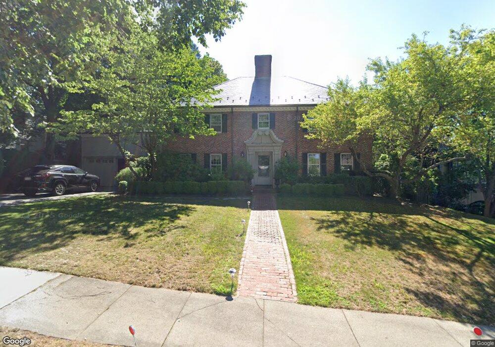
16 Pickwick Rd West Newton, MA 02465
West Newton NeighborhoodEstimated Value: $2,949,043 - $3,300,000
6
Beds
6
Baths
4,122
Sq Ft
$769/Sq Ft
Est. Value
About This Home
This home is located at 16 Pickwick Rd, West Newton, MA 02465 and is currently estimated at $3,168,761, approximately $768 per square foot. 16 Pickwick Rd is a home located in Middlesex County with nearby schools including Peirce Elementary School, F.A. Day Middle School, and Newton North High School.
Ownership History
Date
Name
Owned For
Owner Type
Purchase Details
Closed on
Oct 13, 2009
Sold by
Beverly W Newman T and Winthrop Beverly
Bought by
Winthrop Beverly
Current Estimated Value
Home Financials for this Owner
Home Financials are based on the most recent Mortgage that was taken out on this home.
Original Mortgage
$230,000
Outstanding Balance
$150,646
Interest Rate
5.14%
Mortgage Type
Purchase Money Mortgage
Estimated Equity
$3,018,115
Purchase Details
Closed on
Dec 19, 2007
Sold by
Newman Beverly W
Bought by
Beverly W Newman T and Newman Beverly W
Create a Home Valuation Report for This Property
The Home Valuation Report is an in-depth analysis detailing your home's value as well as a comparison with similar homes in the area
Home Values in the Area
Average Home Value in this Area
Purchase History
| Date | Buyer | Sale Price | Title Company |
|---|---|---|---|
| Winthrop Beverly | -- | -- | |
| Beverly W Newman T | -- | -- |
Source: Public Records
Mortgage History
| Date | Status | Borrower | Loan Amount |
|---|---|---|---|
| Open | Winthrop Beverly | $230,000 |
Source: Public Records
Tax History Compared to Growth
Tax History
| Year | Tax Paid | Tax Assessment Tax Assessment Total Assessment is a certain percentage of the fair market value that is determined by local assessors to be the total taxable value of land and additions on the property. | Land | Improvement |
|---|---|---|---|---|
| 2025 | $25,607 | $2,613,000 | $1,251,100 | $1,361,900 |
| 2024 | $24,760 | $2,536,900 | $1,214,700 | $1,322,200 |
| 2023 | $24,131 | $2,370,400 | $941,200 | $1,429,200 |
| 2022 | $23,089 | $2,194,800 | $871,500 | $1,323,300 |
| 2021 | $22,280 | $2,070,600 | $822,200 | $1,248,400 |
| 2020 | $21,617 | $2,070,600 | $822,200 | $1,248,400 |
| 2019 | $21,008 | $2,010,300 | $798,300 | $1,212,000 |
| 2018 | $20,574 | $1,901,500 | $724,800 | $1,176,700 |
| 2017 | $19,948 | $1,793,900 | $683,800 | $1,110,100 |
| 2016 | $19,079 | $1,676,500 | $639,100 | $1,037,400 |
| 2015 | $18,191 | $1,566,800 | $597,300 | $969,500 |
Source: Public Records
Map
Nearby Homes